| WPC Met Watch |
|
|
Mesoscale Precipitation Discussion: #0224 |
|
(Issued at 800 PM EDT Sat May 04 2024
) |
|
| MPD Selection |
|
|
|
|
|

Mesoscale Precipitation Discussion 0224
NWS Weather Prediction Center College Park MD
800 PM EDT Sat May 04 2024

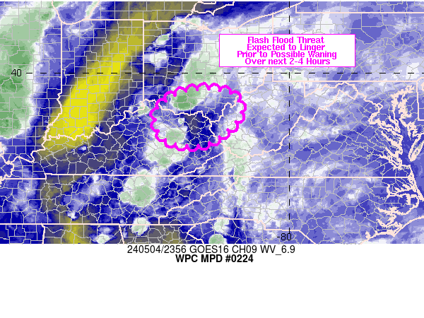
Areas affected...upper OH River Valley

Concerning...Heavy rainfall...Flash flooding possible

Valid 042358Z - 050328Z

SUMMARY...A lingering but likely diminishing flash flood threat
will exist for portions of northeastern KY into southern OH and
far western WV over the next 2-4 hours. Additional rainfall of 2-3
inches will be possible, but these higher end totals should remain
quite localized.

DISCUSSION...2345Z radar imagery showed a small cluster of
thunderstorms over southern OH with WSW to ENE training over
southern Brown and Adams counties. The training was occurring
within confluent low level flow along the leading edge of
convection where outflow has become aligned with the mean steering
flow, producing an MRMS-estimated 1 to 2+ in/hr. SPC mesoanalysis
data from 23Z showed 1000-1500 J/kg MLCAPE in place across the
Upper OH River Valley.

As an upstream upper level shortwave over the IN/KY border
continues to track east early tonight, forcing will translate
eastward and low level confluence is expected to fade, but
overrunning of the rain-cooled outflow should allow for
thunderstorms to persist over the next couple of hours, with a
continued potential for training near the OH/KY border, possibly
migrating into far western WV later tonight. Additional rainfall
of 2-3 inches will be possible with continued rainfall rates of
about 1-2 in/hr within areas of training.

Otto

ATTN...WFO...ILN...JKL...LMK...RLX...

ATTN...RFC...OHRFC...NWC...

LAT...LON   39398340 39378203 38788158 38348178 37878233
            37648288 37678374 38008426 38798435
Download in GIS format: Shapefile
| KML
Last Updated: 800 PM EDT Sat May 04 2024
|


