Slide 26 of 45
Notes:
Squall lines are a Spring/Fall time phenomena. However, if the dynamics/conditions are right, it could occur during any season. Squall lines are generally associated with progressive frontal systems. The polar trough propagates from west-to-east at speeds of 30-40KT. However, as they approach the continent, and clash with the Continental (Subtropical)/South Atlantic Ridge they tend to slow down. Only the southern half of the trough (south of 50S) remains fairly progressive, while the northern half begins to lags as it nears the central Andes of Chile. In the process most of the polar energy is sheared southward across Srn Chile/Patagonia-Falkland Islands.
Squall lines will generally form 100-200 NM ahead of a progressive surface front. Minimal moisture over Patagonia results in little to no organized convection. However, over Central Provinces of Argentina a warmer/moister air mass prevail, which when coupled with a strong baroclinic boundary has disastrous results.
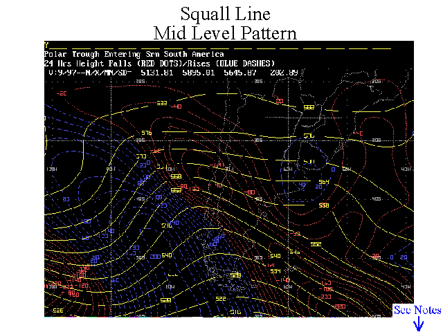
This case study shows a positively tilted Spring Time polar trough. The Bolivian High is not yet settled over the continent, thus more of the polar energy is allowed to push northward across central Chile and Argentina. Notice the height falls ahead of this trough…with 100-120 geopotential meters falls over Chile/Argentina between 36S-42S.