Slide 10 of 23
Notes:
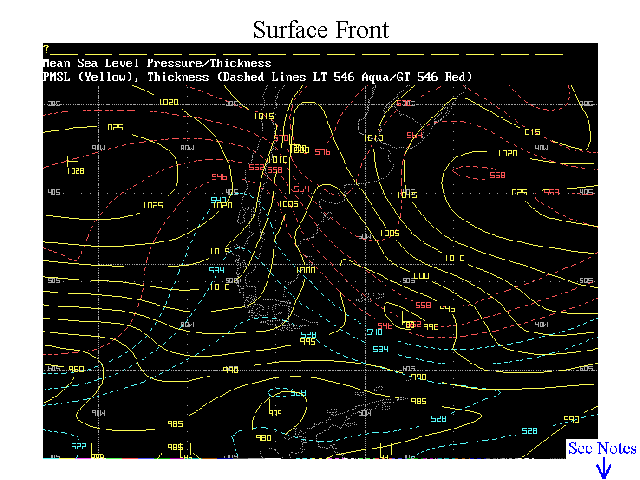
This chart shows a low pressure center SE of the Falkland Islands, with the thickness gradient showing a cold front that extends into Patagonia-southern Cuyo. Thickness values equal and less then 5400 GPM are highlighted in aqua, while values greater than 5400 GPM were plotted in red.
A Warm front also extends from this low, however due to the storm track, warm fronts are limited to southern portions of Chile. But as a cold front pushes northward across Argentina into Brasil-Paraguay, where it will lie quasistationary, the trailing end behaves as a warm front…frequently producing NS with embedded CBs.