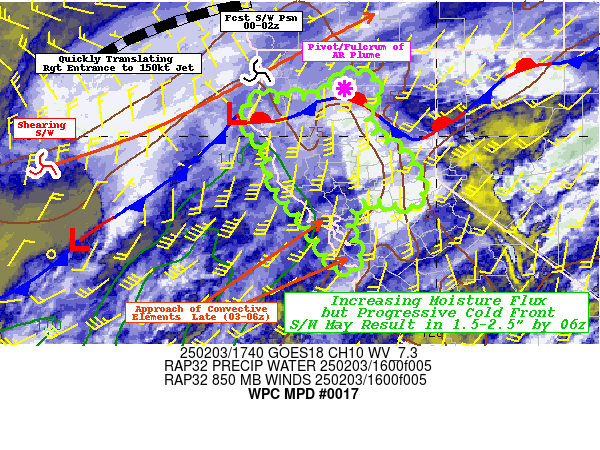
Mesoscale Precipitation Discussion 0017
NWS Weather Prediction Center College Park MD
526 PM EST Sun Jan 21 2024

Areas affected...central to northern CA into far southwestern OR

Concerning...Heavy rainfall...Flash flooding possible

Valid 212225Z - 220910Z

Summary...Rainfall intensity will increase across northern CA this
evening, expanding to the central coast later tonight. Peak
rainfall rates of 0.5 to 1.0 in/hr are expected at times along
with 2-4 inches of rain for portions of northern CA through 09Z.

Discussion...Looping water vapor imagery (6.9 micron channel)
through 2130Z from GOES West showed a strengthening shortwave over
the Pacific near 130W, tracking toward the east. The shortwave was
embedded within a longwave trough which was amplifying, in part
due to an impressive 200 kt upper level jet arcing zonally across
the east-central Pacific before curving anticyclonically just west
of the southern CA coast. Infrared satellite and regional radar
imagery showed a band of low level warm air advection induced
showers reaching the northern CA and southern OR coast, ahead of a
surface occluded front analyzed roughly 200 miles offshore. A
broad region of PWATs greater than 1 inch was observed via blended
TPW imagery and RAP analysis data, streaming toward the CA coast.

As the mid to upper level trough continues to amplify and approach
the West Coast tonight, steepening 700-500 mb lapse rates of 6.5
to 7.5 C/km are expected to support MUCAPE values up to 500 J/kg
along the northern CA coast, mainly north from Sonoma County. PWAT
values will increase as well with RAP forecast values maximizing
near 1 inch for the northern CA coast and up to 1.2 inches from
San Francisco Bay to Point Conception. 850 mb winds from the SSW
to SW ranging from 30 to over 50 kt (highest near the CA/OR
border) will translate into a broad region of 250-500 kg/m/s IVT
from the OR coast to near Point Conception over the next 12 hours.
Given the forecasts of shear and instability along and just
offshore the northern CA coast, quasi-organized cells will be
possible with high rainfall rates (0.5 to 1.0 in/hr). Into the
Sacramento Valley, poor low to mid-level lapse rates should limit
instability to 100 or 200 J/kg at most, decreasing the likelihood
of seeing 0.5+ in/hr rates, though quasi-organized cells and
training could still support these higher rates.

Expect a transition to an increasing coverage of moderate to heavy
rain in the 00Z-03Z window across the northern CA coast into the
Klamath and Cascade Mountains. 2 to 4 inches of rain is expected
through 09Z for portions of the northern CA coast into the Sierra
Nevada. With time, areas of heavier rain should begin to move
southward down the coast as the frontal system nears, with
potential for 0.5+ in/hr rates into the Santa Lucia Range in the
06-09Z window. Much of the region has seen above average rainfall
over the past 2 weeks, but more notably, in the past 72 hours,
increasing potential for flooding from additional rainfall. Areas
of flooding will be possible tonight, especially in urban areas or
other locations of poor drainage.

Otto

ATTN...WFO...EKA...LOX...MFR...MTR...REV...STO...

ATTN...RFC...CNRFC...NWRFC...NWC...

LAT...LON   42852453 42792409 42602380 42312374 41972349
            41832340 41722340 41612341 41472332 41342323
            41252310 41192291 41212277 41232269 41272257
            41322248 41392232 41422227 41452218 41462209
            41422202 41332197 41212191 41152180 41022173
            40642127 40072098 39332056 39102053 38842061
            38542090 38382112 38302130 38252159 38312175
            38292204 38092220 37862218 37672206 37282184
            36962165 36502139 36092093 35382067 35242071
            35092086 35052112 35272152 35902216 37162318
            38012379 39652466 40672486 41932496 42712481
Download in GIS format: Shapefile
| KML
Last Updated: 526 PM EST Sun Jan 21 2024
