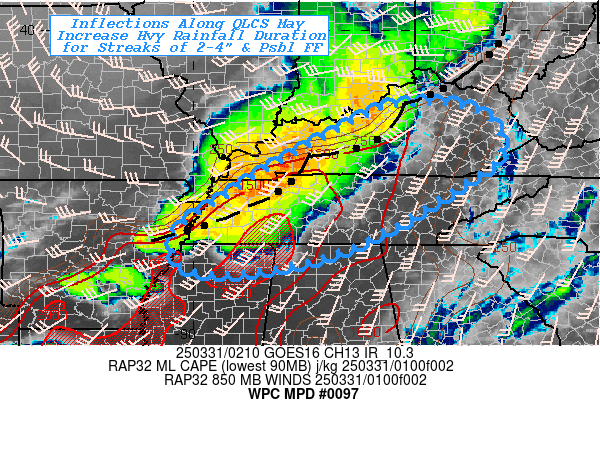
Mesoscale Precipitation Discussion 0097
NWS Weather Prediction Center College Park MD
1244 PM EDT Thu Mar 14 2024

Areas affected...central/eastern Oklahoma, far north Texas, and
far western Arkansas

Concerning...Heavy rainfall...Flash flooding possible

Valid 141643Z - 142043Z

Summary...Scattered thunderstorms will continue to expand in
coverage through the afternoon.  Despite relatively dry antecedent
conditions, at least an isolated flash flood risk will exist where
convective training can materialize.

Discussion...Robust convective development has occurred along a
surface dryline extending from near Norman, OK to near Wichita
Falls, TX.  The storms are in a strongly unstable environment,
with steep lapse rates aloft and convergence along the
aforementioned dryline enabling rapid development amid negligible
forcing for ascent aloft.  In their current state, storms are
oriented generally parallel to southwesterly flow aloft and not
propagating off of their current axis.  This suggests at least a
limited opportunity for isolated flash flood potential to unfold
over the next few hours as training boosts rain rates above 1
inch/hr in a few spots.

Eventually, storms will begin to forward propagate due to maturing
cold pools, allowing for a slightly more eastward component of
motion.  Despite this, an abundant pool of instability and
continued convergence along low-level boundaries should allow for
some degree of continued redevelopment (and perhaps backbuilding)
generally along a zone from Ardmore to Talequah despite modestly
rising geopotential heights.  A mix of cells and linear segments
is expected.  The flash flood risk is expected to gradually
increase through the afternoon, although it is likely that rates
above 2 inches/hr will be needed to overcome the dry antecedent
conditions noted across the discussion area.  Slightly lower FFGs
are noted with northeastward extent (north of I-40), suggesting
slightly more susceptibility to runoff in that area as storms
approach after 18Z.

Cook

ATTN...WFO...FWD...LZK...OUN...SGF...SHV...TSA...

ATTN...RFC...ABRFC...LMRFC...WGRFC...NWC...

LAT...LON   36729475 36249357 35039383 33719494 33179830
            33339887 33939870 35329772 36579629
Download in GIS format: Shapefile
| KML
Last Updated: 1244 PM EDT Thu Mar 14 2024
