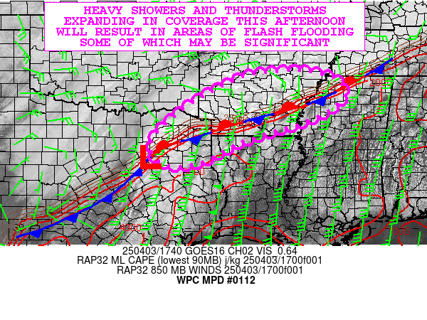
Mesoscale Precipitation Discussion 0112
NWS Weather Prediction Center College Park MD
841 PM EDT Sun Mar 24 2024

Areas affected...west-central to north-central TX

Concerning...Heavy rainfall...Flash flooding possible

Valid 250038Z - 250600Z

Summary...Potential training of thunderstorms from SW to NE over
west-central to north-central TX may lead to localized flash
flooding through 06Z. Rainfall rates of 1-2 in/hr and totals of
2-3 inches will be possible.

Discussion...00Z regional radar imagery over the Southern Plains
showed an elongated line of thunderstorms with cells that were
largely contiguous, extending from northwestern TX into western
portions of the Edwards Plateau, located out ahead of a cold
front/dryline. Individual cells were observed to be moving briskly
toward the NE or ENE at 30-40 kt, not posing a flash flood threat
by themselves given their progressive forward motion. However, new
cells were in the process of organizing over west-central TX
between I-10 and I-20, with some orientation from SW to NE. These
cells were forming within a region of approximately 500-1000 J/kg
MLCAPE and 0.7 to 1.0 inches of precipitable water (00Z SPC
mesoanalysis).

It appears cells to the north will develop/move farther east more
quickly relative to those to the south given extrapolation of
short term trends in radar and forecast boundary movement via the
RAP. Despite nocturnal cooling of the boundary layer (low level
development of CIN), there should be sufficient lift associated
with the cold front and with the approach of an upper-level max in
divergence (left exit region of a RAP-estimated 150-170 kt upper
level jet streak from northern Mexico into western TX), coupled
with 20-40 kt of southerly flow at 850 mb into the boundary or
rain-cooled outflow, to support continued thunderstorm development
over west-central TX into the early overnight. Alignment of
thunderstorms from WSW to ENE will be parallel to the mean
steering flow and set up potential training of 1-2 in/hr rainfall
rates across a portion of west-central to north-central TX. If
training is able to persist long enough, localized 2-3 inch totals
could occur which may produce localized flash flooding given flash
flood guidance of 2.5 to 3+ inches in 3 hours over the region.
This scenario is partially dependent on sufficient instability
lingering long enough to support higher rainfall rates, but it
appears at least an isolated threat for flash flooding will exist
through about 06Z.

Otto

ATTN...WFO...EWX...FWD...MAF...OUN...SJT...

ATTN...RFC...ABRFC...LMRFC...WGRFC...NWC...

LAT...LON   33849619 33579574 32659605 31699747 30749895
            30450031 30490112 31120135 31540101 31960044
            32759911 33439772 33779671
Download in GIS format: Shapefile
| KML
Last Updated: 841 PM EDT Sun Mar 24 2024
