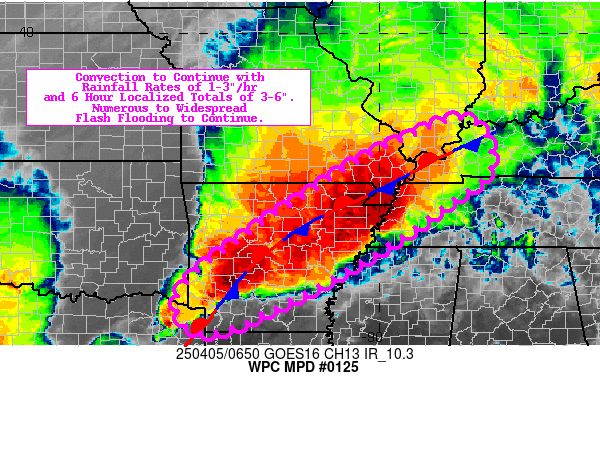
Mesoscale Precipitation Discussion 0125
NWS Weather Prediction Center College Park MD
503 PM EDT Mon Apr 01 2024

Areas affected...northern OK, southeastern KS into central MO and
western IL

Concerning...Heavy rainfall...Flash flooding possible

Valid 012100Z - 020300Z

Summary...Increasing coverage of thunderstorms from the eastern
KS/OK border into MO and western IL may produce flash flooding
from 2-4 inches of rain through 03Z. Multiple rounds of storms are
expected for a few locations with rainfall rates possibly
exceeding 2 in/hr.

Discussion...Regional radar imagery at 2030Z showed a small
cluster of thunderstorms to the east of I-35 in northern
OK/southern KS, tracking toward the northeast. Rainfall was more
stratiform over central MO, but a few areas of embedded
thunderstorms with higher reflectivity values were observed to the
north of I-70 near Marshall and east of St. Joseph. These storms
were forming partially in response to an ejecting positively
tilted mid-level trough axis translating eastward across the
southern High Plains. SPC mesoanalysis data from 20Z showed a
broad swath of MLCAPE between 1000-2000 J/kg within the warm
sector of a frontal cyclone with a surface low located in far
northwestern MO, but with CIN remaining across many locations due
to a capping inversion located between 850-700 mb.

Expectations are for an increase in thunderstorm coverage across
MO later this afternoon/evening, as a result of 1) northeastward
thunderstorm translation from the OK/KS border and 2) new
development across the region as CIN continues to erode with low
to mid-level height falls moving eastward in association with the
aforementioned trough over the southern High Plains. Shear
parameters are plenty supportive of organized cells with an
expected movement of individual cells off toward the northeast in
general, but with more of an eastward translation to thunderstorm
clusters, allowing for possible training of heavy rain from WSW to
ENE.

Additional thunderstorm development is anticipated over central to
northern OK around 00Z, ahead of the rapid eastward advancement of
a secondary cold front just entering the TX Panhandle at 20Z,
forecast to catch up to the dryline later this evening. The
anticipated secondary development of thunderstorms may pass over
some of the same locations that received rainfall from the ongoing
round near the eastern OK/KS border. Rainfall rates of 1-2 in/hr
are likely with localized potential for rates exceeding 2 in/hr.
The result of the two rounds of thunderstorms along with potential
for short term training within each individual round may result in
some flash flooding with 2-4 inches of rain through 03Z.

Otto

ATTN...WFO...EAX...ICT...ILX...LSX...OUN...SGF...TOP...TSA...

ATTN...RFC...ABRFC...MBRFC...NCRFC...NWC...

LAT...LON   40179256 40169085 40148986 40058912 39588904
            39198958 38749028 38349107 37839249 37359403
            36289690 36819746 38439578 39869410
Download in GIS format: Shapefile
| KML
Last Updated: 503 PM EDT Mon Apr 01 2024
