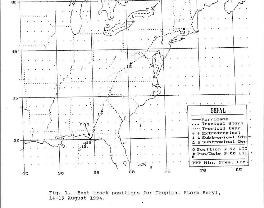
A large upper level low which developed across the southwest
North
Atlantic burrowed its way to the surface as
it retrograded westward. On the morning of the 12th, the surface
low was located off the southwest coast of Florida.
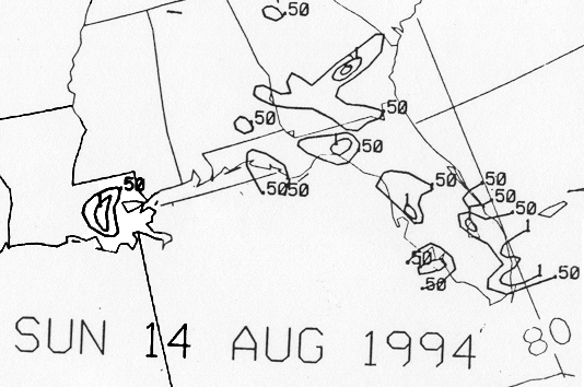
The low moved north-northwest and developed into a tropical depression
100 miles south of Pensacola on the morning
of the 14th. Its forward motion slowed as it neared the Florida
panhandle...and the center propagated east parallel to the
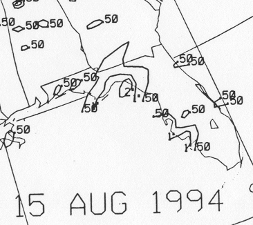
coast. By the morning of the 15th, it had stengthened into a
tropical storm to the west-southwest of Appalachicola.
A mid-level trough approached from the west which allowed the
cyclone
to resume a northerly track. The cyclone
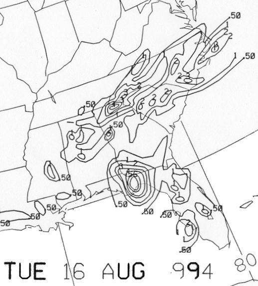
finally made landfall late on the 15th near Panama City. As it
moved into southwest Georgia, the system weakened
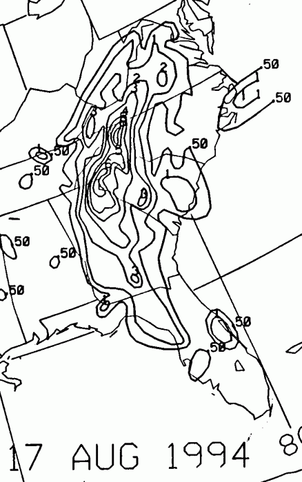
to a tropical depression. It moved north to northeast along the
Appalachians into Pennsylvania, before recurving
east through southern New England. Below is the track of this
storm, provided by the National Hurricane Center.
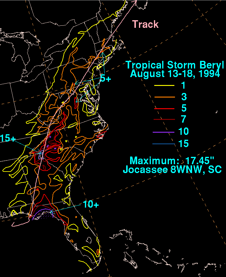
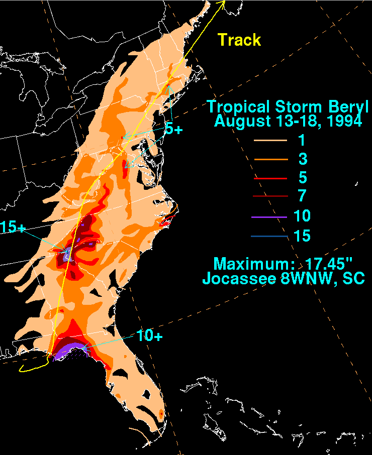
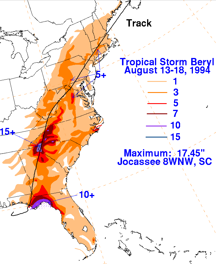
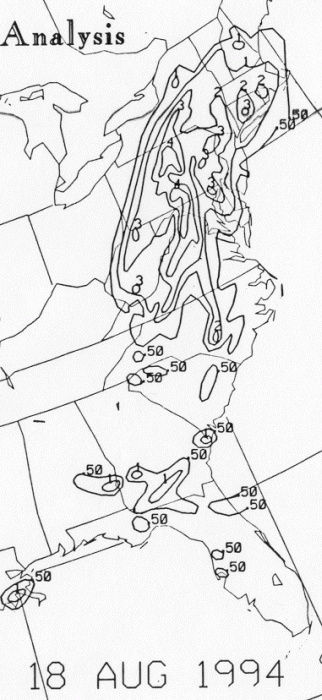
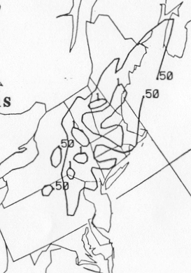
The storm total rainfall maps below were constructed using data from
the
National Climatic Data Center.
 |
 |
 |
Below are the calendar for Daily Precipitation Maps. Note that
the 24-hour periods end
at 12z that morning.