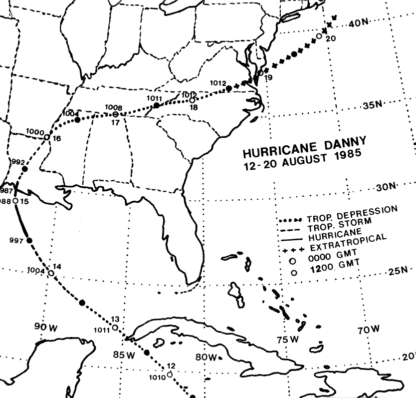
A tropical wave emerged off the west coast of Africa on July 30th
and moved westward, entering
the eastern Caribbean Sea on the 8th of August. Shower activity
increased with the wave on the
10th as it moved through the eastern Caribbean, and a broad low formed
by midday on the 10th.
Reconaissance aircraft found a tropical depression on the 12th just
west of Grand Cayman Island.
The depression moved northwest, intensifying into a tropical storm on
the 13th and a hurricane
on the 14th. Danny continued to move along a smooth parabolic
track, striking just south of
White Lake, Louisiana midday on the 15th with maximum sustained winds
of 90 mph. The
cyclone initially weakened rapidly into a tropical depression as
it entered Mississippi, and the
well-defined system became a frontal low on the 18th across
southern Virginia. Its track lies
below, provided
by the National Hurricane
Center.
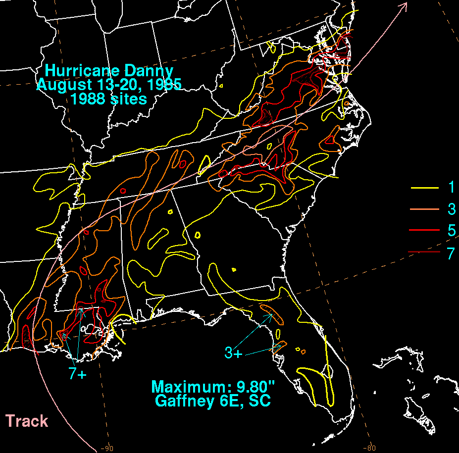
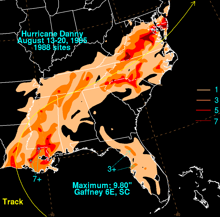
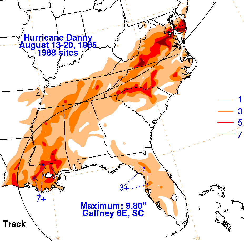
Below are the storm total rainfall maps for Danny. Rainfall
information was obtained from the
National Climatic Data Center. Note the maximum east of the point
of landfall in Missisippi,
and a shift of the precipitation to the left of the track as it become
a frontal low across Virginia.
 |
 |
 |