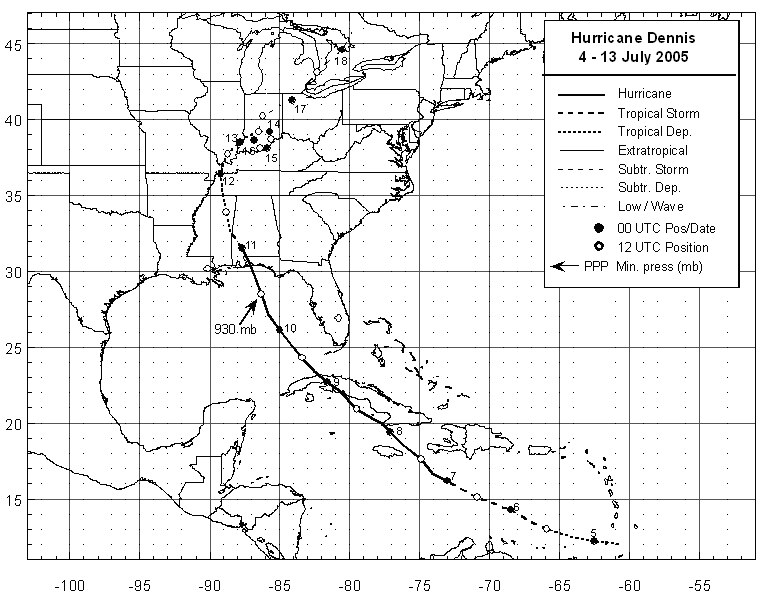
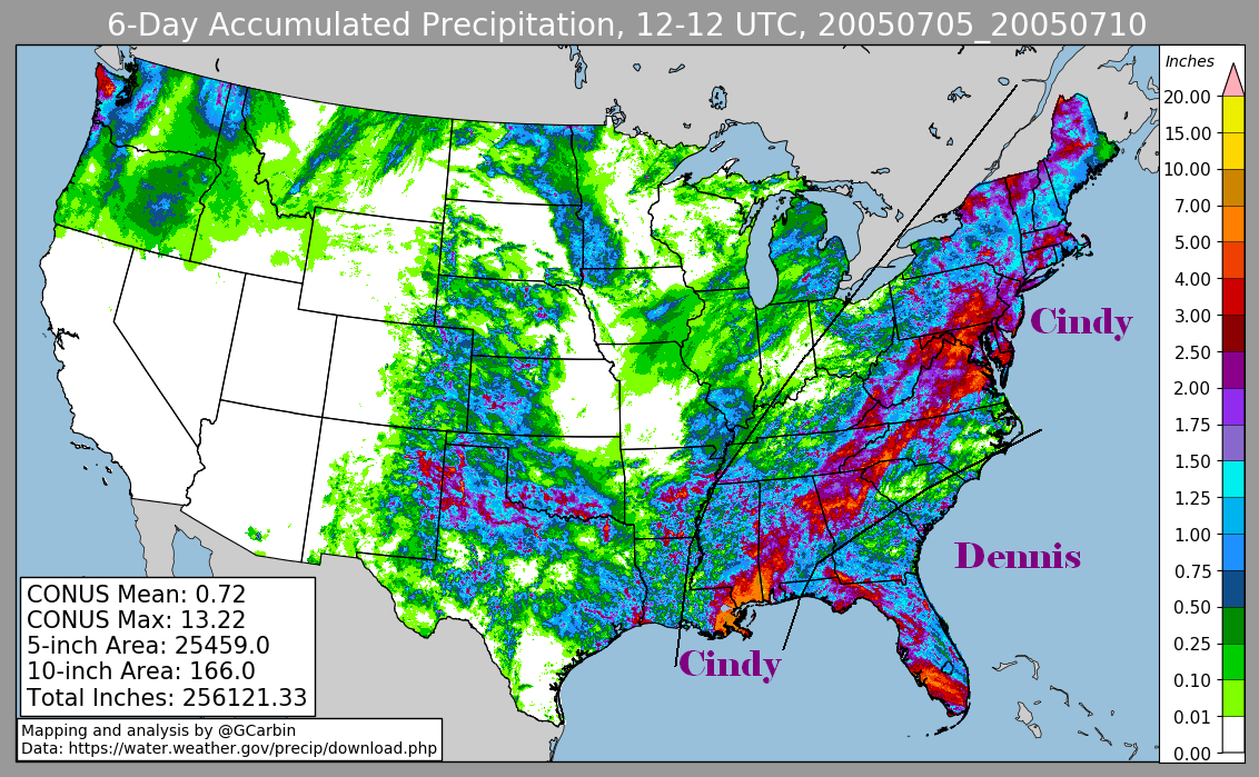
Dennis developed on July 4th from a tropical wave near the southern Windward islands.
The depression moved west-northwest across the Caribbean Sea...becoming a tropical storm
on the 5th and a hurricane early on the 6th about 245 miles east-southeast of Jamaica.
Dennis intensified over the next couple days becoming a major hurricane with winds of
150 mph on the 8th just south of central Cuba. The hurricane struck land at Cabo Cruz,
Cuba early on the 8th with winds of 135 mph, and then hit Cienfuegos with winds of 145
mph that afternoon. Dennis passed back into the Gulf of Mexico near Havana early on the
9th...weakening to a category 1 hurricane after crossing Cuba.
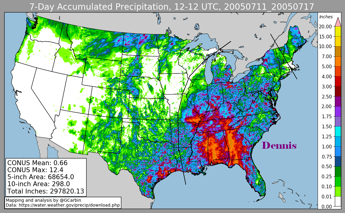
Dennis restrengthened to a category 4 hurricane, but weakened to a category 3 hurricane
before making landfall near Navarre Beach, Florida late on the 10th. Dennis devolved
into an elongated remnant low in the western Tennessee Valley early on the 12th,
then looped over southern Indiana from the 13th through 15th. For much of this time
period, its main inflow band sent rains into the southern Appalachians, leading to
record rains in northern Georgia. The low finally moved northeast across northern
Indiana and the lower peninsula of Michigan on the 16th and becoming absorbed into a
larger low over central Canada late on the 17th. Below is the track of this storm.
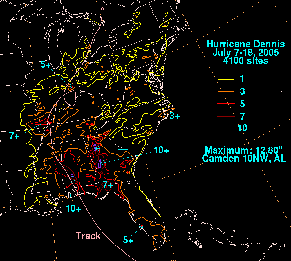
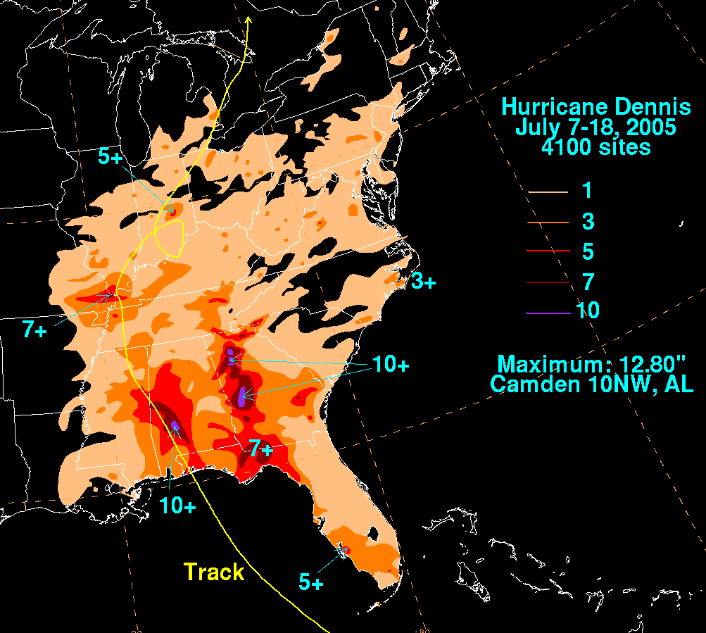
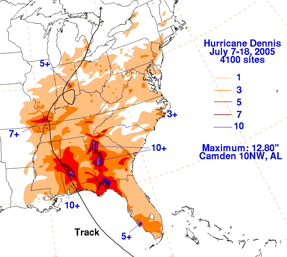
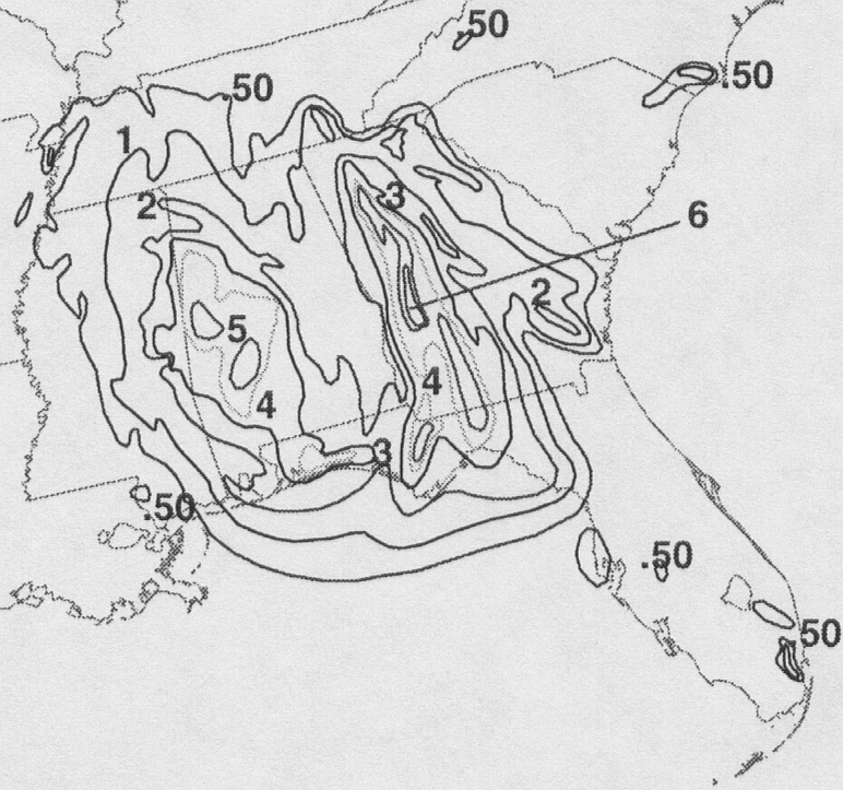
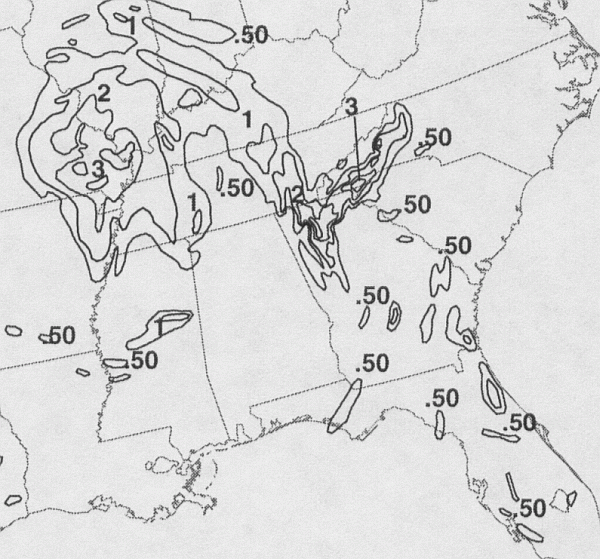
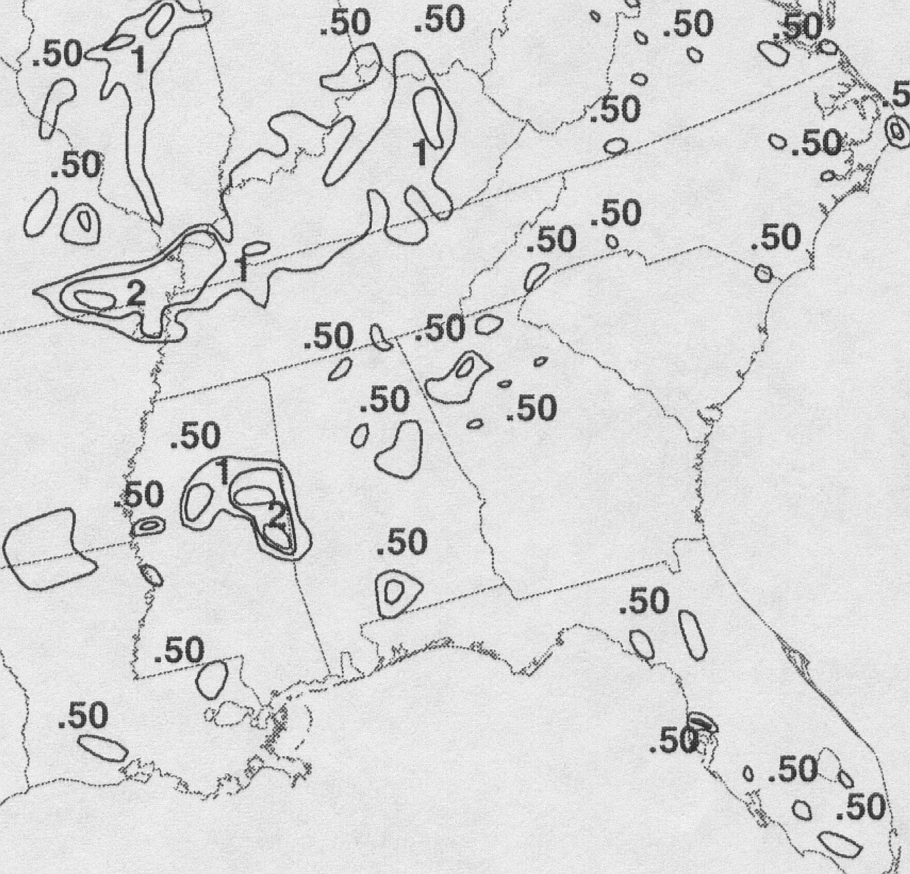
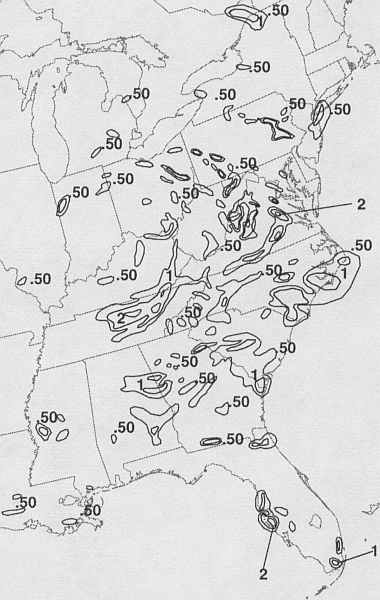
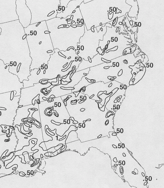
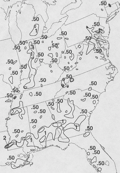
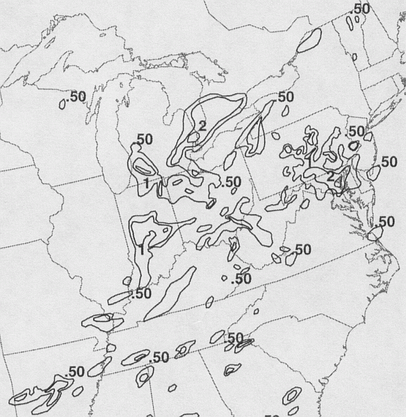
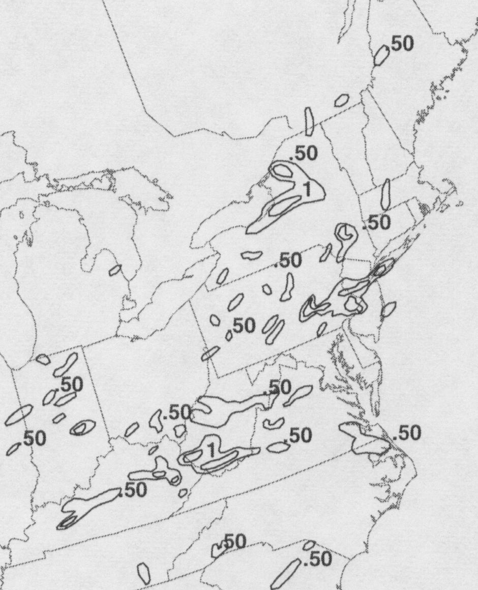
The first three storm total rainfall maps below were constructed using rain guage data
reported by the River Forecast Centers.
The second row/last two were based on radar-
derived information.
 |
 |
 |
 |
 |
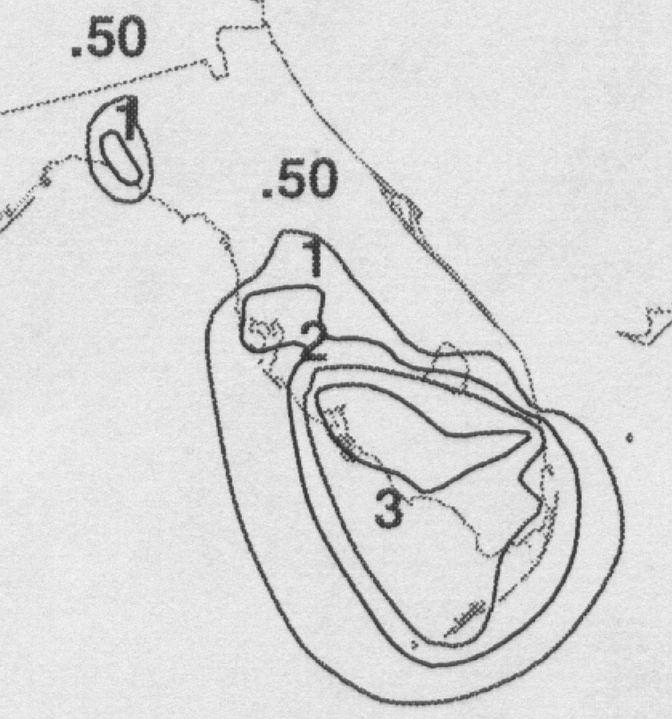
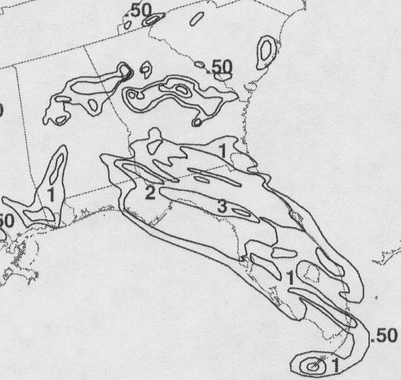
Below are the calendar for Daily Precipitation Maps. Note that
the 24-hour periods end
at 12z that morning.