A strong tropical wave, accompanied by a vigorous low
pressure system, moved off the west coast of Africa on
August 19th.
Both conventional satellite data and QuikSCAT microwave wind data
indicated that the wave came close
several times over the next few
days to developing into a tropical cyclone. Convection became most
pronounced on the
21st when some outer banding features and a
circular cirrus outflow pattern briefly developed. The
rapid westward
motion, exceeding 20 mph at times, may have disrupted
the low-level circulation enough to prevent the convection from
becoming concentrated near the center. The system also moved
through a mid- to upper-level region of very dry air over
the
central tropical Atlantic, and by late on 22 August nearly all of
the convection had dissipated.
As the pre-Grace wave continued its westward trek, a
second convective development phase occurred when the system
slowed
as it moved across the Lesser Antilles on 24th and 25th. However,
southwesterly upper-level shear ahead of a large
upper-level trough
located to the west disrupted development. Devoid of
significant thunderstorm activity, the wave moved
west-northwestward at under 10 mph
until it reached the northwestern Caribbean Sea on the 28th, when
deep convection
redeveloped along the wave axis. When the tropical
wave crossed the northern Yucatan Peninsula on the 29th, a broad
low pressure area redeveloped along the wave axis as it turned
northwestward toward the Texas coast. While there was
an abundance
of deep convection associated with this system, the disturbance
remained poorly organized until later
that day.
Convective organization continued to improve during
the early morning hours of the 30th, and surface observations in
conjunction with satellite intensity estimates indicated that
tropical Depression Eleven had formed about 290 n mi east-
southeast
of Corpus Christi, Texas. The depression initially showed some
signs of
interaction with an upper-level
cold low, but this was short-lived
and subsequent reconnaissance flights indicated that the cyclone
was mostly tropical
in nature. More specifically, a reconnaissance
flight during the afternoon of the 30th indicated the depression had
likely
strengthened into Tropical Storm Grace about 245 n
mi east-southeast of Corpus Christi, Texas. The upper-low situated
a few hundred miles to the west of Grace created persistent
southerly to
southwesterly upper-level shear which prevented
the deep convection from
organizing around the low-level circulation. While remaining broad
and somewhat disorganized,
Grace moved northwestward on the 31st
at a faster forward speed of about 15 mph.
A large surface high located over the southeastern United
States strengthened the pressure gradient and the low-level
wind
field for several hundred miles northeast of the center. The long
fetch of southeasterly winds and
cyclonic shear, in conjunction
with several bursts of deep
convection east of the original low-level center, caused
the spin up of a new center about 100 n mi
farther to the north of the former center.
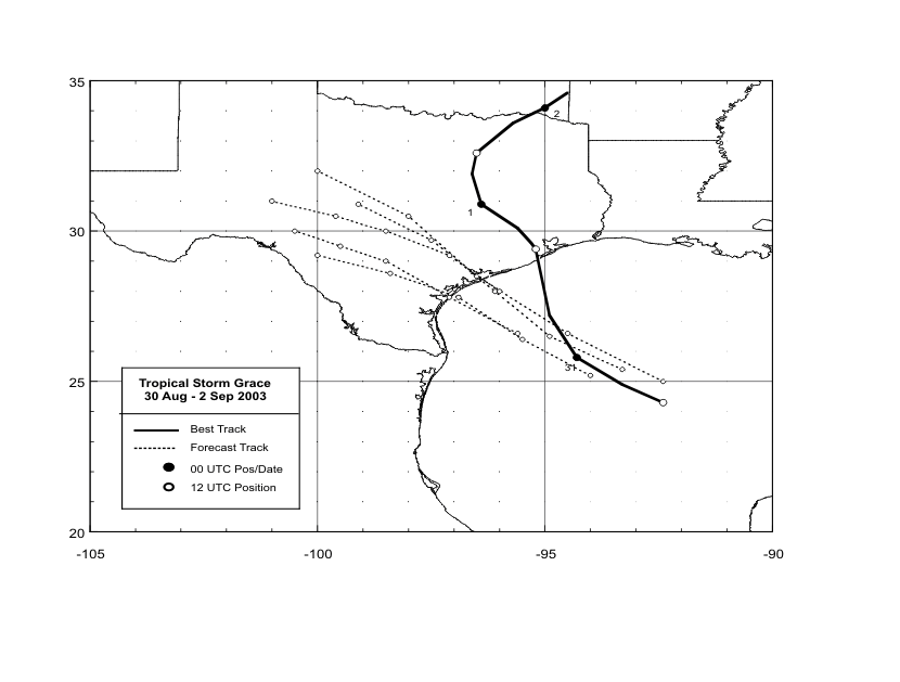
This new circulation center of Grace moved inland near San Luis
Pass, Texas
on the southwestern tip of Galveston Island during the morning of
the 31st as a weak tropical storm. The original circulation
weakened
and eventually dissipated before it made landfall. Grace continued
to move northwestward and quickly weakened
back to a tropical
depression shortly after making landfall. Tropical Depression Grace
turned northward over northeastern
Texas on 1 September and merged
with a frontal zone near the Arkansas-Oklahoma border early on 2
September.
Below is its track provided by the National Hurricane Center
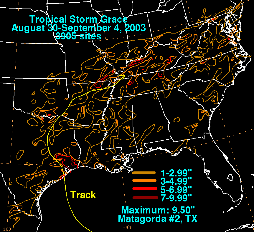
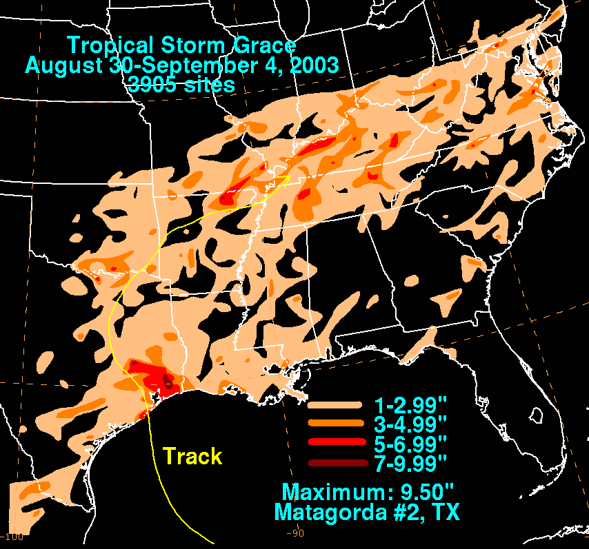
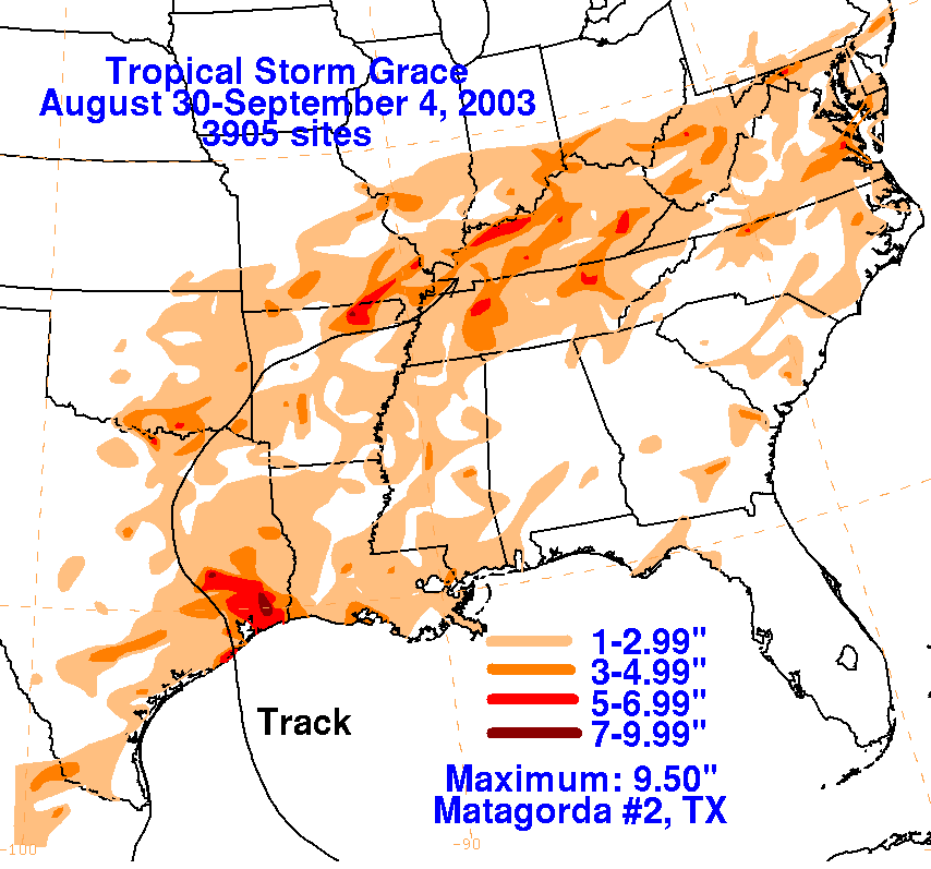
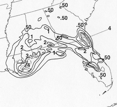
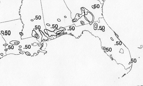
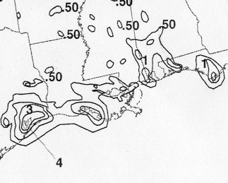
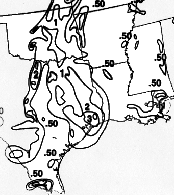
The storm total rainfall maps below were constructed using data from
data
provided by the National
Climatic Data Center, the Harris County Office of Emergency
Management, and Jefferson County/
Texas Drainage District 6 ALERT data.
 |
 |
 |
Below are the calendar for Daily Precipitation Maps. Note that
the 24-hour periods end
at 12z that morning.