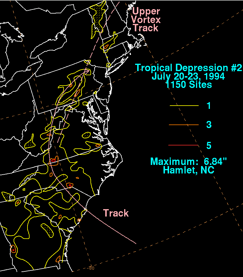
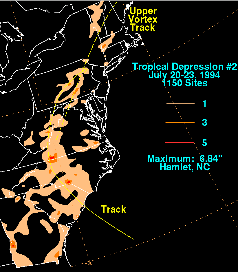
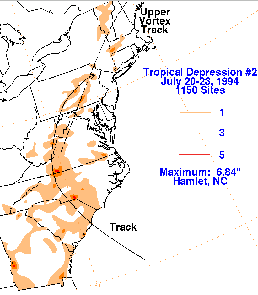
Tropical Depression #2 formed from a weather system of nontropical
origin. A broad upper trough
extended northeast from the Bahamas in mid-July. Thunderstorms
increased within this trough to the
north of the Bahamas on the 18th. A weak surface low gradually
developed a couple hundred miles
southeast of South Carolina by the 19th. That night, a tropical
depression formed from this low. Its
circulation became much better defined just prior to landfall with a
significant increase in convection.
It moved northwest into South Carolina. Its low pressure area
ill-defined on the 21st, though the
convective system retained organization until it accelerated into Nova
Scotia on the 22nd. Below
are the storm total rainfall maps for the depression. Rainfall
information was obtained from the National
Climatic Data Center.
 |
 |
 |