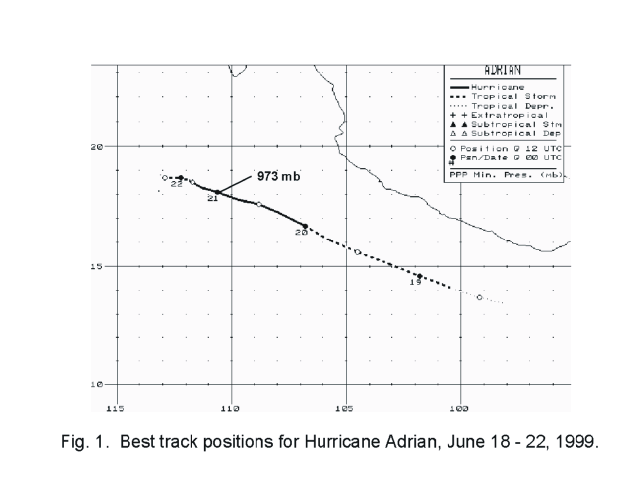
A large area of disturbed weather formed south of the Gulf of Tehauntepec. A low level circulation formed
on the 16th. A tropical wave moved into the area at that time. The system became organized enough to be
considered a tropical depression on the 18th about 225 miles southeast of Acapulco. The cyclone moved west-
northwest about 200 miles offshore the Mexican coast, with some acceleration on the 19th and decceleration on
the 22nd. Meanwhile, Adrian became a tropical storm on the 18th and a hurricane on the 20th. Cooler sea surface
temperatures and southeast wind shear led to subsequent weakening, and the system became a swirl in the low
cloud field on the 22nd while 300 miles southwest of the southern tip of Baja California. Below is Adrian's track,
supplied by the National Hurricane Center.
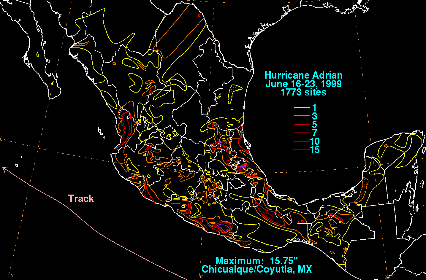
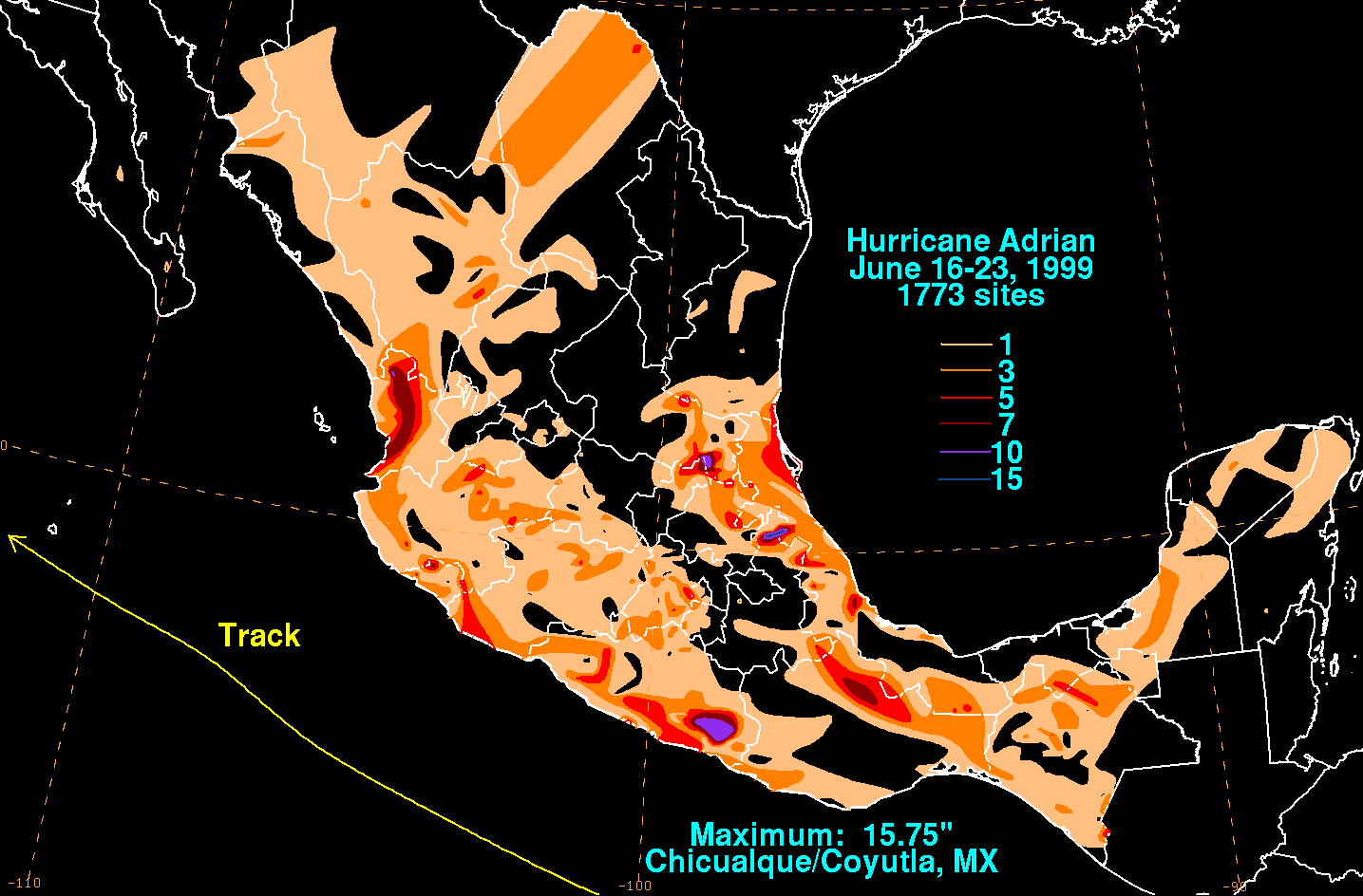
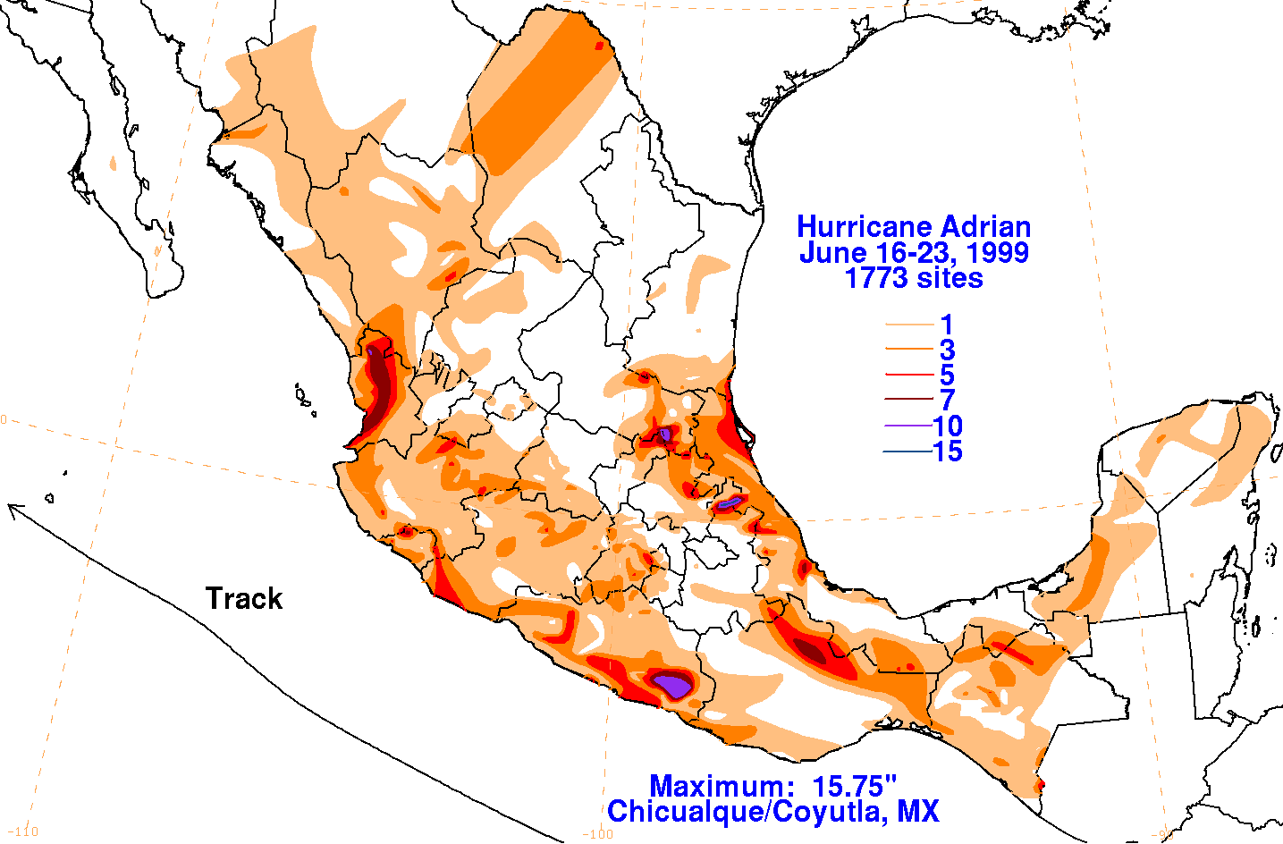
Below are the maps of the storm total rainfall related to Adrian in Mexico, constructed using data from
the Comision Nacional del Agua, part of Mexico's National Weather Service.
 |
 |
 |