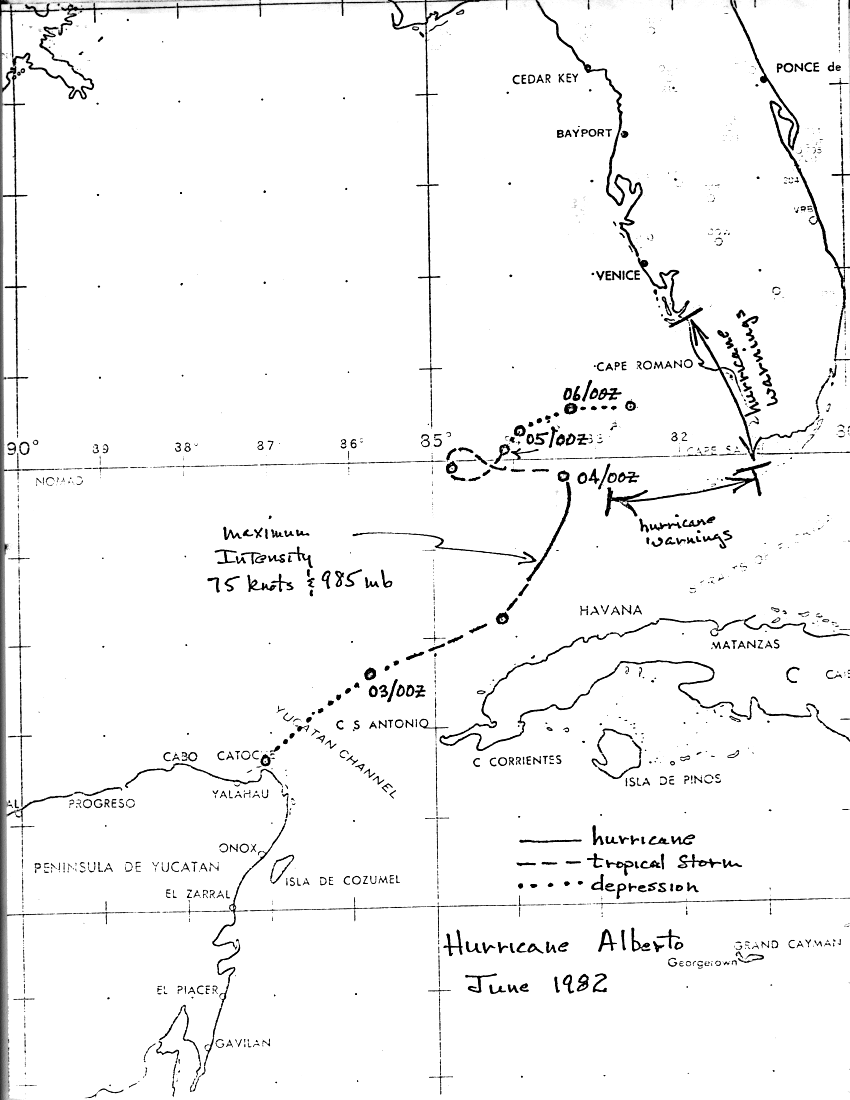
An organized cloud system developed over the Yucatan Peninsula on the
1st of June, with an accompanying area of low pressure. This system slowly
edged out into the southeast Gulf of Mexico, becoming a tropical depression.
Intensifying as it moved east-northeast, it became a tropical storm by the morning
of the 3rd, and a hurricane by that afternoon.
Soon after becoming a hurricane, Alberto weakened back into a tropical storm.
The track doubled back to the west as a sheared system. By late on the 4th, it had
weakened back into a tropical depression, ultimately dissipating on the afternoon
of the 6th about 60 nm off the coast of southwest Florida. Below is the track
of this cyclone, provided by the National Hurricane Center.
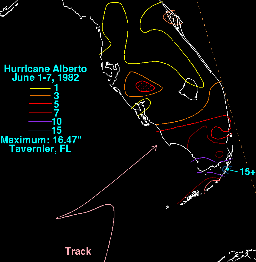
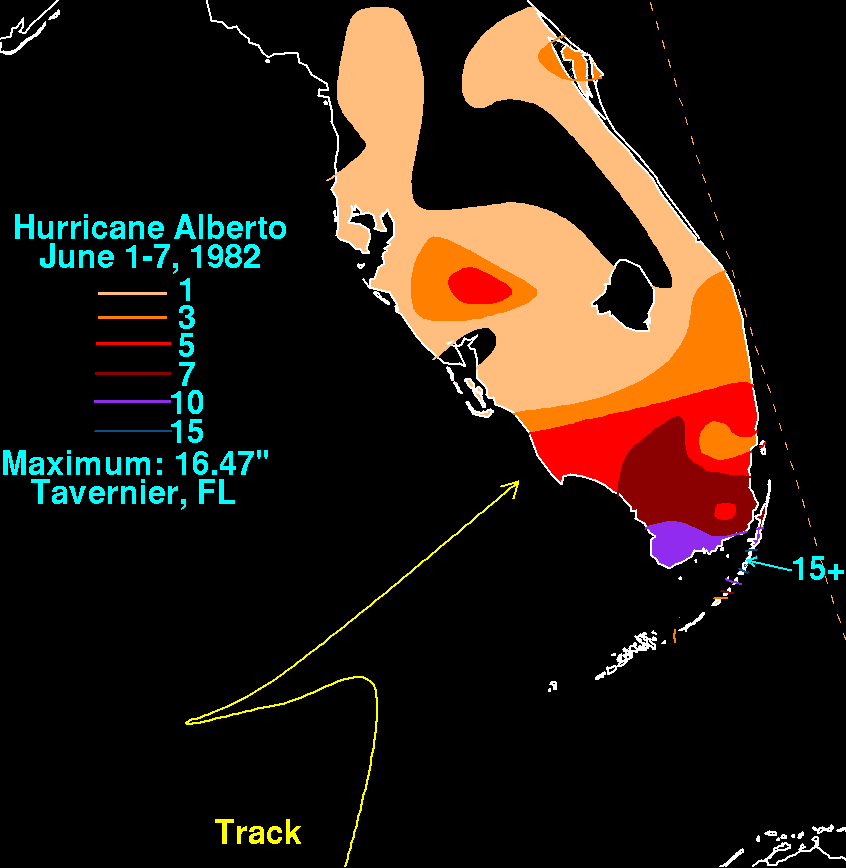
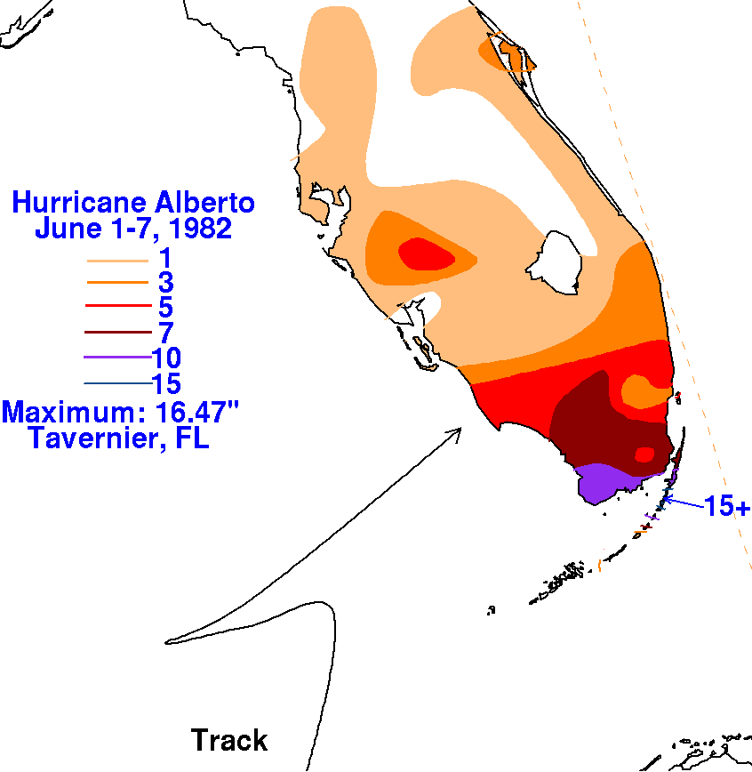
The graphics below show the storm total rainfall for Alberto.
Note
the maxima across
the Florida Keys and South Florida, well to the east of the cyclone.
 |
 |
 |