A negatively tilted trough across portions of the central Gulf of Mexico and the northwest Caribbean sea led to disturbed
weather and a surface low over the western Caribbean by May 20. The low drifted west into the Yucatan peninsula on the 23rd.
Meandering over land for a couple of days, it moved back out into the northwest Caribbean on the 25th and acquired a well-
defined center. As the low was involved with an upper level low and had a broad wind fieled, it was designated as a
subtropical depression just east-northeast of Chetumal, Mexico. Its center propagated northeast into the Yucatan Channel
by the 26th. Once it entered the southeast Gulf of Mexico, thunderstorms became located closer to its center, and the system
strengthened into a subtropical storm just north of the western tip of Cuba. Alberto turned north and became a tropical
storm on the 27th south of Apalachicola, Florida just before its central thunderstorm activity became more scarce. The system
moved ashore the western panhandle on the 28th and gained central convection from then onward while tracking through
the Southeast, Tennessee Valley, and Midwest.
Alberto weakened as it entered Michigan and became entangled with a weak frontal boundary as it moved towards Lake
Huron. A low to the west absorbed Alberto as it moved into Ontario on the morning of the 31st.
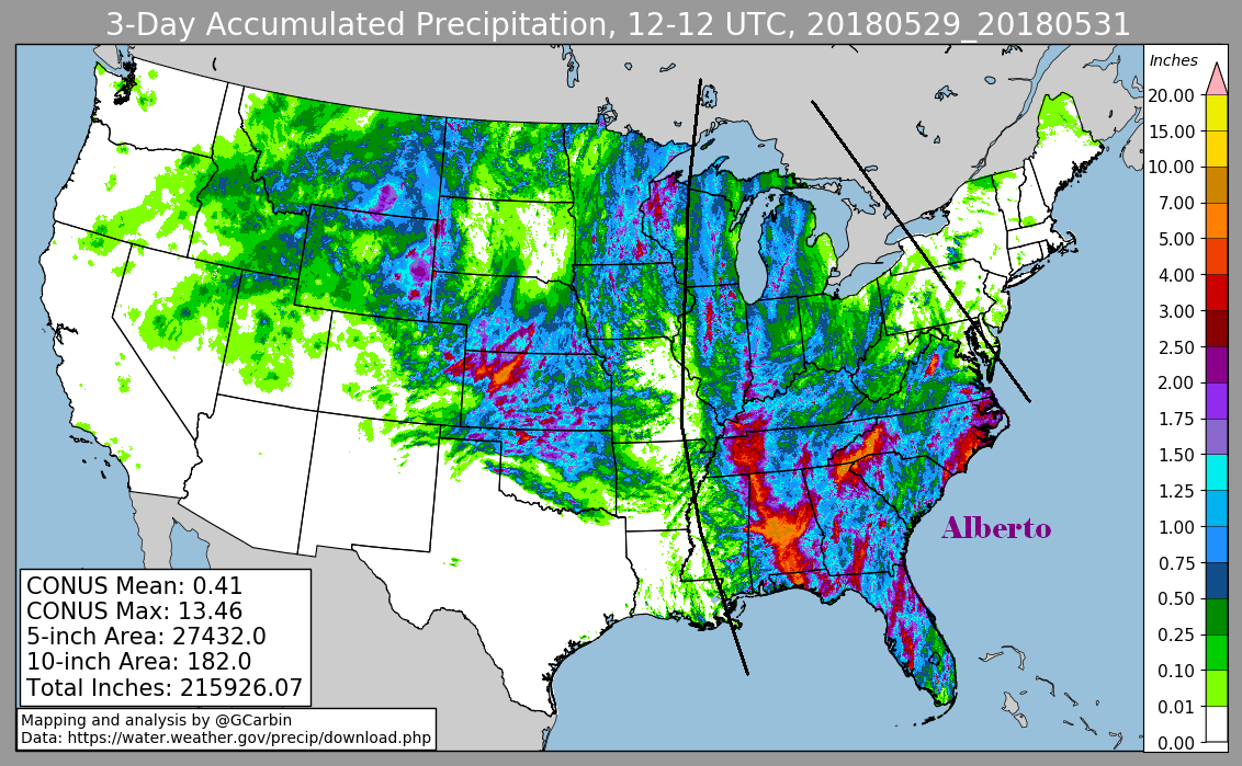
The first three graphics below show the storm total rainfall for Alberto, which used rain guage information from the National
Weather Service River Forecast Centers, Forecast Offices, and CoCoRAHS. The fourth graphic uses the official National Weather
Service multi-sensor rainfall estimates for Alberto, which includes radar-derived information.
 |
 |
 |
 |