In early June, an upper trough moved through the Southeast into the tropics. A closed cyclone formed
at the base of the trough near Cabo Gracias a Dios on the 3rd. This spurred cyclogenesis over Nicaragua
and Honduras on the morning of the 4th. By the 5th, the cyclone moved out into the Gulf of Honduras
and became a tropical depression. Heavy rains fell across Central America during its development, with
a report of 30 inches in San Rafael, Honduras. This excessive rainfall led to significant flooding and 73 deaths.
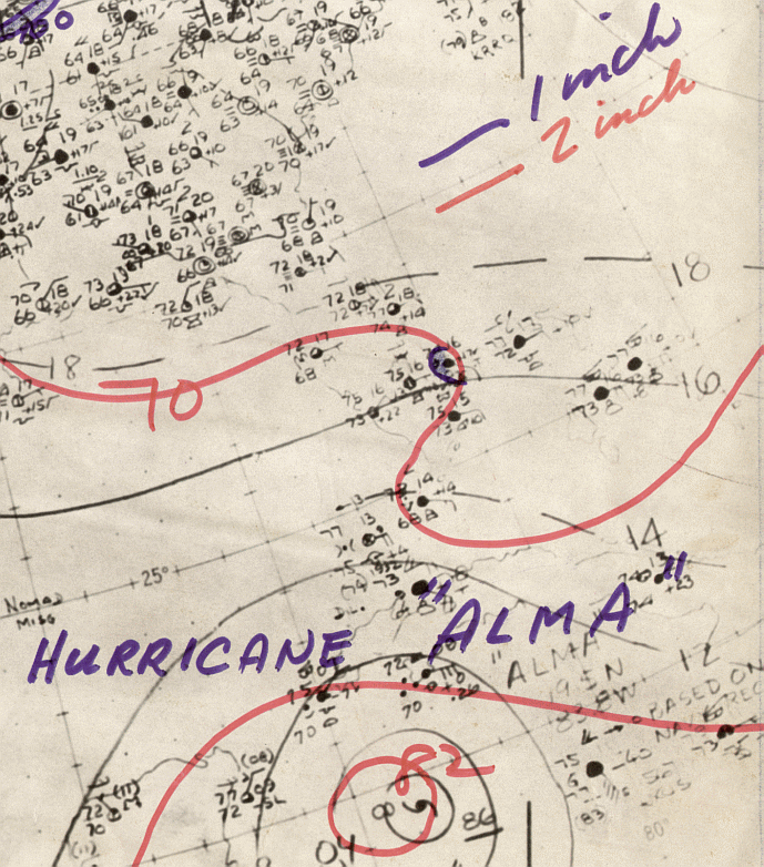
As the system moved northward it strengthened into a tropical storm and ultimately into a hurricane by the 6th.
Strengthening was partially attributed to a portion of the jet stream which extended from the Yucatan channel
across western Cuba and South Florida. Alma struck western Cuba as a strong category two hurricane, leading
to structural damage and a loss of crops. The hurricane moved between the Dry Tortugas and Key West as it
trekked through the eastern Gulf of Mexico. Weakening as it approached Apalachee Bay, likely due to cooler
waters, Alma was a weakening cyclone as it crossed the coast. Alma became a tropical storm as it moved through
the eastern Florida panhandle and southern Georgia. It moved out into the subtropical Atlantic becoming a hurricane
once more offshore Cape Hatteras. Cooler and drier air led to the storm's transformation into an extratropical cyclone
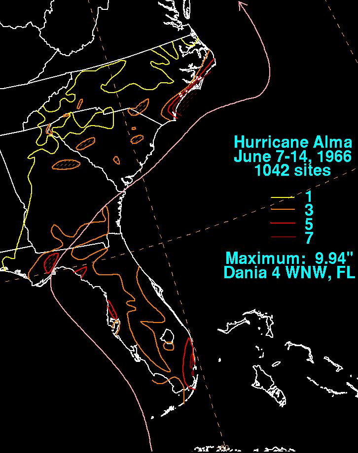
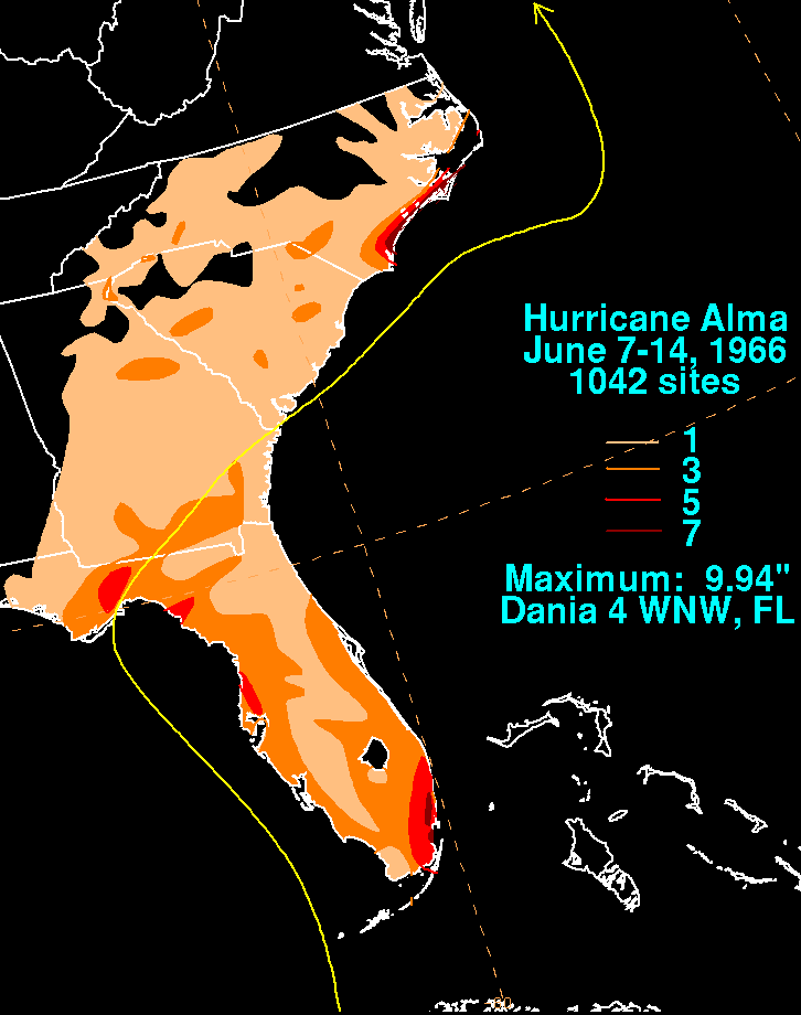
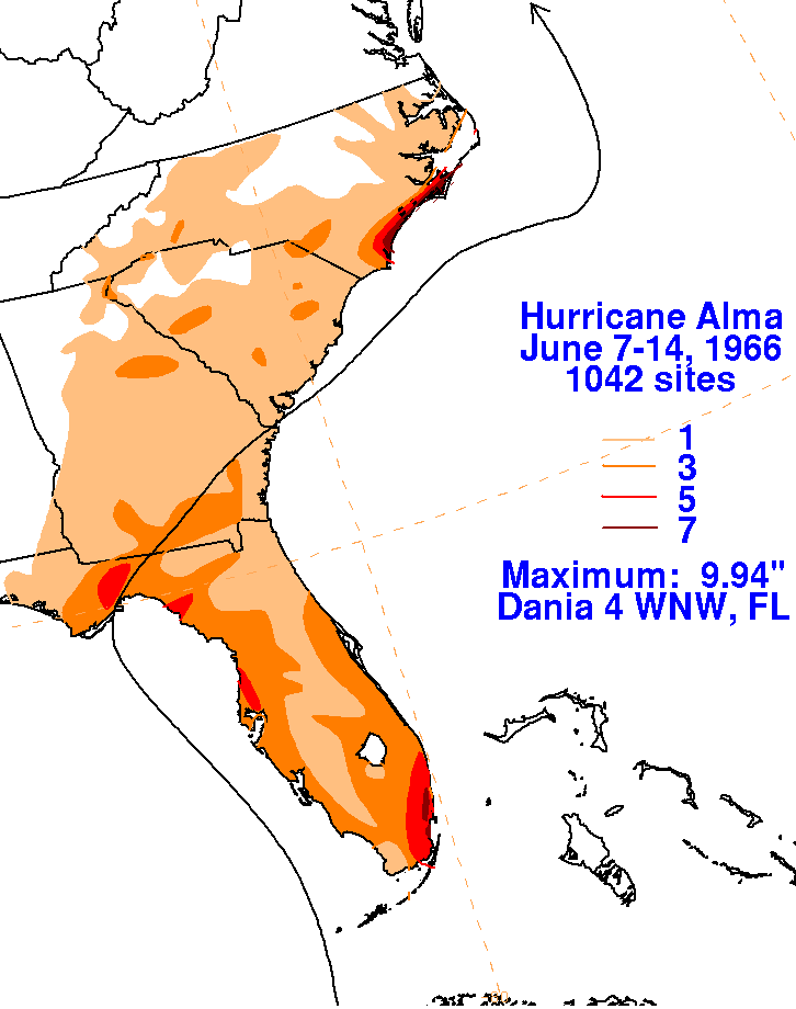
on the 13th. The graphics below show the storm total rainfall for Alma. Data was acquired from the National
Climatic Data Center in Asheville, North Carolina.
 |
 |
 |
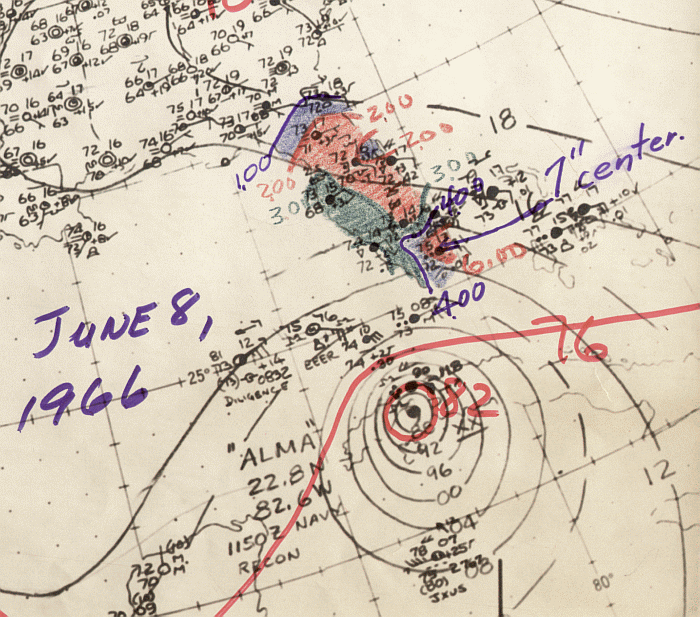
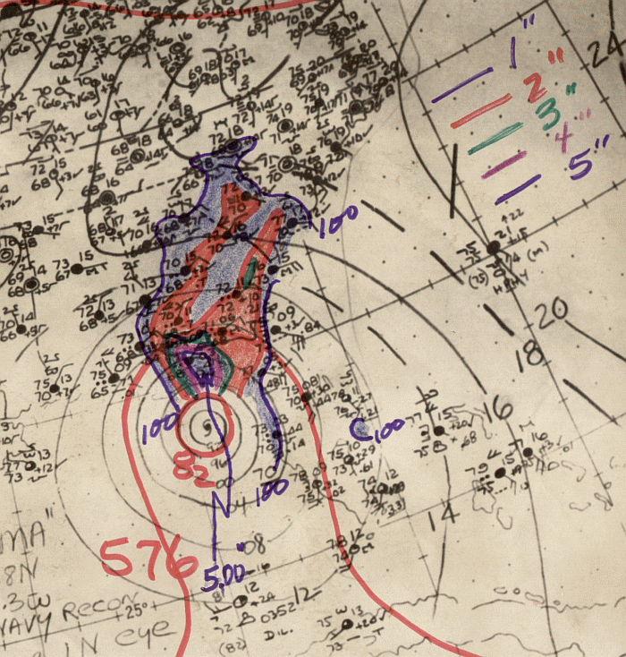
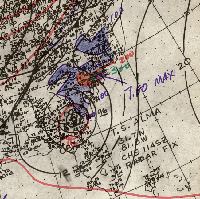
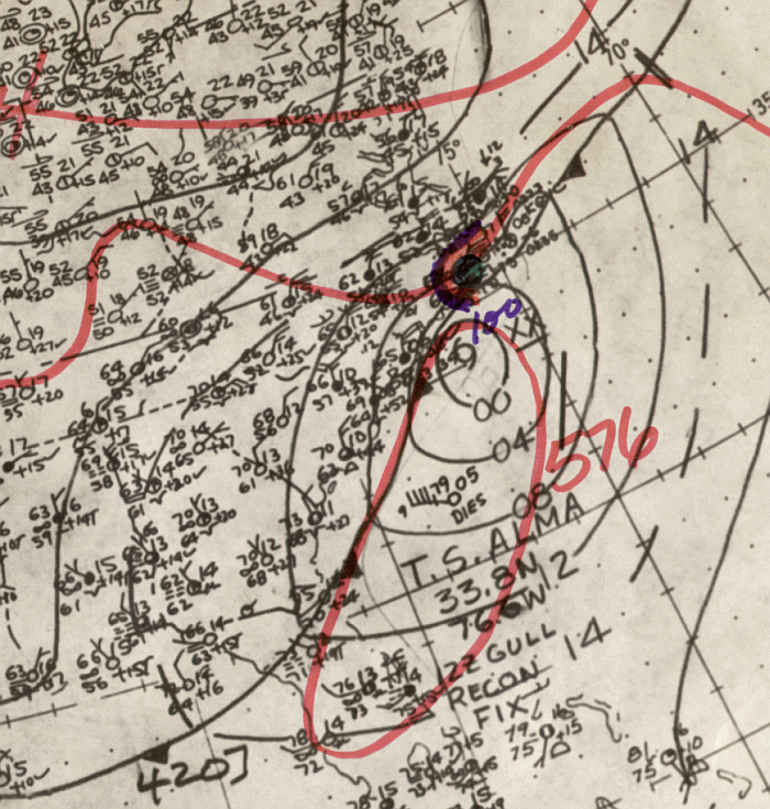
Below is the daily calendar of Rainfall, with 24 hour amounts ending
at 12z in
the morning that day. Surface
analyses are from the start of the rainfall period (i.e. surface map
from 17th
at 12z will underlay the precipitation
which falls between the 17th and 18th at 12z). The time 12z
corresponds
to 8 am EDT, or 7 am CDT.
| Sun. |
Mon. |
Tue. |
Wed. |
Thu. |
Fri. |
Sat. |
| 8 |
9 |
10 |
11 |
|||
| 12 |