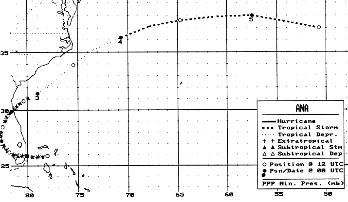
The incipient stage of Ana was as a low to mid level circulation 275
nm
east of Jacksonville on the morning of June 25th. It moved
on an anti-
cyclonic path, developing a surface low on the morning of the 29th as it
tracked across the northern Bahamas. The low moved
westward across
South Florida, went northward along the southwest coast, then
northeast
towards St. Augustine by the evening of the 1st. Accelerating
east-northeast
out into the Atlantic, the low became a tropical depression late on the
2nd,
then a tropical storm by late on the 3rd as it passed northwest of
Bermuda.
Below is the track of this cyclone,
provided by the National Hurricane
Center.
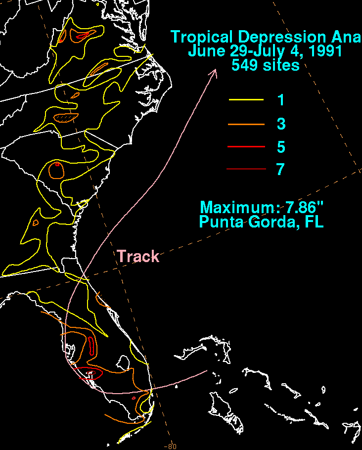
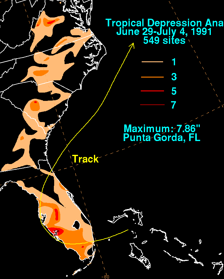
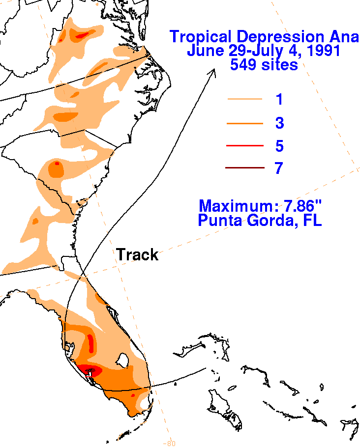
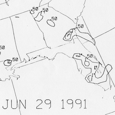
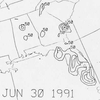
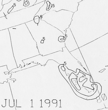
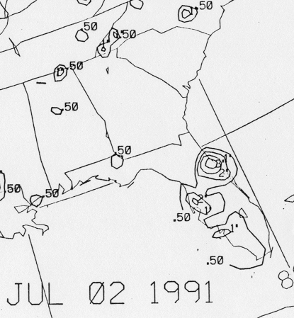
The graphics below show the storm total rainfall for Ana.
Note
the maximum
across southwest Florida, to the east of the track of the cyclone.
 |
 |
 |
Below are the 24 hour rainfall totals valid at 12z...8 a.m. EDT...on
that respective date.
| Sun. |
Mon. |
Tue. |
Wed. |
Thu. |
Fri. |
Sat. |
| 29 |
||||||
| 30 |
1 |
2 |
3 |