A well organized tropical wave with an area of low pressure and significant thunderstorm activity
moved offshore the African coastline on August 9th. The system moved northwest until reaching
the southern Cape Verde Islands, then turned westward out into the open Atlantic. The system was
upgraded to a tropical depression on August 11th, but easterly vertical wind shear kept the system
from strengthening, and led to a reduction of thunderstorm activity which devolved the system into
a remnant low pressure area on the 13th. By the 14th, the system redeveloped thunderstorm activity
and redeveloped into a tropical depression, which strengthened into a tropical storm early on the 15th
well to the east of the Lesser Antilles.
Soon afterwards, vertical wind shear from the west began to displace thunderstorms east and northeast of
the center, beginning Ana's weakening trend. Also, the high pressure system steering Ana caused the system
to accelerate westward. The weakening tropical storm crossed the Lesser Antilles, and was downgraded to a
tropical depression southeast of Puerto Rico on the 16th. During the day on the 17th, aircraft reconnaisance
determined that the system had dissipated southwest of Puerto Rico, as it no longer had a low-level circulation.
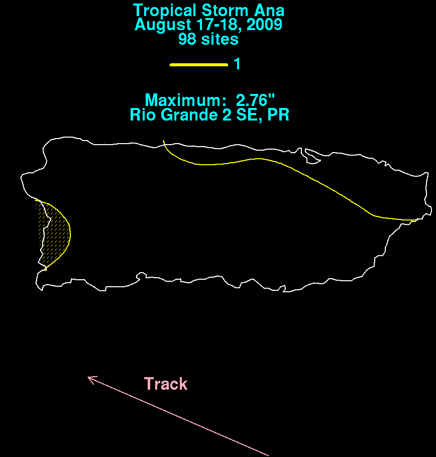
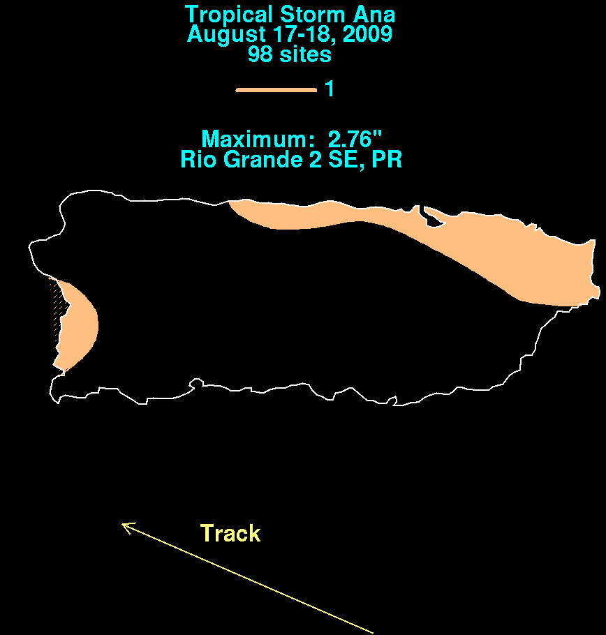
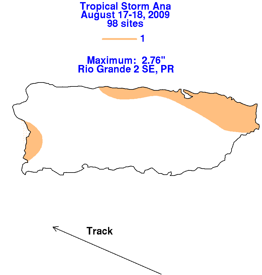
Below are the storm total graphics for Ana. Data was compiled from the National Weather Service River
Forecast Centers from the San Juan National Weather Forecast Office.
 |
 |
 |