A weak low pressure area formed in the eastern Gulf of Mexico on
July 9th along a decaying frontal zone.
The system meandered for a few days before accelerating through the
Southeast on the 13th as a mid-level
trough approached from the northwest. As it moved offshore the
coast of North Carolina, thunderstorm
activity increased in organization sufficiently for the system to be
considered a tropical depression on the 14th.
As the cyclone pulled away from the East coast, the depression
strengthened into a tropical storm as it
accelerated east-northeast to the south of a mid-level cyclone over the
Canadian Maritimes. As it moved
north around the mid-level cyclone's eastern periphery, the low became
extratropical as it moved through
southeast Newfoundland. On the 19th, the low weakened as it
meandered between Newfoundland and
Greenland. Below
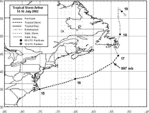
is the track of Arthur, furnished by the National
Hurricane Center.
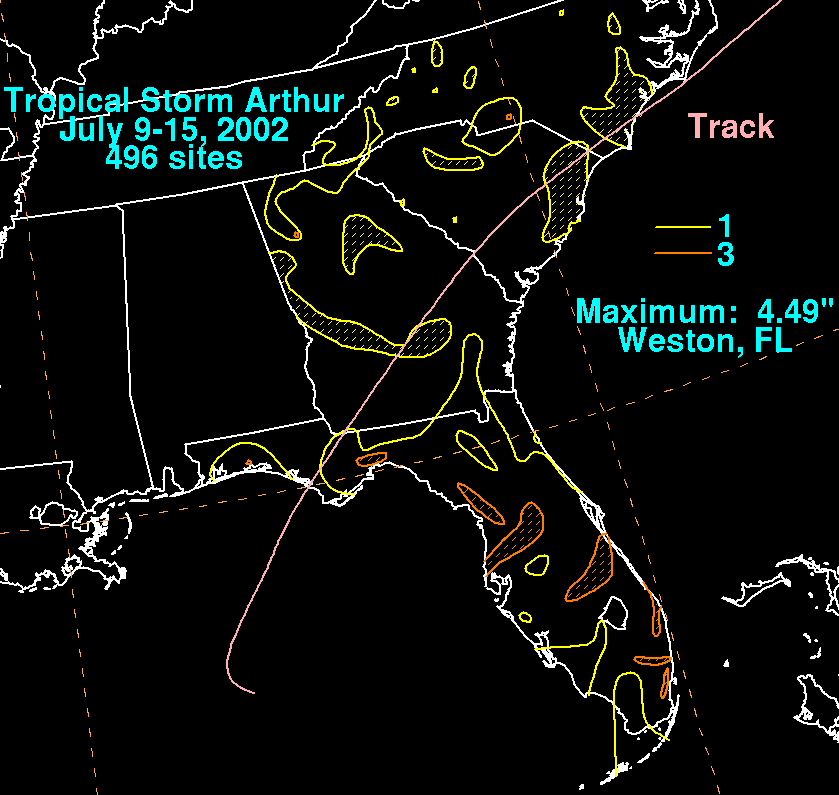
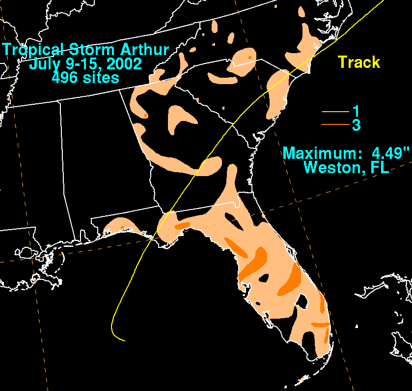
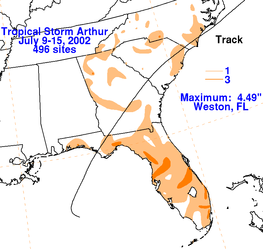
The storm total rainfall maps below were constructed using data from
the
National Climatic Data Center.
 |
|
|