A convective system moving across the northwest Gulf of Mexico sent a mid- level shortwave through the southeast United States.
As the shortwave interacted with a frontal zone across the Carolinas, a surface low formed on June 27. The low moved southeast
into the Atlantic, though its convection was minimal towards the end of June. On June 30, the low had a well-defined circulation.
Late in the day, convection became better organized and the system became a tropical depression that night. Development continued,
with Arthur becoming a tropical storm during the morning of July 1 while looping offshore Florida. On July 2, Arthur moved north
in the direction of the Carolinas. Hurricane status was acheived early on July 3. Arthur turned north-northeast as an upper-level
trough deepened across the East. Becoming a category two hurricane, Arthur moved ashore eastern North Carolina late on July 4
with a well-defined eye. The cyclone weakened after moving back into the Atlantic, with its eye becoming obscured on July 5 while
moving south of New England. Vertical wind shear became an increasing issue, with Arthur evolving into an extratropical low on
July 7.
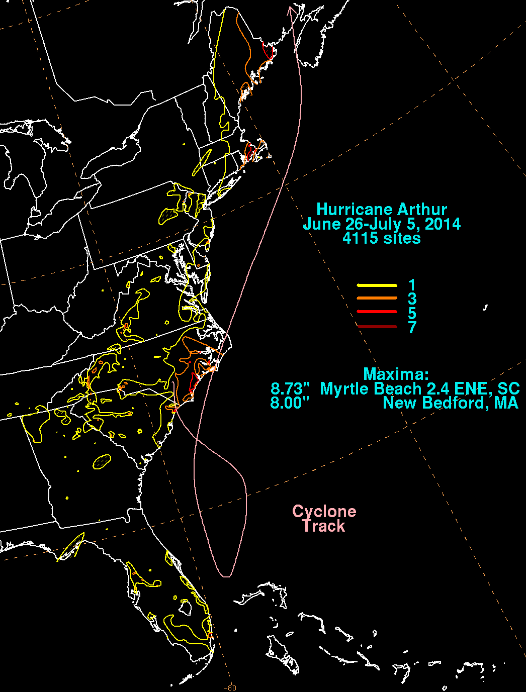
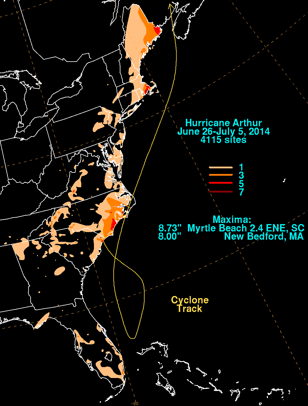
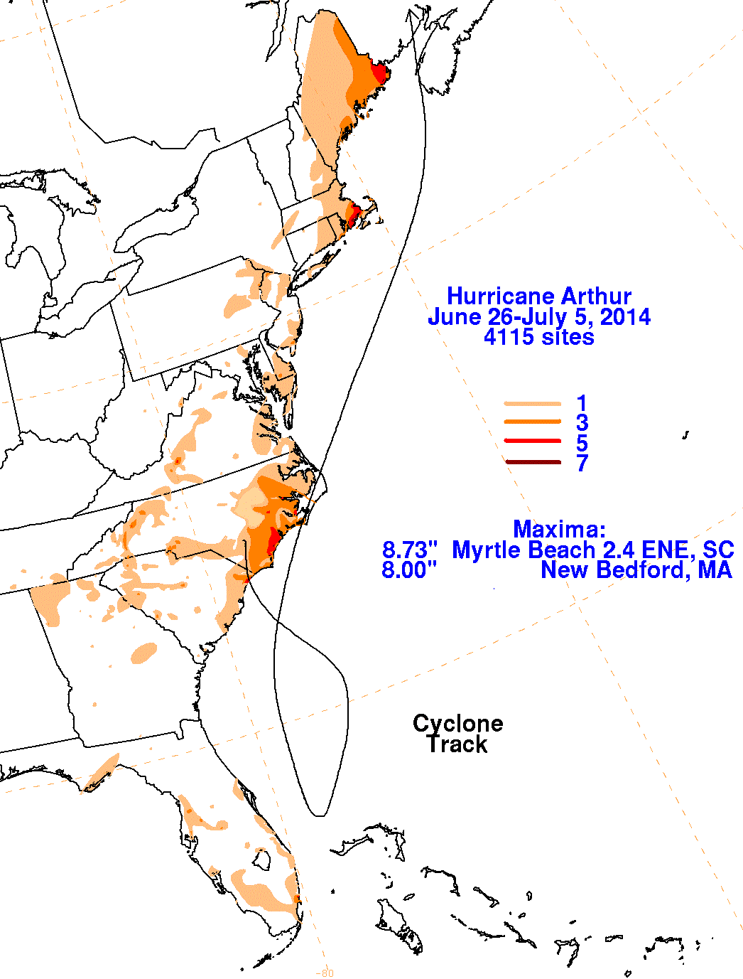
The first three graphics below show the storm total rainfall for Arthur, which used rain guage information from the National Weather
Service River Forecast Centers, Forecast Offices, and CoCoRAHS. The fourth image used multi-sensor rainfall estimates, which
includes radar-derived information.
 |
 |
 |
 |