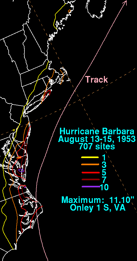
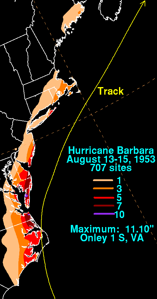
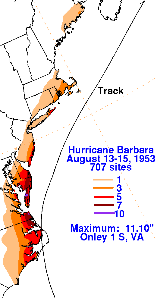
A tropical wave moved through the tropical north Atlantic ocean in
early August 1953. By August 10th, a low
level circulation formed over eastern Cuba on the northern end of the
wave axis. Moving northward to the east
of the Bahamas, the system became a tropical storm on the 11th, and a
hurricane on the 12th. Barbara intensified
into a category 2 hurricane on the 13th as it approached North
Carolina. Moving through the Outer Banks between
Morehead City and Ocracoke, the hurricane began to weaken. The
storm paralleled the Mid-Atlantic and southern
New England coasts on its way towards Atlantic Canada, becoming an
extratropical cyclone on the 15th near Nova
Scotia. The system then hooked northward into eastern Canada on
the 16th. The rainfall maps below for Hurricane
Barbara were created using rainfall data from the National Climatic
Data
Center in Asheville, North Carolina.
 |
 |
 |