A broad low pressure area formed near Central America on May 30th. Slowly moving northward, convection
was slow to organize around its broad center as it moved through the western Caribbean Sea. Entering the
southeast Gulf of Mexico on June 1st, a well-defined circulation developed as thunderstorm activity moved
closer to the center despite an environment of increasing vertical wind shear. The system became a tropical
storm by afternoon, and moved north-northeast into the west coast of Florida near Tampa. The cyclone became
extratropical as it moved along the coast of the Southeast United States, and its central pressure continued to fall
as it moved offshore the Mid-Atlantic States. As a mature cyclone, it slowly weakened as it moved through New
England. A second cyclone moving through southeast Canada absorbed the remains of Barry late on the 5th.
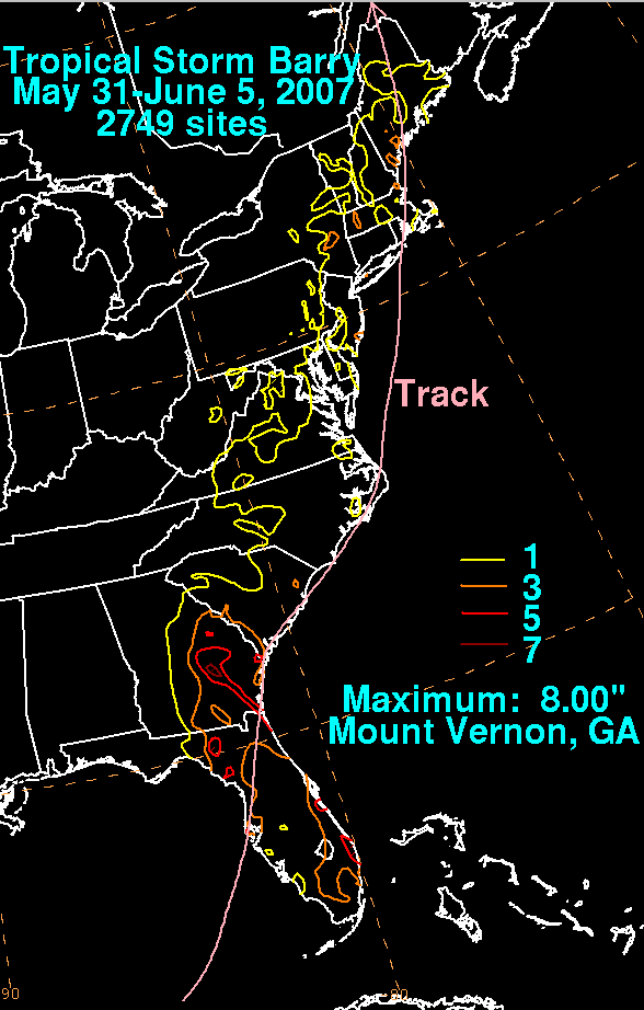
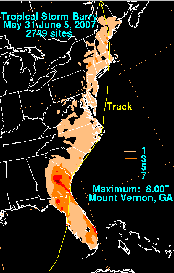
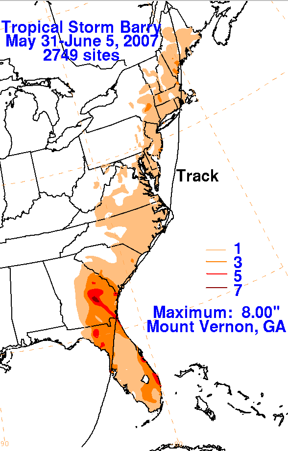
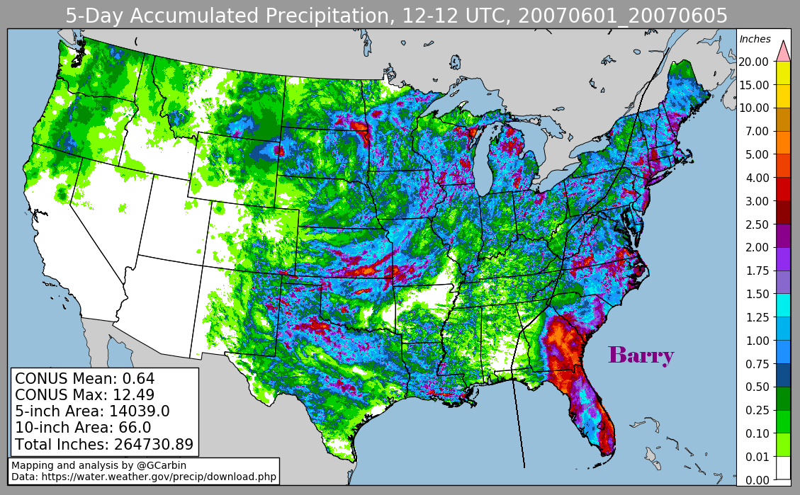
The graphics below show the storm total rainfall for Barry. The first three used rain guage data provided by the River
Forecast Centers, CoCoRAHS, and post storm reports from the Melbourne, Tampa, Tallahassee, and Jackonville forecast
offices in Florida as well as the Columbia, South Carolina forecast office. The fourth image used radar-derived information.
 |
 |
 |
 |