A tropical wave moved south of the Cape Verde Islands on July 26. The system began to organize on July 28, with a low pressure
area forming on July 29. The cyclone would carve out of parabolic path through the north Atlantic during its life cycle. Tropical
storm status was achieved on August 1 while approaching the Lesser Antilles. Vertical wind shear was an issue through much
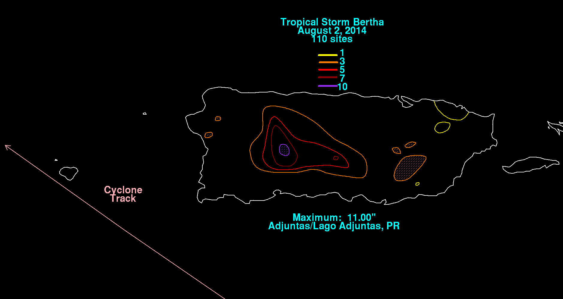
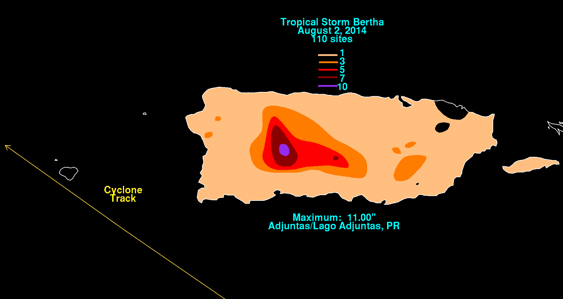
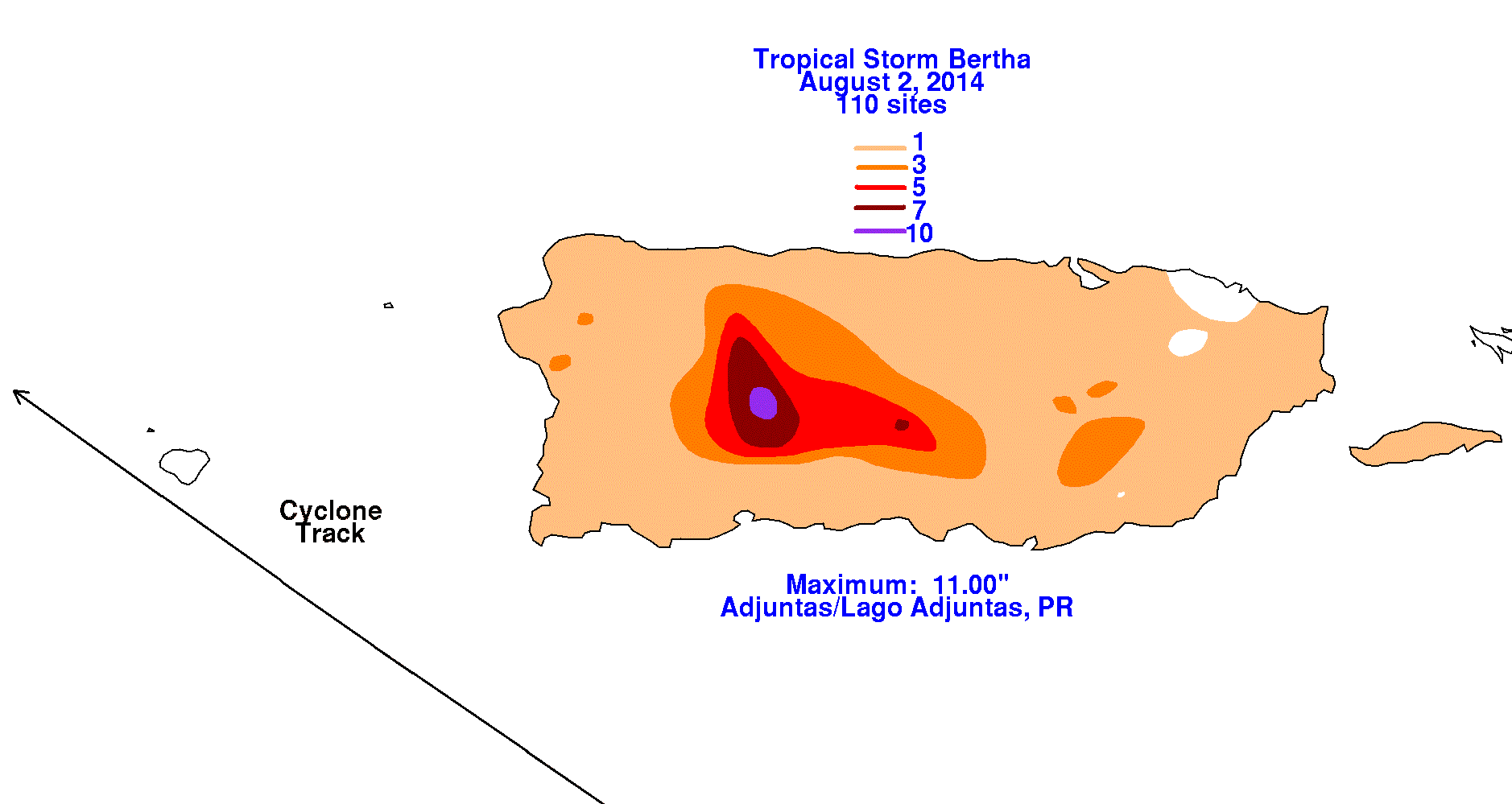
of its life cycle, which slowed development. Its center moved south of Puerto Rico on August 2 while moving swiftly through
the northeast Caribbean sea. Bertha moved by eastern Hispaniola on August 3 before emerging back into the north Atlantic.
Bertha's development resumed as it moved by the Turks and Caicos Islands late that day. By August 4, Bertha had become a minimal
hurricane, despite structural issues. The cyclone accelerated and turned towards the northeast ahead of an upper-level trough,
which began its extratropical transition. Bertha fully evolved into an extratropical cyclone south of Nova Scotia on August 6.
The cyclone raced across the north Atlantic, striking Great Britain on August 10 and into Scandanavia on August 14.
The graphics below show the storm total rainfall for Bertha, which used information from the National Weather
Service River Forecast Centers, Forecast Offices, and CoCoRAHS.
 |
 |
 |