An upper low near the Bahamas, the tail end of a baroclinice trough, and an incoming tropical wave caused disturbed
weather in the Gulf of Mexico. It had to wait for Sally and the upper low west of Sally in the Gulf of Mexico to move
along before it could develop further. The Gulf disturbance turned southwest and south due to Sally, with the resulting broad
surface low existing in the western Gulf of Mexico by the 15th. After Sally moved inland and the upper low to its north
filled, the disturbance became better organized on the 16th. By the morning of the 17th, a tropical depression formed
over 300 miles south-southeast of Brownsville. Motion shifted from northeast to north-northeast by the 18th. The depression
strengthened into a tropical storm on the 18th as the nearby upper trough weakened. Ridging developed to its north in the low-levels,
which slowed further motion to the north and northeast on the 19th. As the high to the north strengthened further, Beta turned to
the west-northwest. Vertical wind shear allowed dry air to entrain into the system, causing a period of haphazard bursting
within what was otherwise a broad non-tropical appearing statocumulus swirl. Beta made landfall near Matagorda Bay during the
evening of the 22nd, and the upper trough across Texas causing the vertical wind shear caused Beta to sharply recurve just inland
of the Texas coast. Beta regained tropical depression status late on the 22nd as it was linking up with a frontal boundary,
becoming extratropical/post-tropical soon after. The low continued moving east- southeast across the South over the next few
days as the system elongated, the nature of most extratropical cyclones.
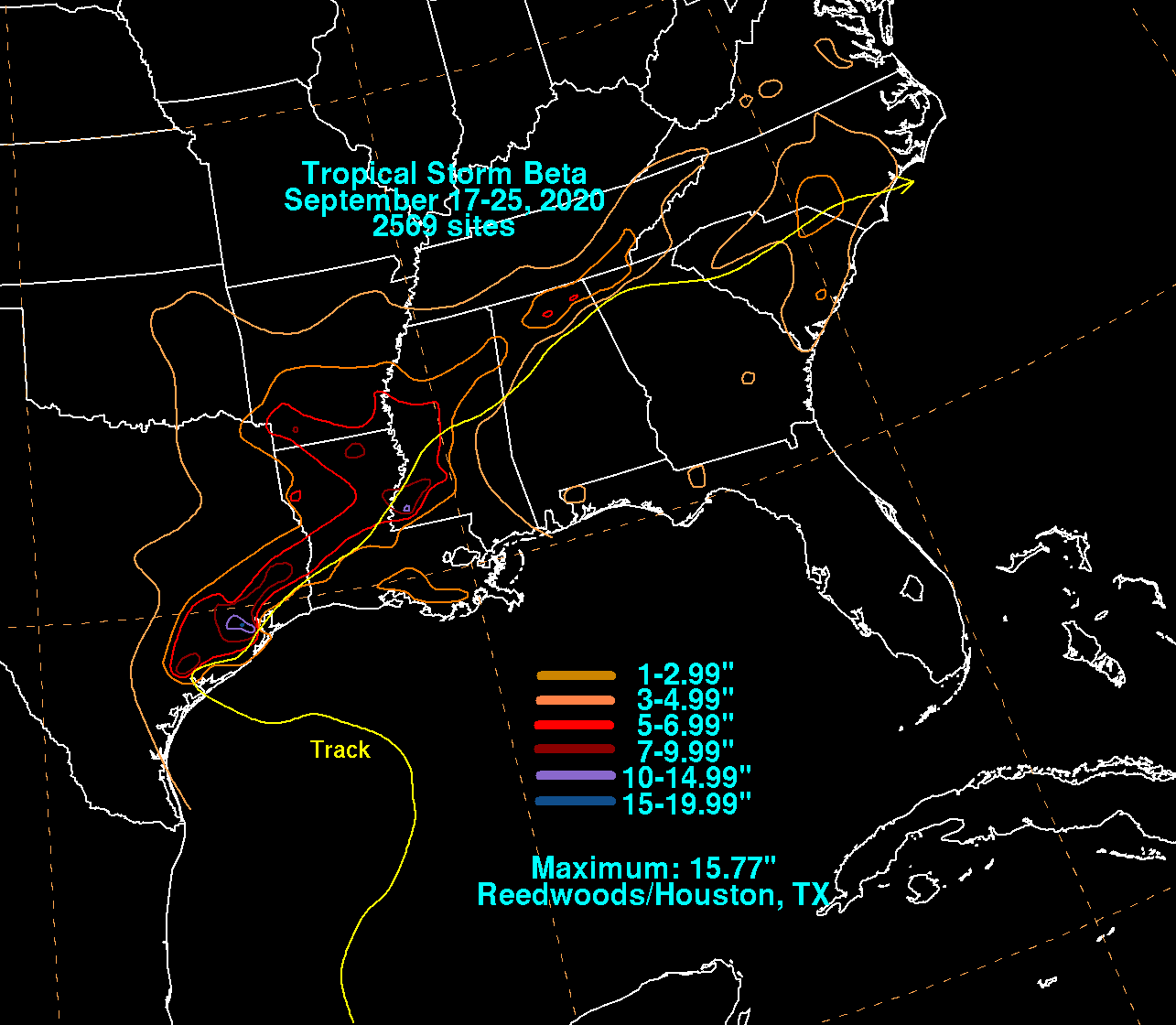
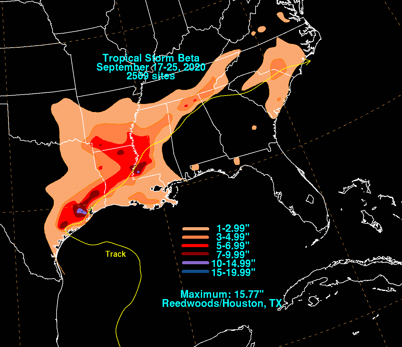
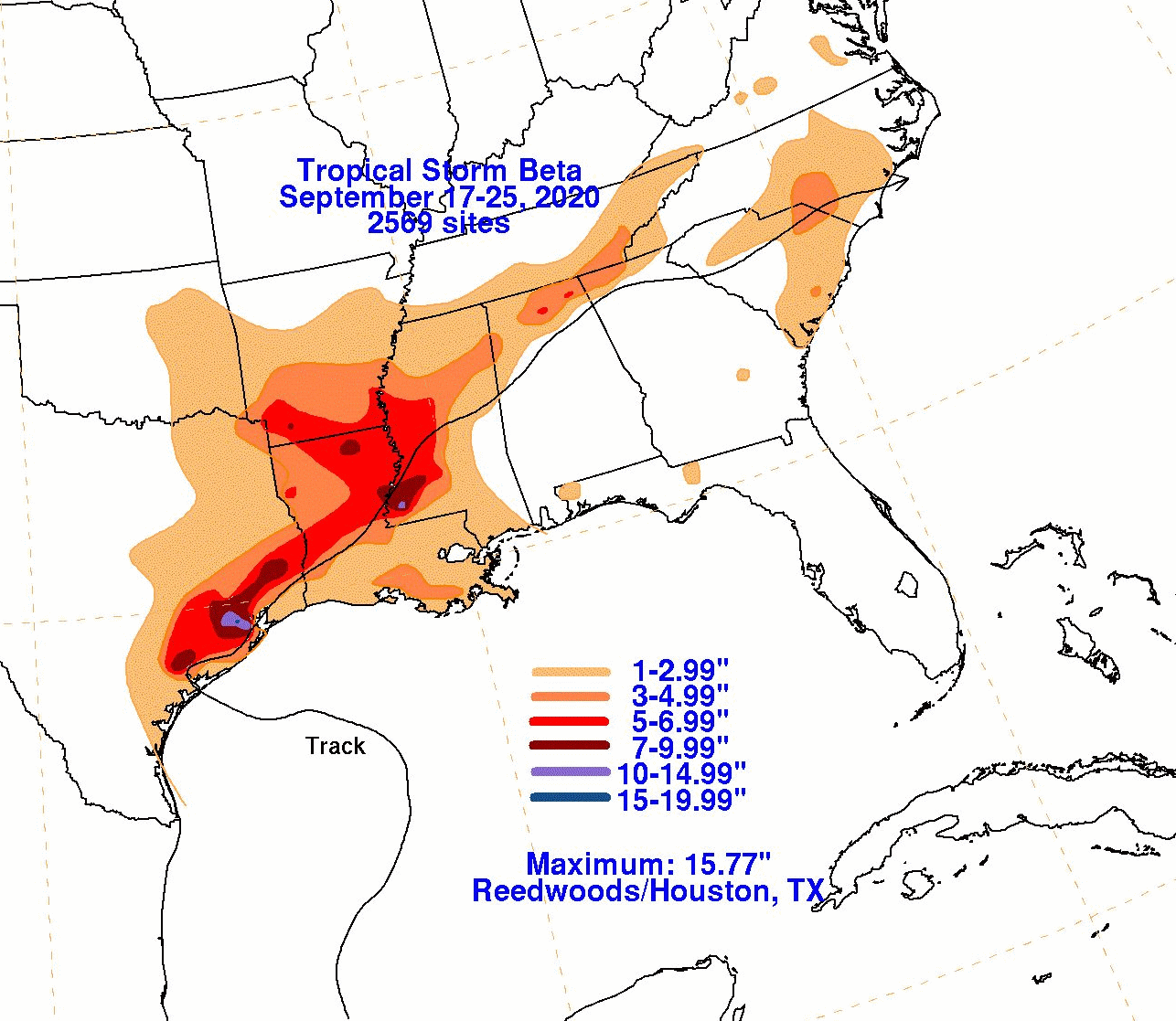
The graphics below show the storm total rainfall for Beta, which used rain gage information from the National Weather
Service River Forecast Centers, Forecast Offices, and CoCoRAHS.
 |
 |
 |