A well-organized tropical wave and low pressure center moved offshore the African coast on August 12th. By the 15th, it was deemed
a tropical depression. Later in the day, the system continued to develop and was designated Tropical Storm Bill. Bill moved on a parabolic
track around the subtropical ridge, becoming a hurricane in the central tropical Atlantic on the 17th, and a major hurricane east of the Leeward
Islands on the 18th. After peaking in intensity on the 19th, Bill moved northwest and developed a large eye while weakening. Turning
northward, Bill moved over cooler waters and steadily weakened as it moved offshore New England and much of Atlantic Canada, making
landfall in Newfoundland late on the 23rd as a hurricane as it was evolving into an extratropical cyclone. The system crossed the northern
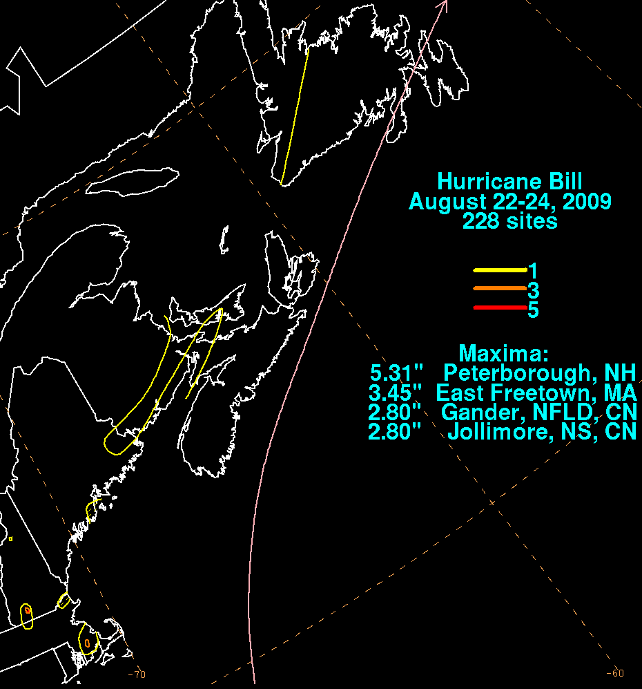
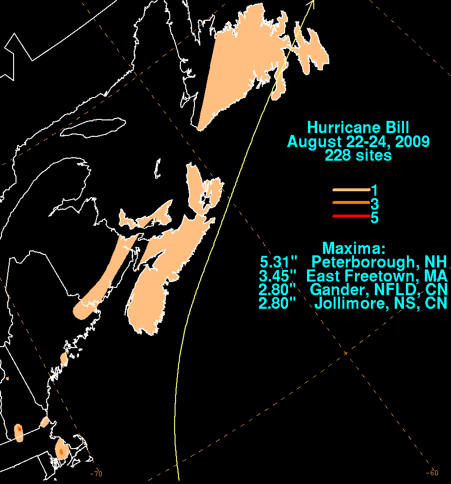
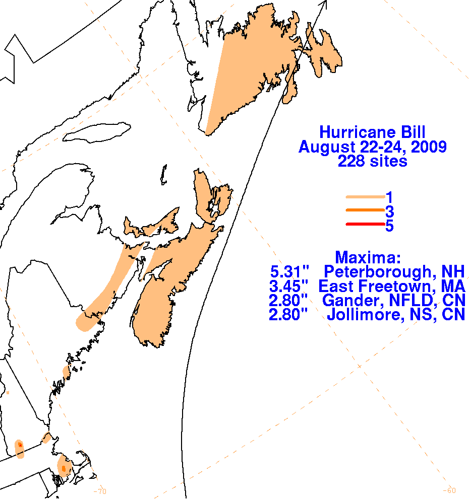
Atlantic ocean, impacting Great Britain with heavy rains and significant surf. Below are the storm total graphics for Bill. Data was compiled
from the Northeast River Forecast Center and Environment Canada. The peak of heavy rainfall in New Hampshire occurred indirectly with
the storm, as moisture pooled along a frontal boundary to its northwest. Rainfall from southeast New England through eastern Atlantic Canada
was directly associated with Bill's rain shield.
 |
 |
 |