An ill-defined tropical wave emerged from the west coast of Africa on May 31st. It tracked westward through the Tropical Atlantic
with virtually no associated weather, ending up in the western Caribbean sea on June 11th. Meanwhile, Hurricane Carlos had
developed south of Mexico and moisture to its east had focused into the elongated trough of low pressure. By the 13th, a broad
low had formed over Belize and the Yucatan peninsula of Mexico. The system moved northwest into the Gulf of Mexico on the
14th and 15th, developing a well-defined circulation late on the 15th which is when it was deemed that a tropical storm had
formed, named Bill, about 175 miles offshore Corpus Christi, Texas. The storm moved west-northwest to northwest, making landfall
on Matagorda Island on the 16th. It weakened into a tropical depression as it passed just east of Austin and moved across east
Texas into Oklahoma, causing heavy rainfall in its vicinity. Its surface low moved east-northeast across the Ohio Valley over
the next few days before dissipating over West Virginia on the 20th.
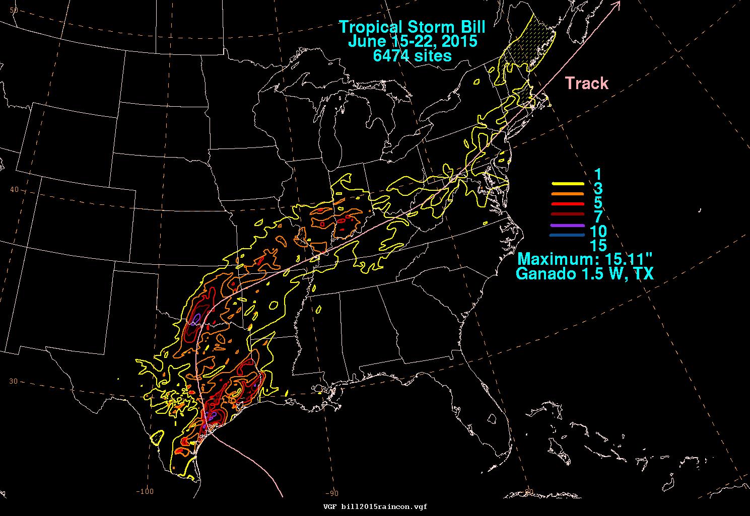
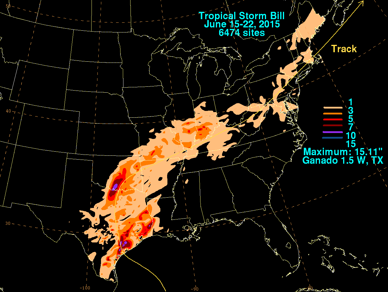
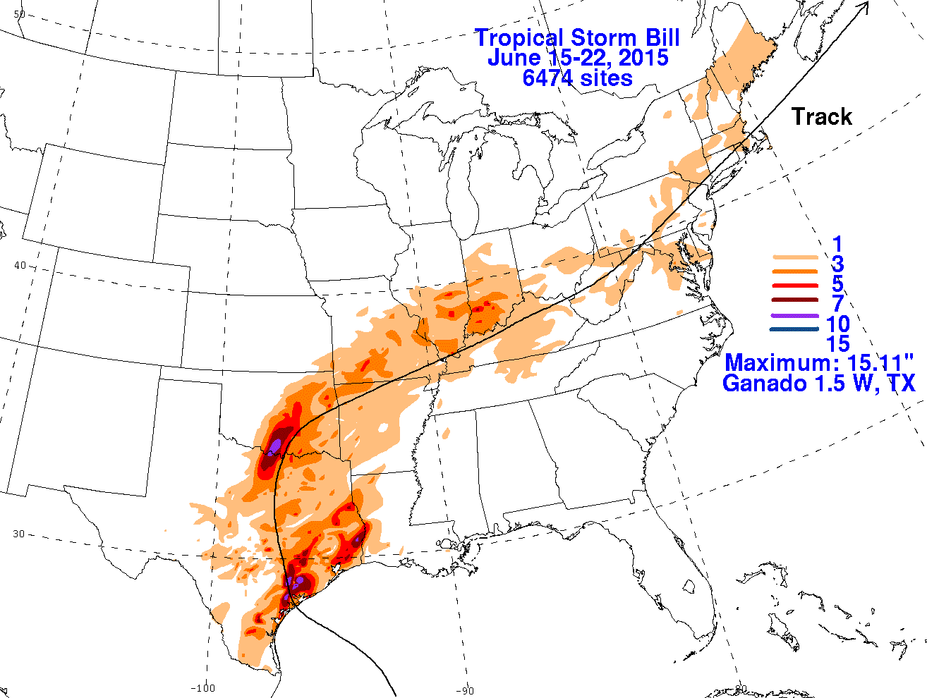
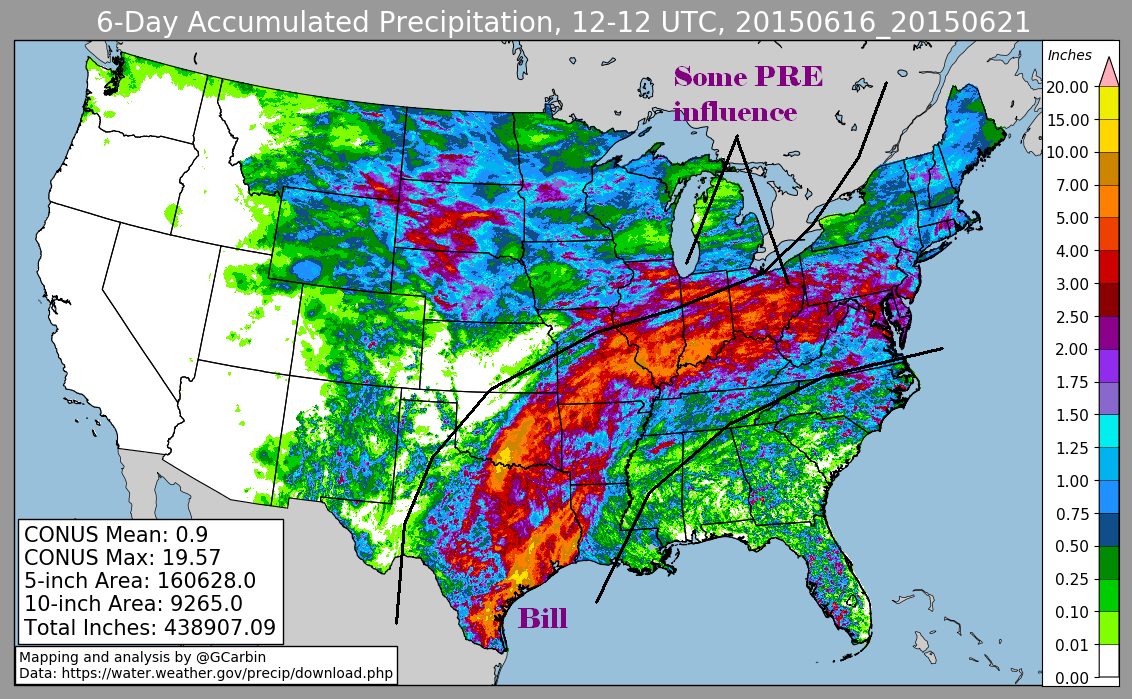
The first three graphics below show the storm total rainfall for Tropical Storm Bill, which used rain guage information from National Weather
Service River Forecast Centers, Forecast Offices, and CoCoRAHS. The fourth image uses multi-sensor rainfall estimates, which includes
radar-derived information.
 |
 |
 |
 |