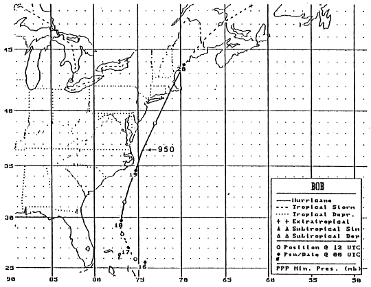
The beginnings of this tropical cyclone were along an old frontal
boundary
southeast of Bermuda on the 12th. Convection increased as it
moved southwest
and west over the next few days. By the morning of the 15th, a
low was located
a couple hundred miles east of the Bahamas. By the next day, it
is estimated the
cyclone developed into a tropical depression 175 nm east of
Nassau. The system
turned to the west and west-northwest, and developed into a tropical
storm on the
16th. The next day, a central dense overcast was noted, and Bob
had become a
hurricane as it turned northward. A deep trough over the East had
picked up
the storm, and it accelerated northward. Bob intensified into a
major hurricane
east of the Outer Banks of North Carolina, then passed over cooler
shelf waters.
Weakening ensued as it approached New England, clipping the east side
of Long
Island. It came ashore again over Block Island before striking
Newport, Rhode
Island on the afternoon of the 19th as a category 2 hurricane. It
made a final landfall
as a tropical storm late on the 19th near Rockport, Maine, later
crossing Maine,
New Brunswick, the Gulf of St. Lawrence, and northern
Newfoundland. It crossed
the Atlantic as a nontropical low in the westerlies, dissipating near
the coast of
Portugal on the 29th. Below is the track of this cyclone,
provided by the
National Hurricane Center.
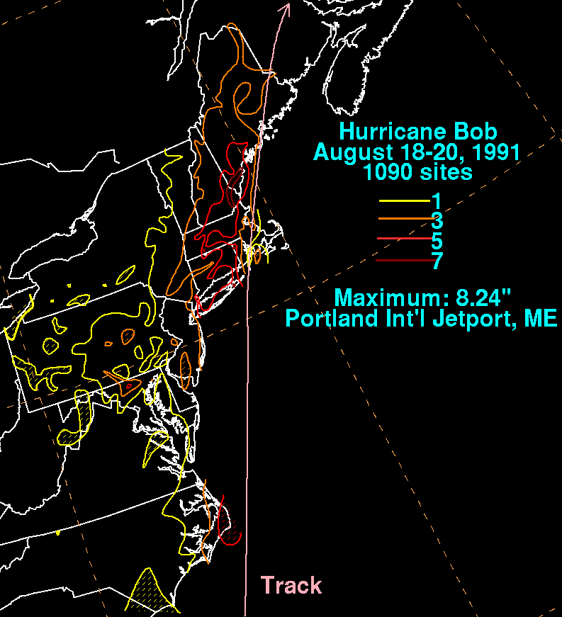
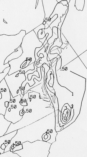
The graphics below show the storm total rainfall for Bob.
Note
the maximum
across southwest Maine, just to the west of the track of the cyclone.
 |
 |
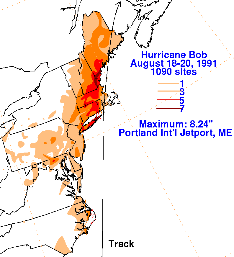 |
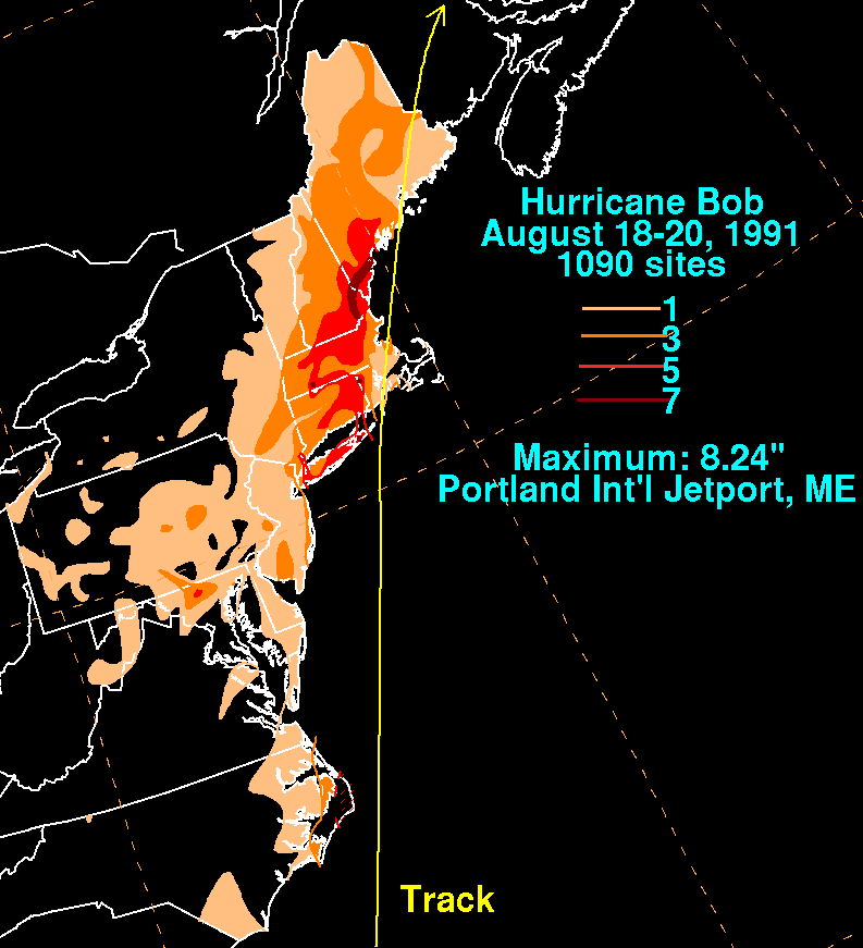
Below are the 24 hour rainfall totals valid at 12z...8 a.m. EDT...on
that respective date.
| Sun. |
Mon. |
Tue. |
Wed. |
Thu. |
Fri. |
Sat. |
| 19 |
20 |