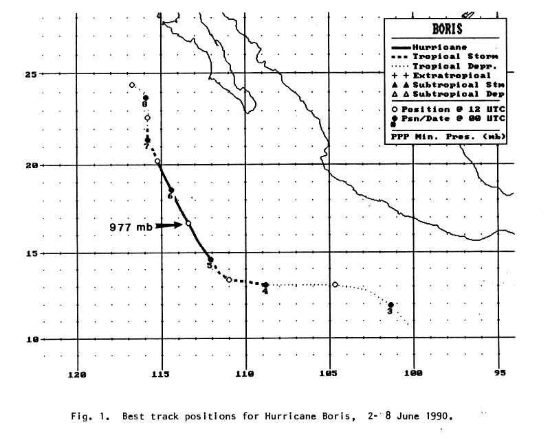
A tropical wave emerged from the coast of Africa on May 20th. Moving quietly across the tropical Atlantic and
Caribbean, ITCZ cloudiness south of Central America increased and moved northward as the wave entered the
eastern Pacific ocean on the 31st. A tropical disturbance formed and moved westward, organizing into Tropical
Depression Two-E late in the morning on June 2nd. The depression moved west-northwest, and strengthened
into a tropical storm 435 miles southwest of Manzanillo on the afternoon of the 3rd. Over the next day, development
continued and Boris strengthened into a hurricane. A deepening trough offshore the west coast of the United States
steered Boris more to the north, and led to its elongation early on the 6th. Vertical wind shear took its toll and it
weakened back into a tropical storm early that morning, and into a tropical depression that night. While the surface
circulation spun down off the northwest coast of Baja California, its circulation aloft lifted northeast through the
Intermountain West. Below is the track of this cyclone, constructed from data provided by the National
Hurricane Center.
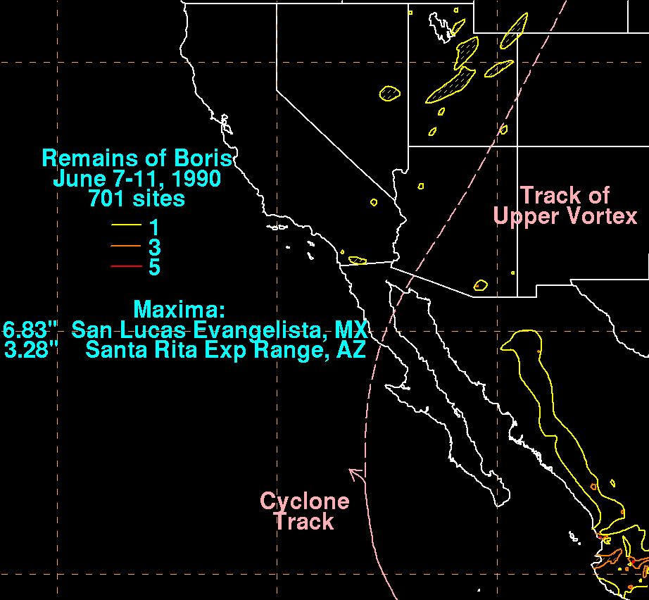
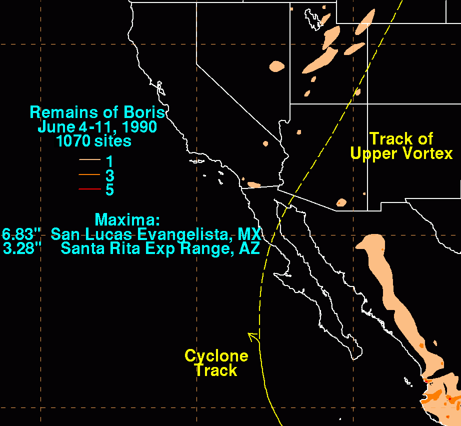
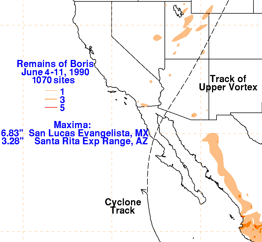
The graphics below show the storm total rainfall for Boris.
Much of the rainfall which fell across the Sierra Madre
Occidental and southeast Arizona was due to a monsoon surge around
Boris' eastern periphery. Some outer bands
contributed to the higher amounts in southwest Mexico around June 5th.
 |
 |
 |