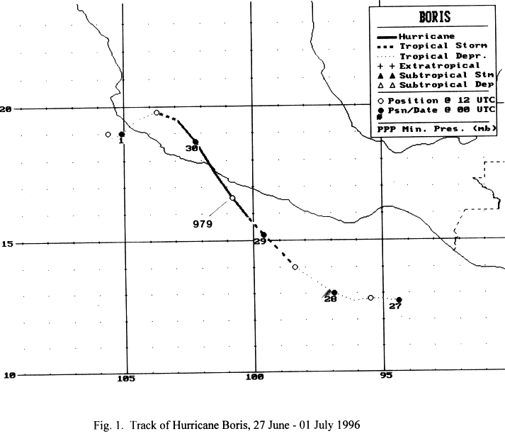
A weak tropical wave which emerged off the coast of Africa on June 8th and crossed Central America on the
23rd may have led to the development of this cyclone. A low level circulation formed on the 26th about 250
miles south of the Gulf of Tehuantepec. The system organized into a tropical depression on the 27th and moved
initially moved westward. The system turned northwest as it became a tropical storm on the 28th, and then a
hurricane later that day. The center made landfall midway between Lazaro Cardenas and Acapulco on the 29th.
As it weakened quickly over Mexico, the system turned more westward due to increased ridging to its north.
Emerging back into the Pacific as a tropical depression late on the 30th, its surface circulation completely
dissipated south of Puerto Vallarta. Below is its track, supplied by the National Hurricane Center.
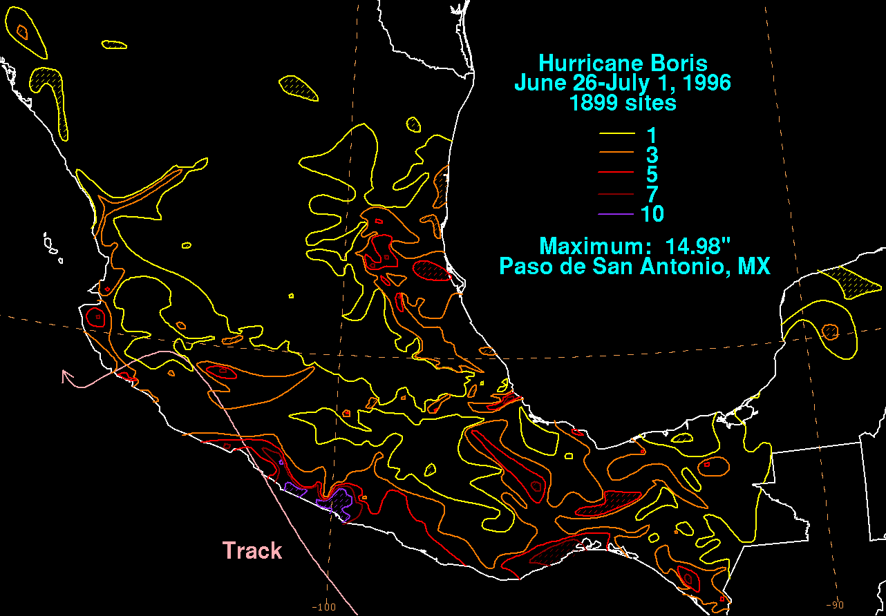
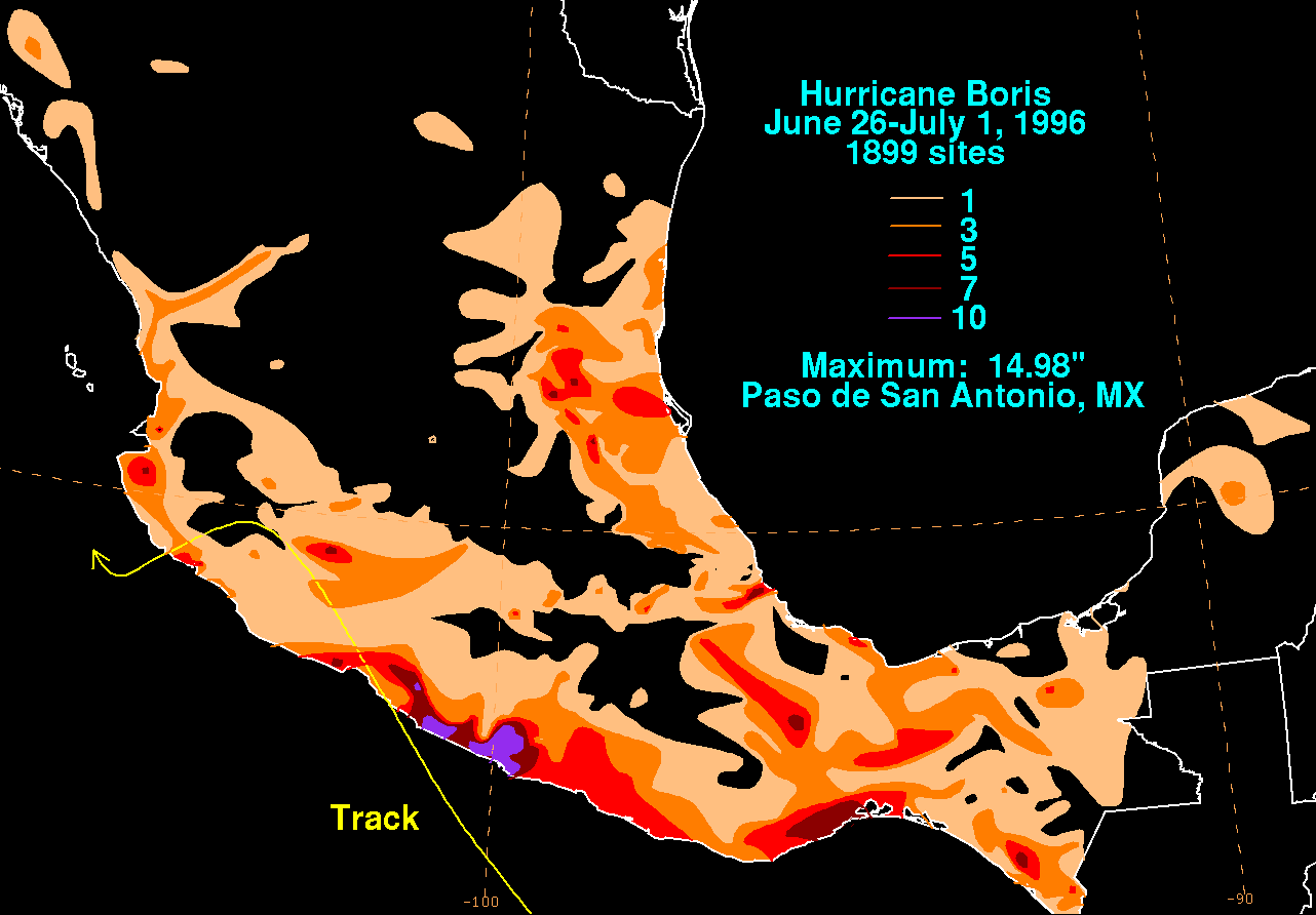
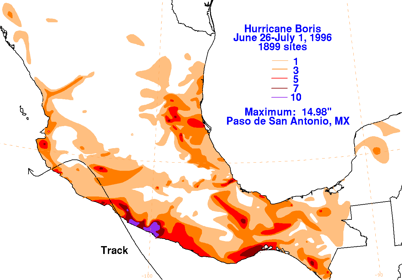
The graphics below show the storm total rainfall for Boris, which used rainfall information from the Comision
Nacional del Agua, which contains Mexico's National Weather Service. The maximum in eastern Mexico occurred
when its inflow bands intersected the Sierra Madre Oriental.
 |
 |
 |