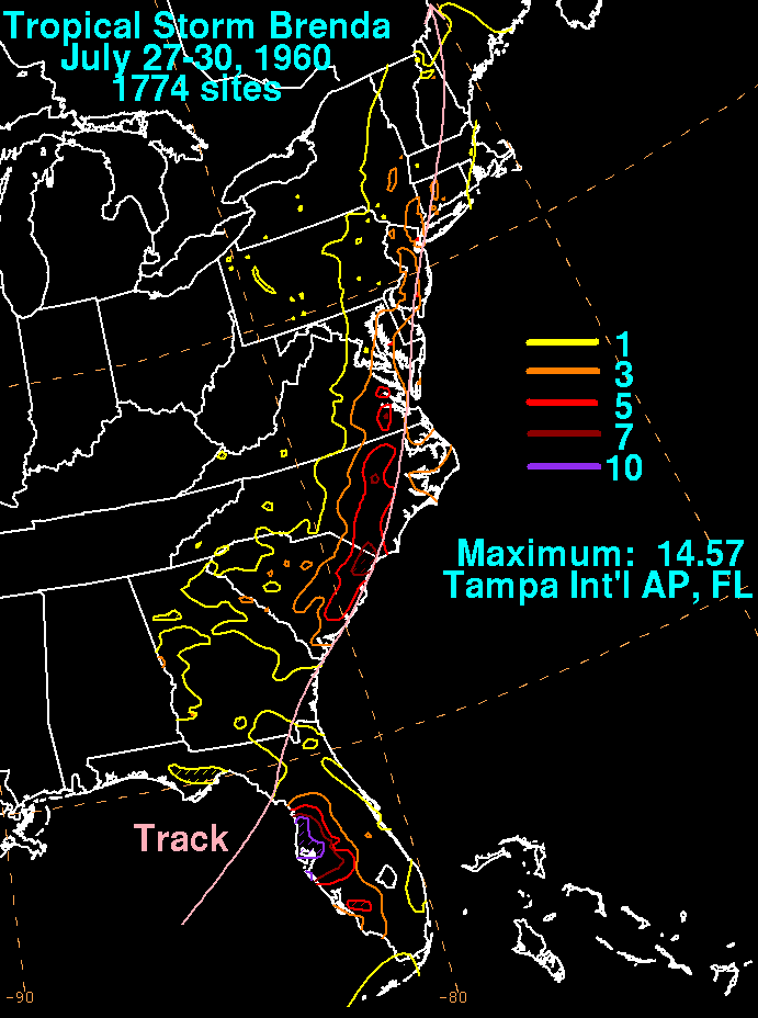
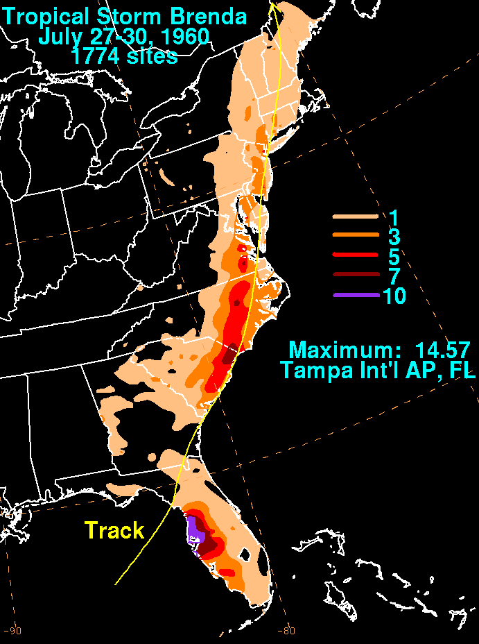
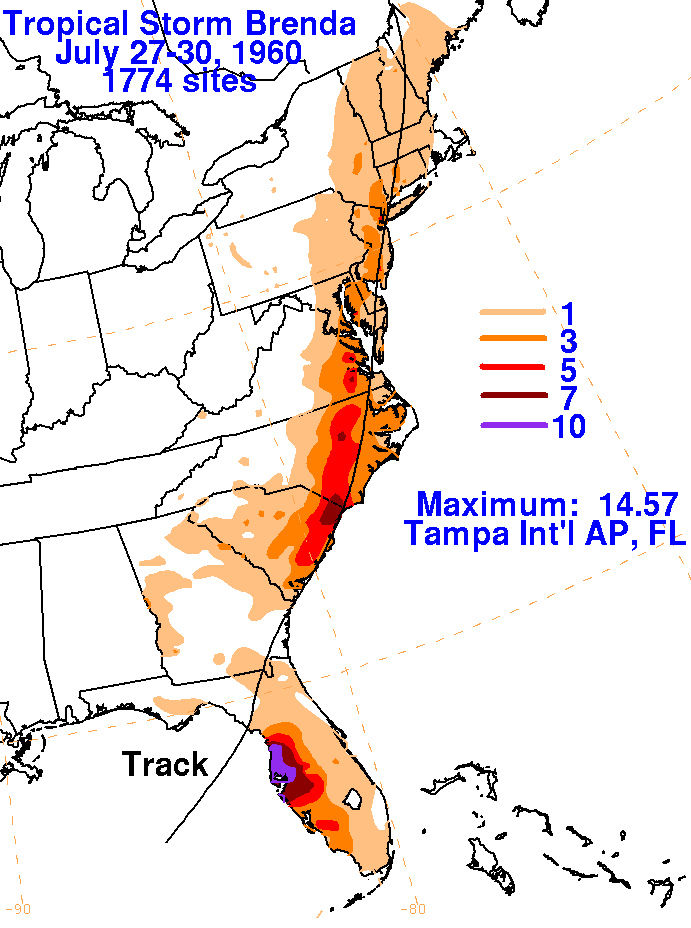
A weak tropical depression formed offshore western Florida on July
27 around 150 miles offshore of Tampa.
The system had a broad center with light winds, similar to a
subtropical cyclone. Its wind pattern did not tighten
up into a more typical tropical cyclone-like wind field until it
reached the Carolinas. The cyclone strengthened
and sped northeastward up the coastal plain of the Southeast and
Mid-Atlantic States before becoming an extratropical
cyclone as it curved northward through New England. The rainfall
graphics below for Brenda used
data supplied
by the National Climatic Data Center in Asheville, North
Carolina. The heaviest rainfall fell to the right of its track
as it moved ashore from the Gulf of Mexico, causing considerable
flooding in west-central Florida, and shifted left of
the center thereafter as the cyclone transitioned into an extratropical
low.
 |
 |
 |