A tropical wave passed through the Gulf of Tehuantepec, spurring the development of a tropical
disturbance on July 2nd. The system initially moved westward, and by the morning of the 4th
developed into a tropical depression to the southeast of Acapulco. Intensification continued, and
by that evening tropical storm status had been achieved. By late on the 5th, Calvin became a hurricane
while moved more to the northwest. Its outflow pattern expanded to encompass Central America,
southern Mexico, and the Pacific ocean east of the 110th meridian. Widespread rains began to fall
across southern Mexico while the center was still well offshore.
An upper level low south of Baja California caused an acceleration in its forward motion towards
the Mexican coast. At landfall during the morning of the 7th, Calvin had become a strong category
two hurricane. It became one of two known hurricanes to strike Mexico's west coast. Weakening
significantly thereafter, the system moved just inside the coastline before emerging into the southern
Gulf of California late that day as a tropical storm. The cyclone continued to weaken, and Calvin
became a tropical depression once more when it made landfall across the southern portion of Baja
California Sur during the afternoon of the 8th. The low pressure area once associated with Calvin
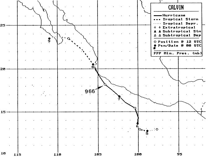
disspiated west of Baja California early on the 9th. Below is its track, supplied by the National
Hurricane Center.

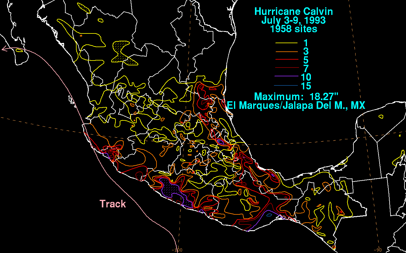
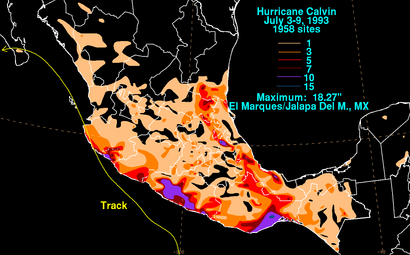
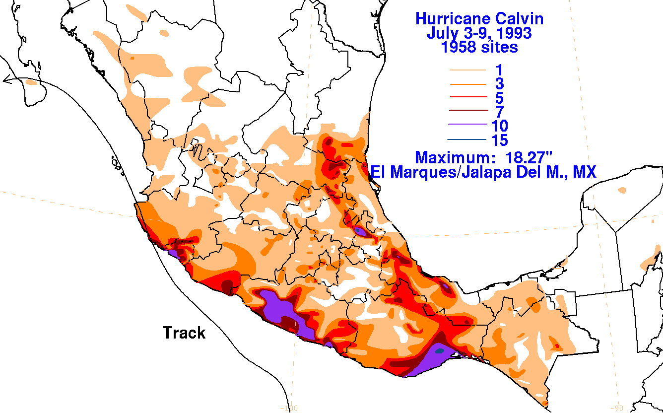
Below are the graphics showing the storm total rainfall. Data from Mexico was supplied
by the Comision Nacional del Agua, parent agency of their national weather service.
 |
 |
 |