The system that led to Chantal's development appeared as an ITCZ
disturbance near
Trinidad on July 24th. It moved westward across the Caribbean
showing little development
until approaching Honduras on the 27th. By the afternoon of the
18th, synoptic observations
indicated the possibility of a low near Belize City. Thereafter,
it moved across the Yucatan
peninsula as a disorganized system. As it emerged off the coast
early on the 30th, convective
development improved, and Tropical Depression Four formed by
mid-morning on the 30th.
Around midnight on the night of the 30th, the depression
strengthened into a tropical storm
310 nm southeast of Galveston, TX. Chantal's development was
double the climatological
curve, and the cyclone was moving northwest at 12 mph towards
Texas. During the afternoon
of the 31st, Chantal became a hurricane. On the morning of the
1st just prior to landfall, the
system peaked as a strong category 1 hurricane, making landfall at High
Island, TX.
Chantal passed closed to Dayton, Conroe, northeast of College
Station, and east of Waco
before continuing west of Cleburne and east of Mineral Wells before
dissipating in southwest
Oklahoma just after midnight on the 3rd. Although the system
could no longer be tracked at
the surface, its cloud shield moved from eastern Kansas across eastern
Iowa, Michigan, and
into New York before it redeveloped a surface circulation. It
merged with a frontal zone over
New England, then moved through Newfoundland on the 7th.
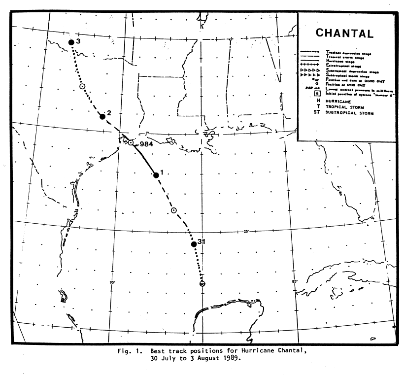
Below is the track of this
storm, provided by the National Hurricane Center.
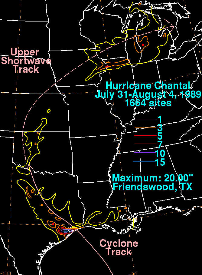
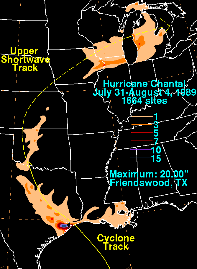
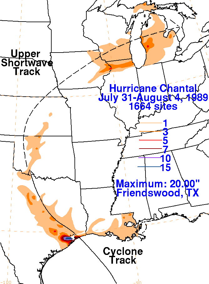
The storm total rainfall map below was constructed using data from
the
National Climatic Data Center.
Note how right near the point of landfall, the heaviest rains were
shifted left of track due to the upper low
to Chantal's south. Later on, the heaviest rains fell to the
right of the track of the shortwave.
 |
 |
 |
