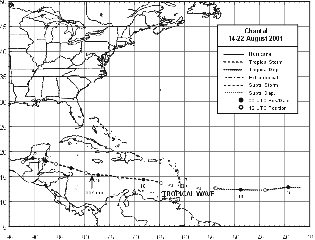
A tropical wave moved off the coast of Africa into the Atlantic on August 11th. By the 13th, a broad surface low
formed. Late on the 14th, the system became a tropical depression 1300 miles east of the southern Windward
Islands. By the morning of the 16th, Chantal no longer had a closed circulation, and it moved across the eastern
Caribbean Sea as a tropical wave. It redeveloped into a tropical storm 250 miles south of St. Croix, and it brought
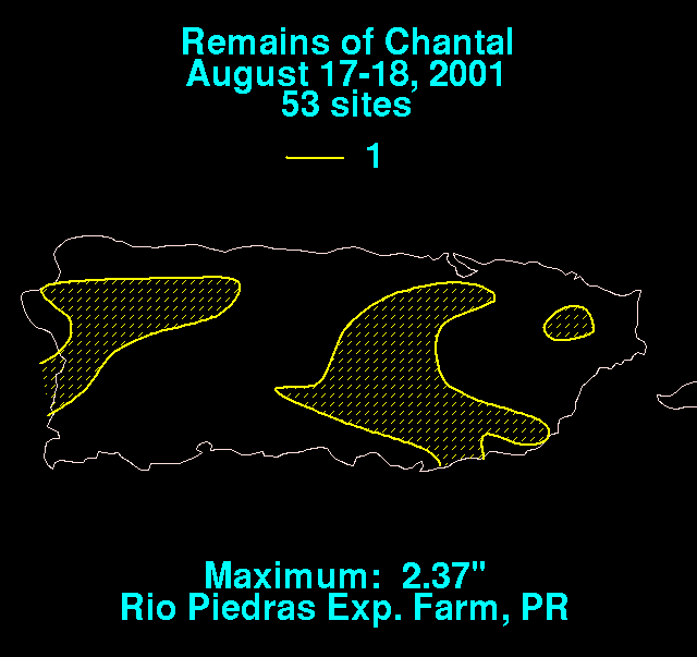
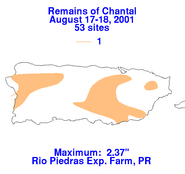
light to moderate rainfall across Puerto Rico and the U.S. Virgin Islands. Below are the storm total rainfall
graphics for Chantal in Puerto Rico. Rainfall data was provided by the National Climatic Data Center in
Asheville, North Carolina.
 |
 |
 |
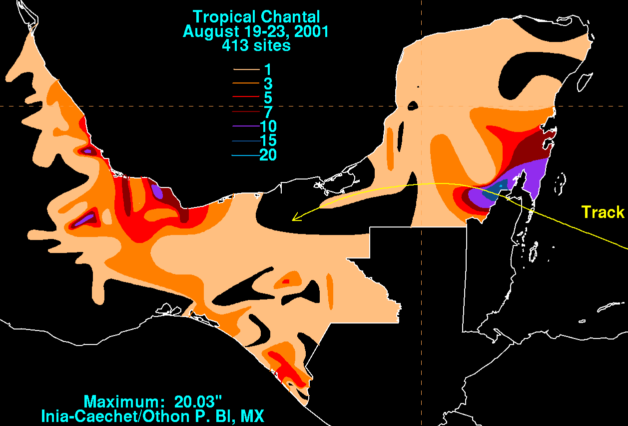
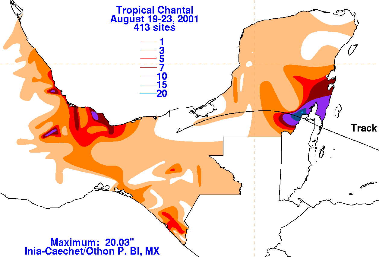
The storm later passed 160 miles south of Jamaica, striking Central America near the Mexico/Belize border
late on the 20th. Over the succeeding day and a half the system dropped southwest through the Yucatan and
southeast Mexico, ultimately dissipating late on the afternoon of the 22nd.
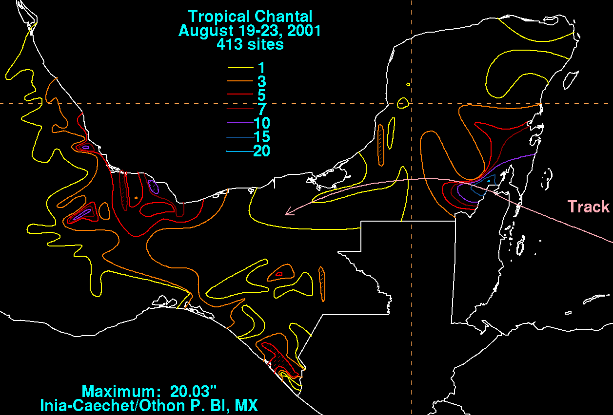
Below lies the storm total rainfall graphics relating to Mexico from Chantal's passage through the southeast portion
of the country. The maxima are generally near and to the right of the track.
 |
 |
 |