The system that led to Chris moved off the western coast of Africa
on
August 15th. It became
Tropical Depression #6 on the 21st in the tropical Atlantic midway
between
Africa and the Lesser
Antilles when a low level cloud circulation was identified on satellite
imagery. The low moved
around the periphery of the subtropical high, and remained a tropical
depression for a week as it
moved across portions of the Lesser and Greater Antilles as well as the
Bahamas. Heavy rains
fell across the islands of the northeast Caribbean as it passed by to
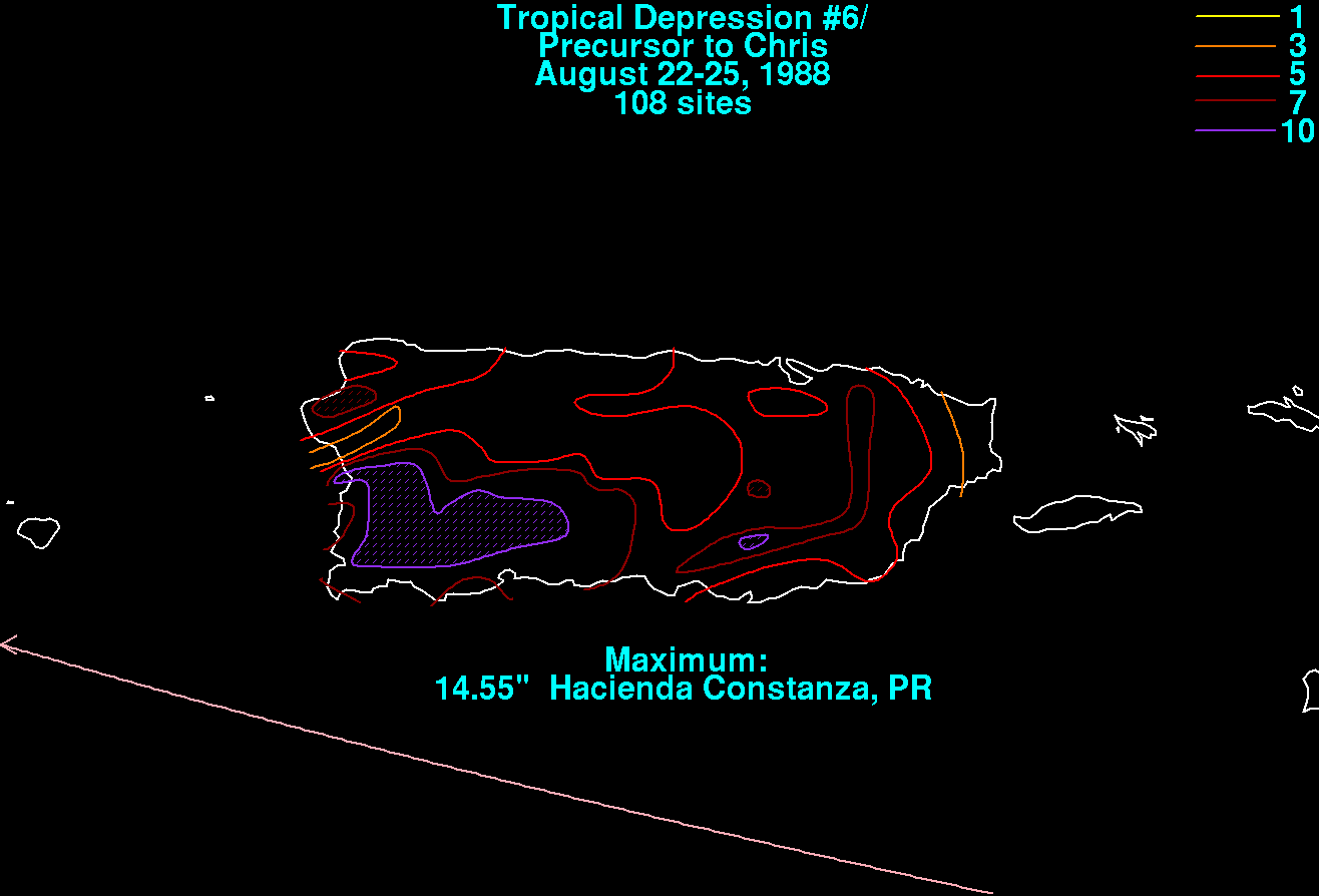
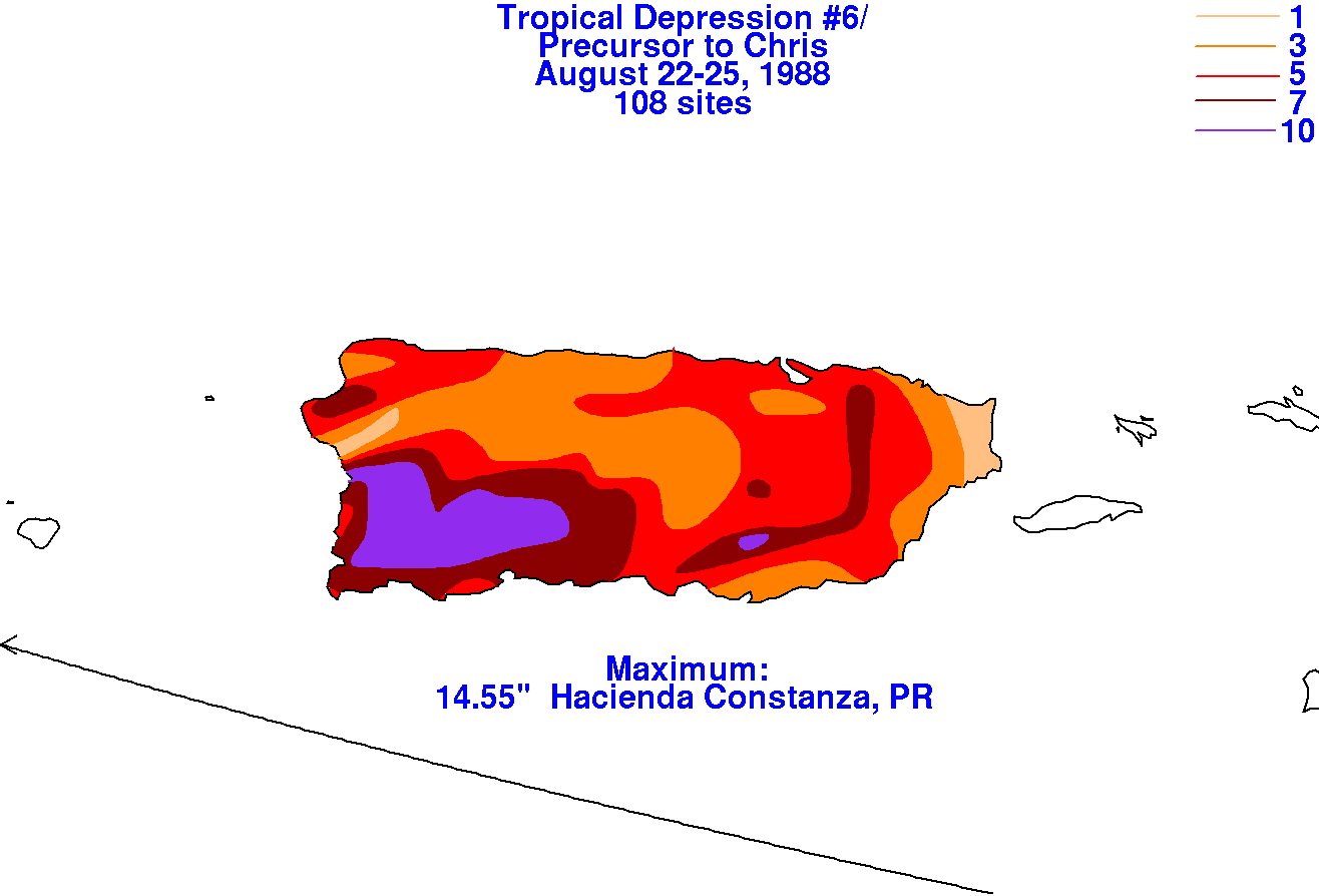
the south. Below are the storm
total maps for Chris covering Puerto Rico using
data provided by the National Climatic Data Center
in Asheville, NC.
 |
 |
 |
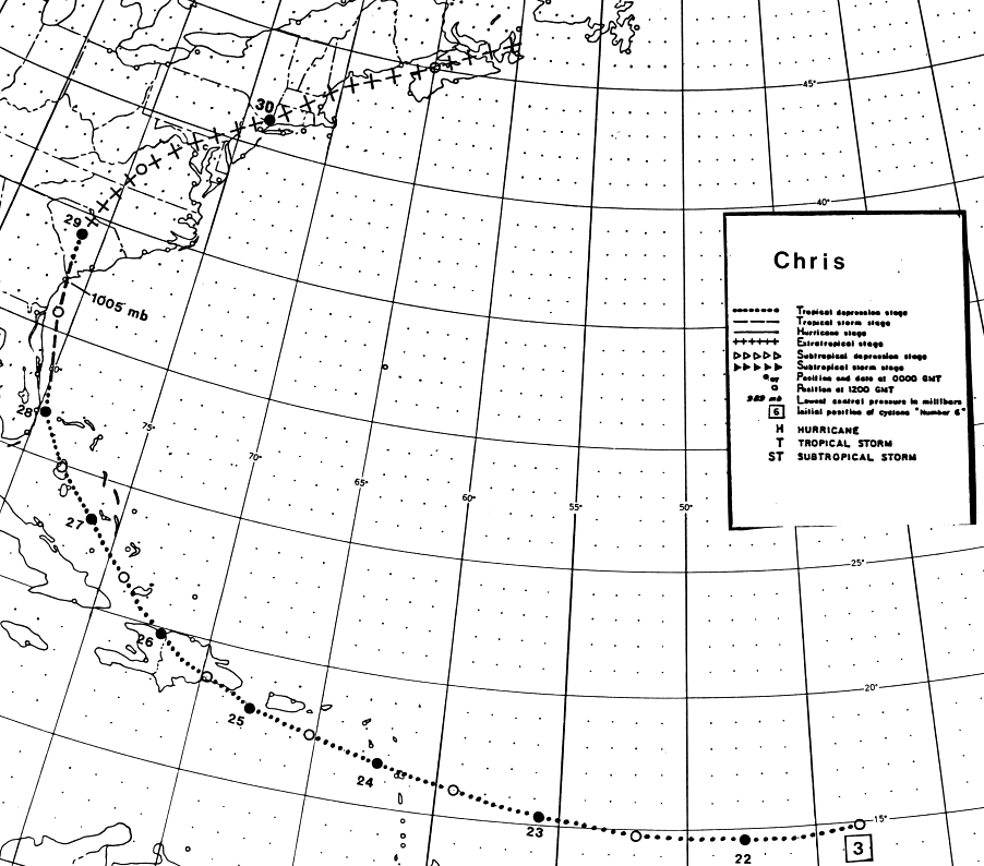
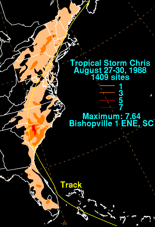
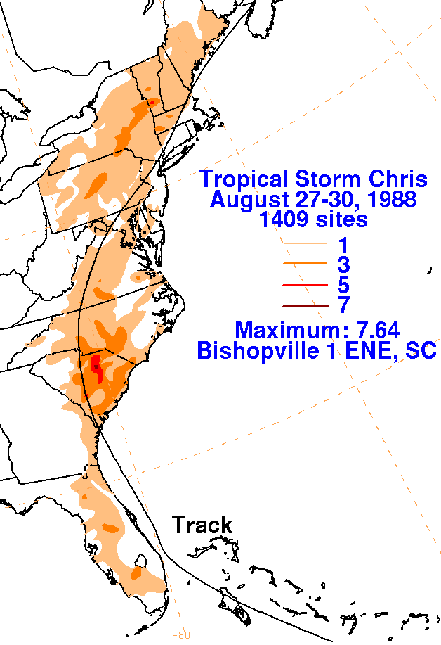
Chris became a tropical storm for only 12 hours, from offshore
Melborne, Florida until
it moved inland near
Savannah, Georgia on the morning of the 28th, as it accelerated
north-northeast through the Eastern
Seaboard and Nova Scotia by the 30th. Its track lies
below, provided
by the National Hurricane
Center.
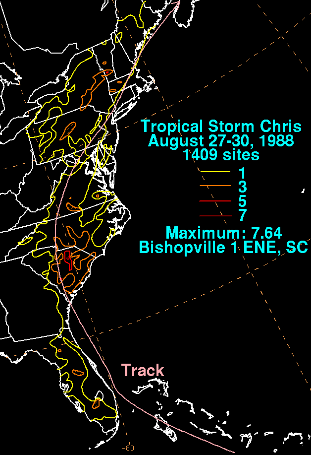
Below are the storm total rainfall maps for Chris. Data was
provided
from the National Climatic Data
Center.
 |
 |
 |