A Central American Gyre formed during the second week of June, which was enhanced by two tropical waves which moved
off the African coast on June 4th and 7th. The second of the waves entered the western Caribbean on the 17th, and then
northwest into the south-central Gulf of Mexico on the 19th. At that point, it had developed into a broad low
pressure area with tropical storm-force winds, but it lacked a well-defined center or central thunderstorm activity;
its appearance resembled an extratropical cyclone. By the 20th, the center became better defined and the system was deemed
a tropical storm during that afternoon. The convectionless center of Cindy moved northwest and north, making landfall near
the Louisiana-Texas border early on the 22nd. Once inland, Cindy weakened into the tropical depression that evening. Bursts
of thunderstorm activity occurred near its center as it moved through Louisiana and Arkansas and headed towards
Kentucky on the 23rd. The low turned east-northeast, crossing the Appalachians and becoming ill-defined as it
moved across the Mid-Atlantic states on the night of the 23rd.
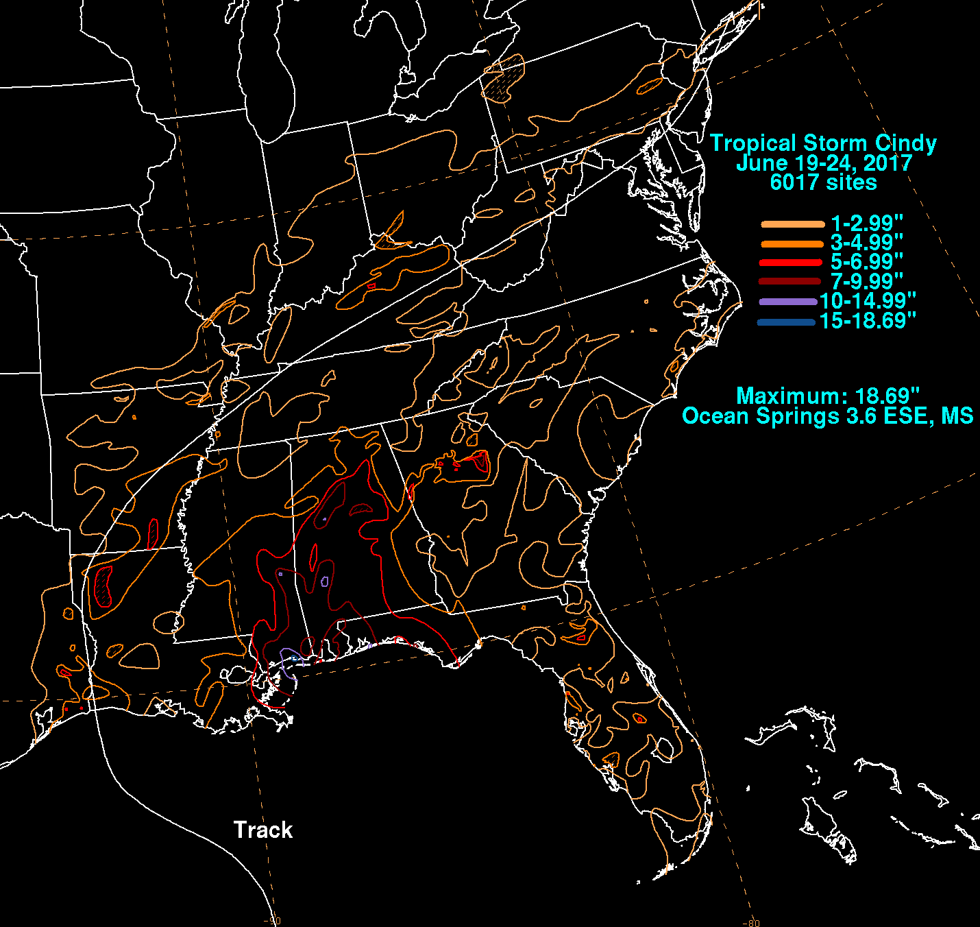
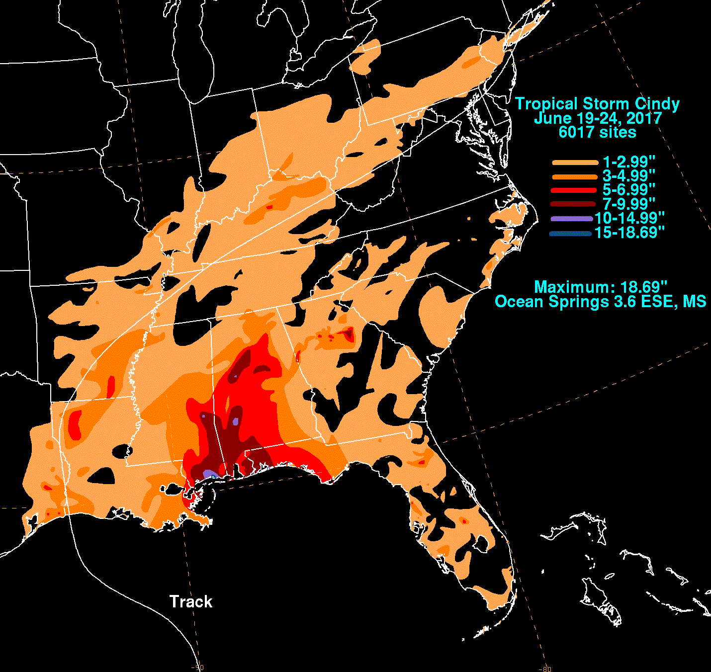
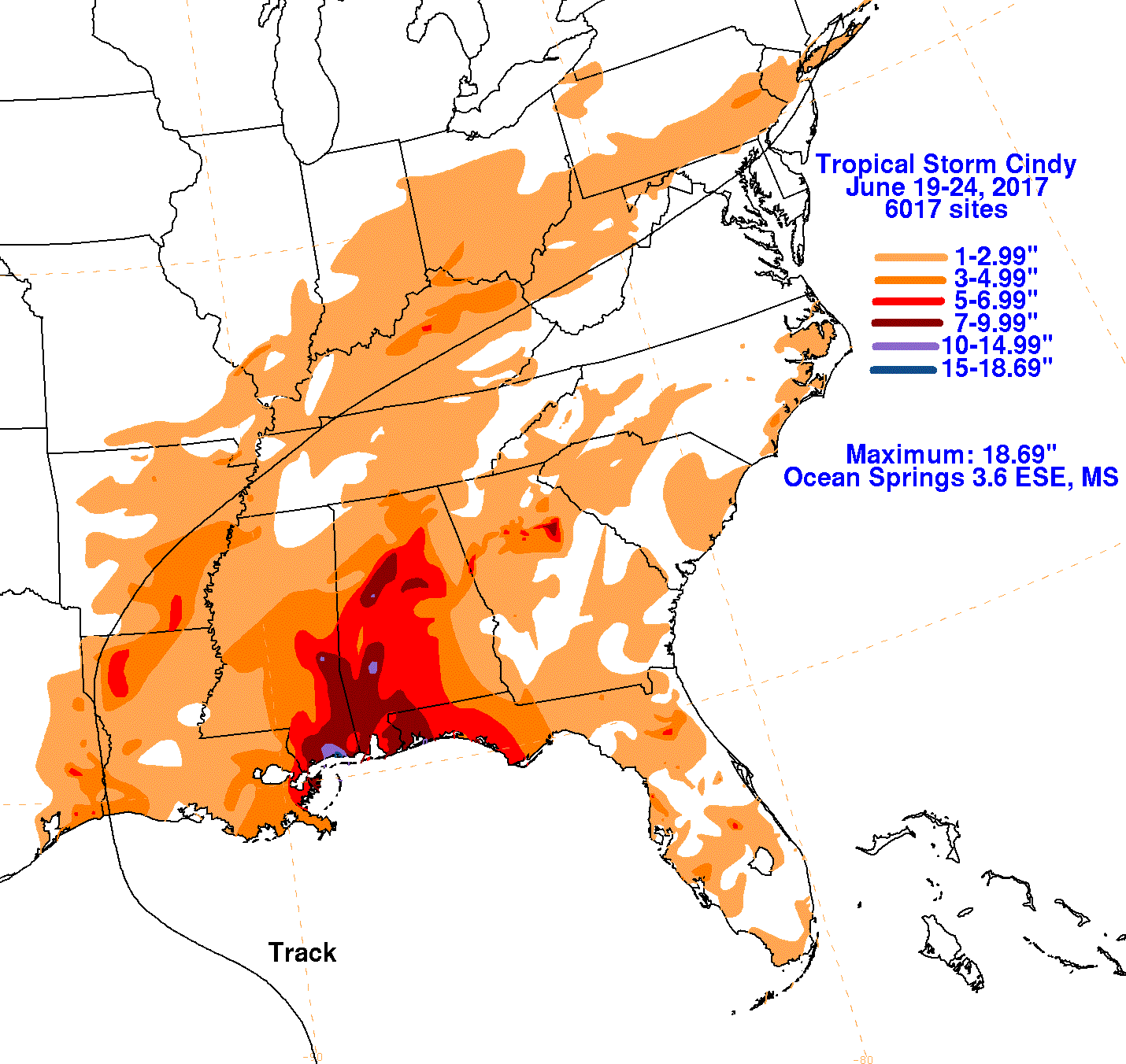
The first three graphics below show the storm total rainfall for Tropical Storm Cindy, which used rain guage information from
National Weather Service River Forecast Centers, Forecast Offices, and CoCoRAHS. The fourth graphic uses the offical National
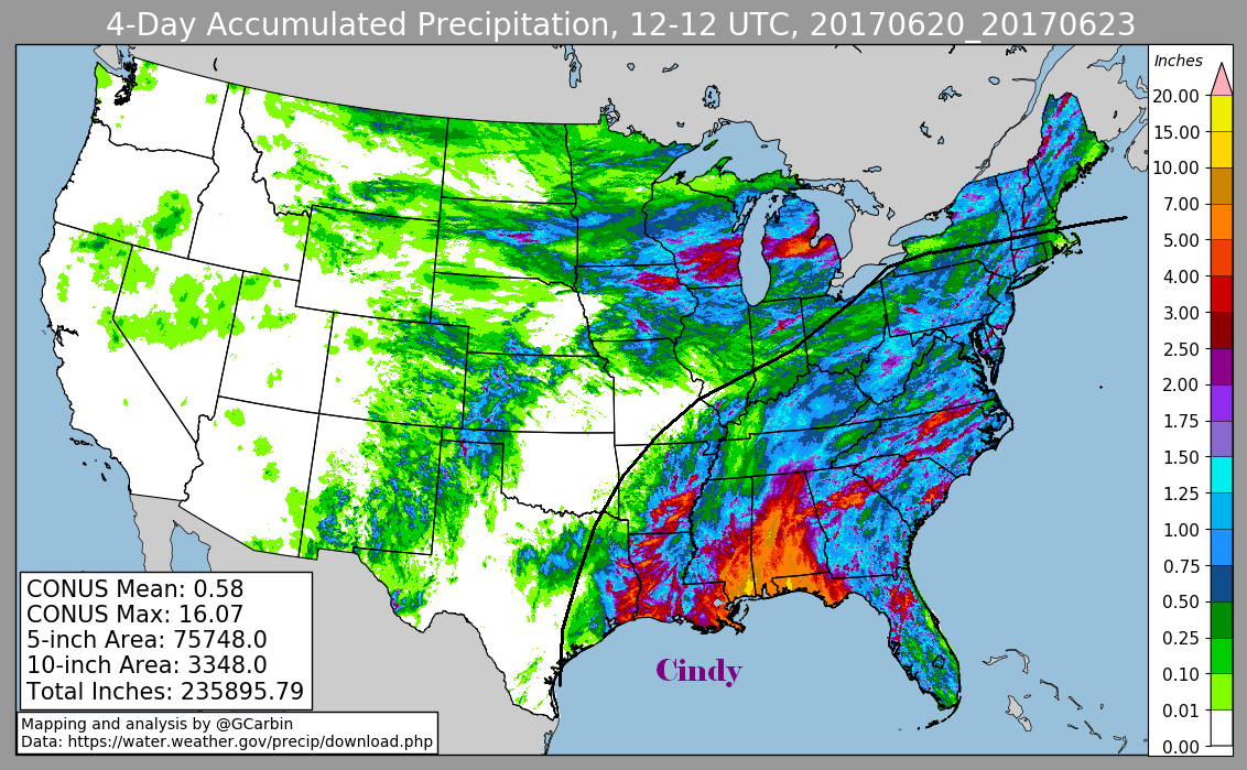
Weather Service multi-sensor rainfall estimates, which includes radar-derived information.
 |
 |
 |
 |