A weak tropical wave moved into the eastern Caribbean Sea on June 6th. It moved across the southern Caribbean and flared some
convection before moving over Nicargua and Honduras on the 10th. The system interacted with the eastern portion of the monsoon trough
and by the 12th, had developed a broad circulation over Central America. It was active with thunderstorm activity over the next several
days while remaining stationary. The system broke in two, with the Pacific portion becoming Tropical Storm Dolores on the 18th. On
the 14th, an area of disturbed weather formed in the Bay of Campeche. Northwest vertical wind shear and proximity to land hindered development.
By the 16th, it began to move north-northeast into the Central Gulf of Mexico with increased organization. A well-defined circulation
kept the system from achieving a tropical cyclone classification on the 17th. By late on the 18th, as it moved into the north-central Gulf
of Mexico, the tropical storm-force low finally acquired a sufficiently well-defined circulation a short distance south of Morgan City,
Louisiana, achieving tropical storm status. Vertical wind shear from the southwest kept the circulation broad. After making landfall
on the night of the 18th, Claudette moved northeast and weakened. Very early on the 21st, Claudette emerged into the Atlantic offshore
North Carolina and gained organized convection. Accelerating northeast, Claudette began to undergo extratropical transition, with
the system becoming post-tropical very early on the 22nd. The extratropical low would move offshore southeast Nova Scotia before dissipating
very early on the 23th.
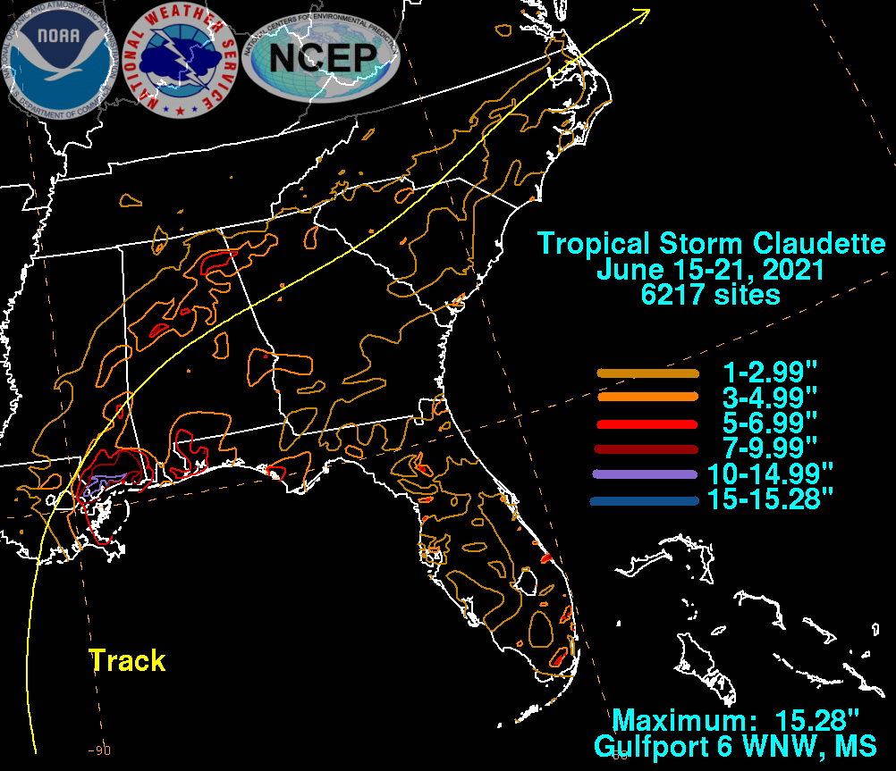
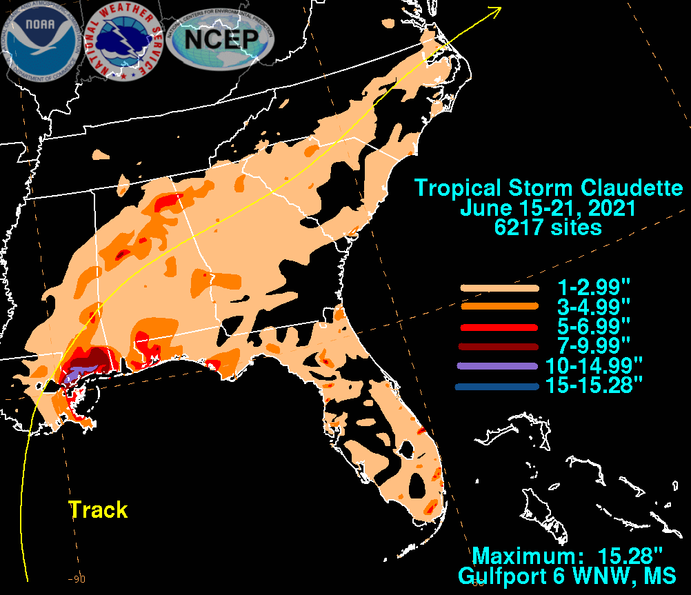
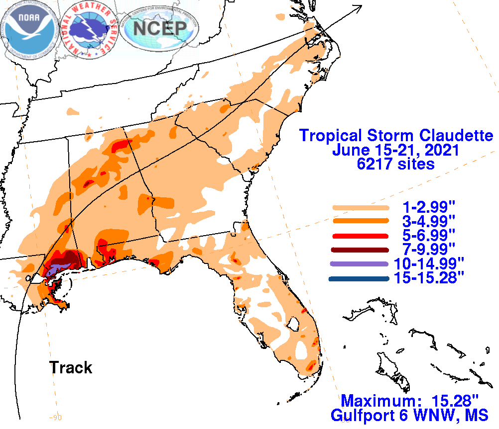
The graphics below show the storm total rainfall for Claudette, which used rain gage information from the National Weather
Service River Forecast Centers, Forecast Offices, and CoCoRAHS.
 |
 |
 |