A tropical wave emerged from the west coast of Africa on May 27th. The system moved west through the tropical Atlantic,
entering the Caribbean Sea on June 1st. Thunderstorms increased near the feature on the 3rd. Organization of the convection
increased on the 4th, which forced the formation of a broad surface low near the Yucatan Peninsula late that day. Moving
northwest to north-northwest, the system satisfied the definition of a tropical depression by the morning of the 5th near
the north coast of the Yucatan Peninsula. By early
afternoon, the system strengthened into a tropical storm. The poorly organized storm moved north for a day or two and
reached its peak intensity on the morning of the 6th while over the eastern Gulf of Mexico. Colin then accelerated
northeast ahead of a longwave trough in the East, with its center making landfall near Keaton Beach, Florida during the night
of the 6th. On the 7th, Colin had quickly moved through the Southeast into the western subtropical north Atlantic. That
morning, Colin transitioned into an extratropical low which then moved rapidly northeast and east-northeast through the
western Atlantic shipping lanes before merging with another non-tropical low near Atlantic Canada by the 9th.
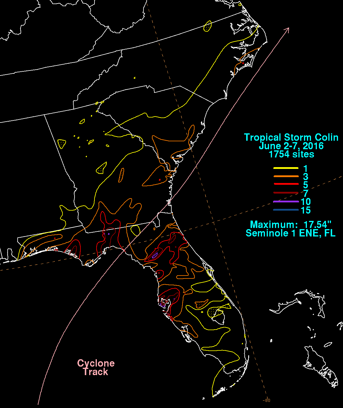
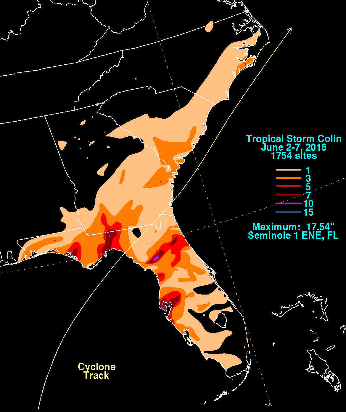
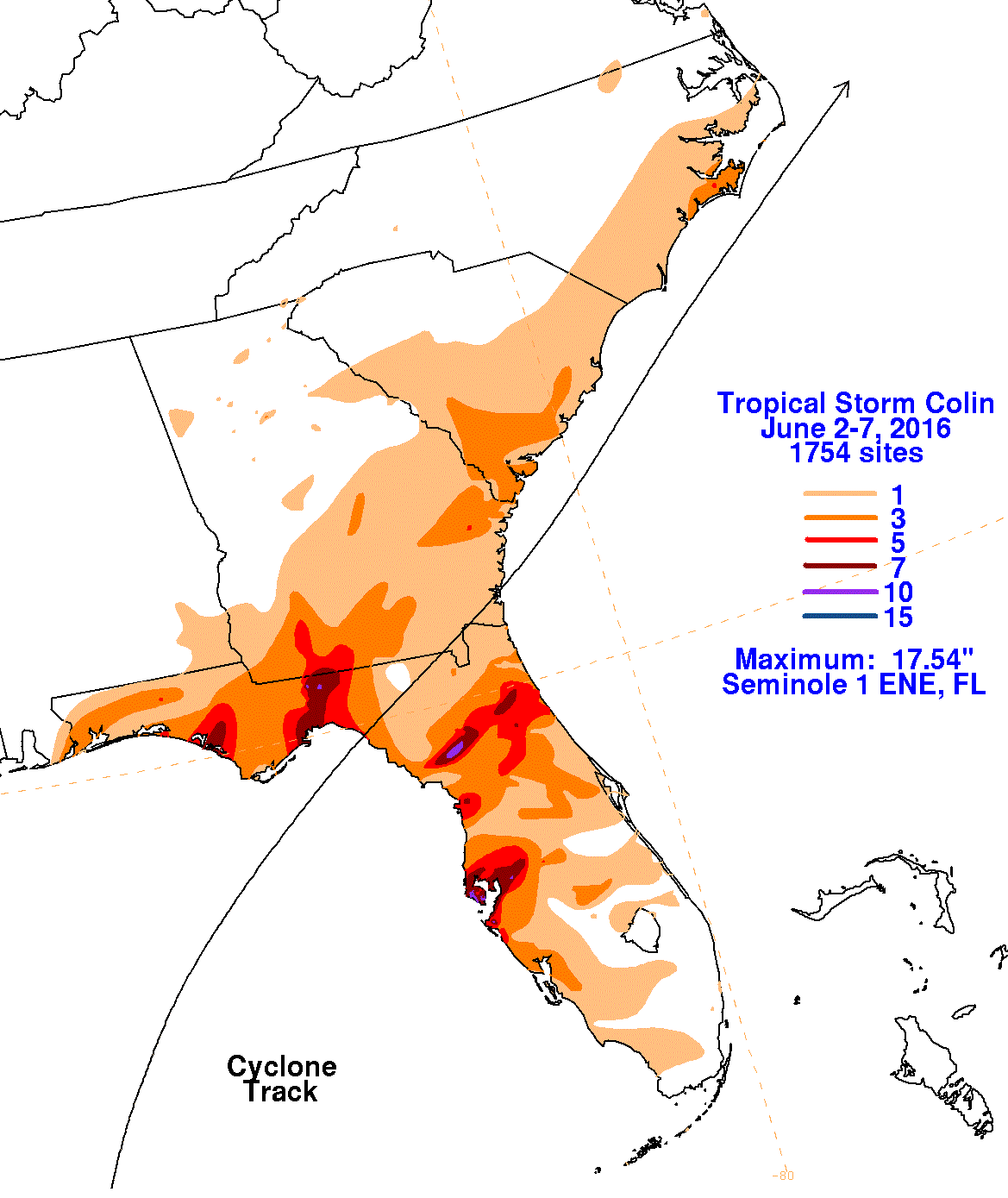
The first three graphics below show the storm total rainfall for Colin, which used rain guage information from National
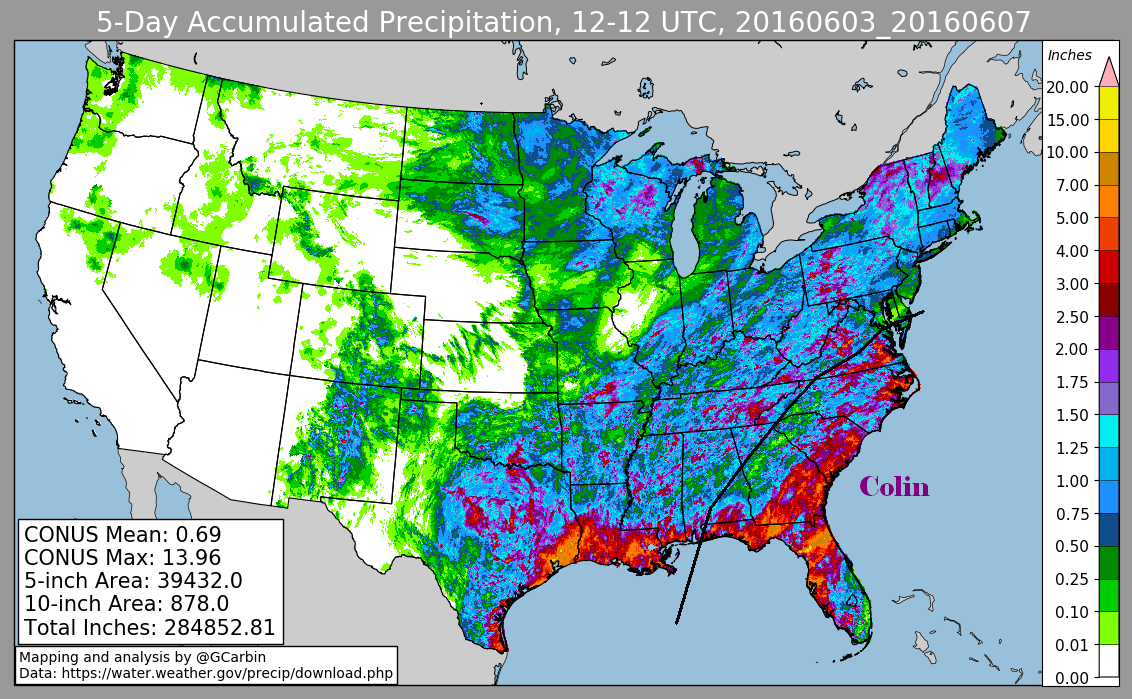
Weather Service River Forecast Centers, Forecast Offices, and CoCoRAHS. The fourth graphic shows its rainfall distribution
using a multi-sensor rainfall estimate, which includes radar-derived information.
 |
 |
 |
 |