On the morning of August 3, a ship moved to the south of the
cyclone, reporting strong westerly winds a
few hundred miles east-southeast of Barbados. An additional ship
sailed near the cyclone's center, reporting
a pressure of 996 hPa, indicating the presence of a tropical
storm. The next day, reconnaissance found the
eye of Connie tilted northeast, with the center redeveloping in that
direction. The storm moved west-northwest
near 15 mph and intensified rapidly, passing within 150 miles of the
northern Leeward Islands and Puerto Rico.
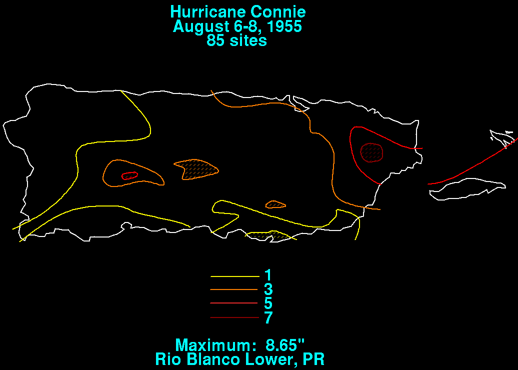
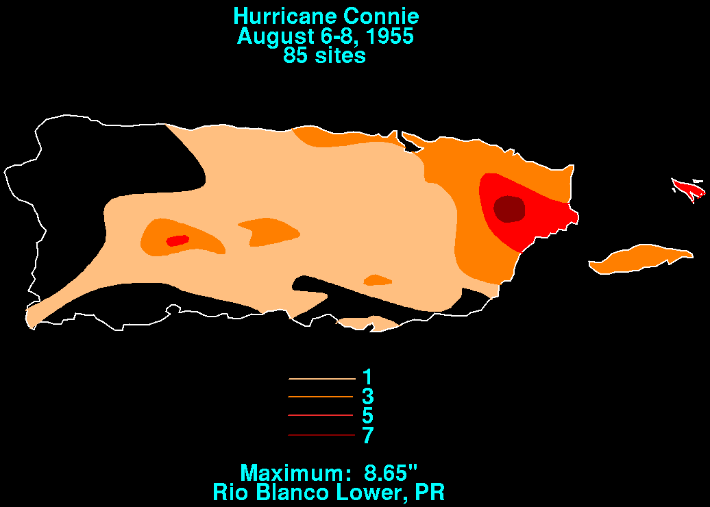
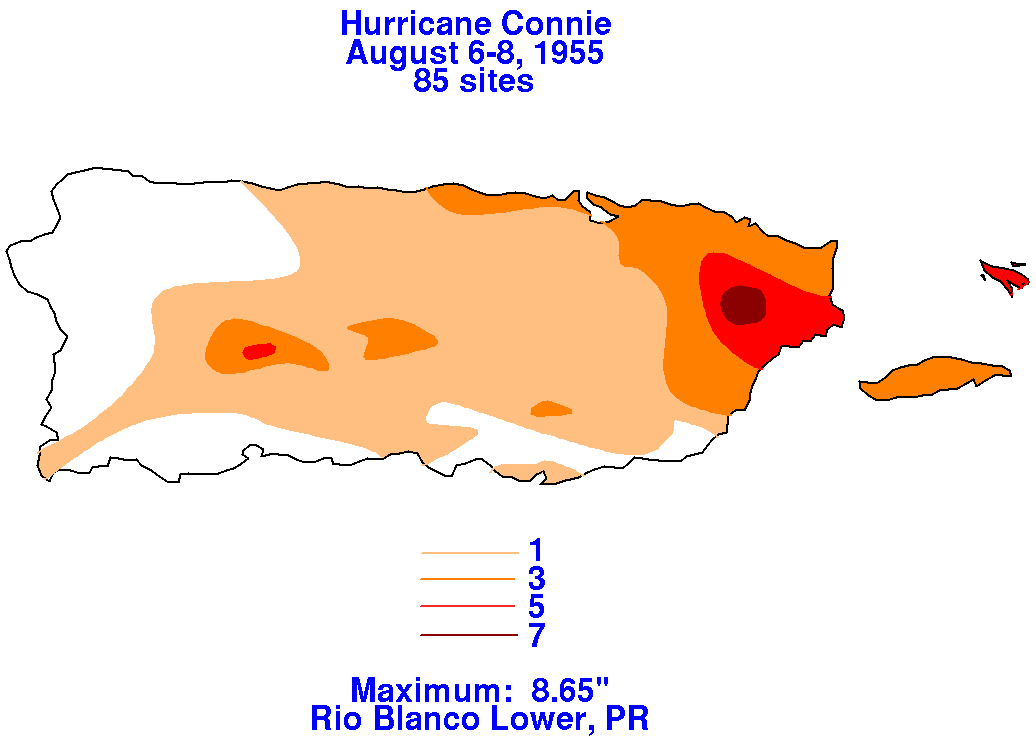
Below is the rainfall graphic for Puerto Rico, using data provided by
the National Climatic Data Center in
Asheville, North Carolina.
 |
 |
 |
On the 6th and 7th, Connie coupled with a cold low aloft before its
core rewarmed. By the 7th and 8th,
Connie had become a major hurricane as it moved a few hundred miles
east of the Bahamas. The system
slowed down its west-northwest motion and weakened thereafter.
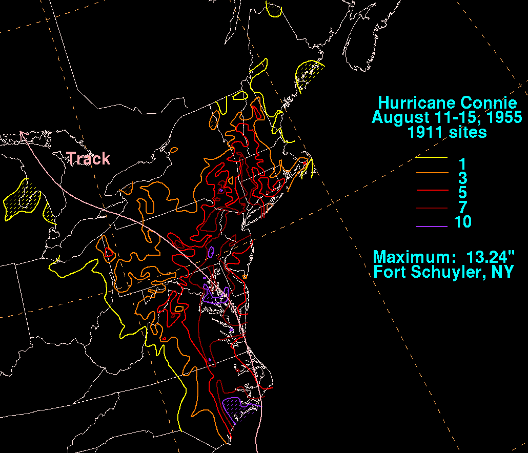
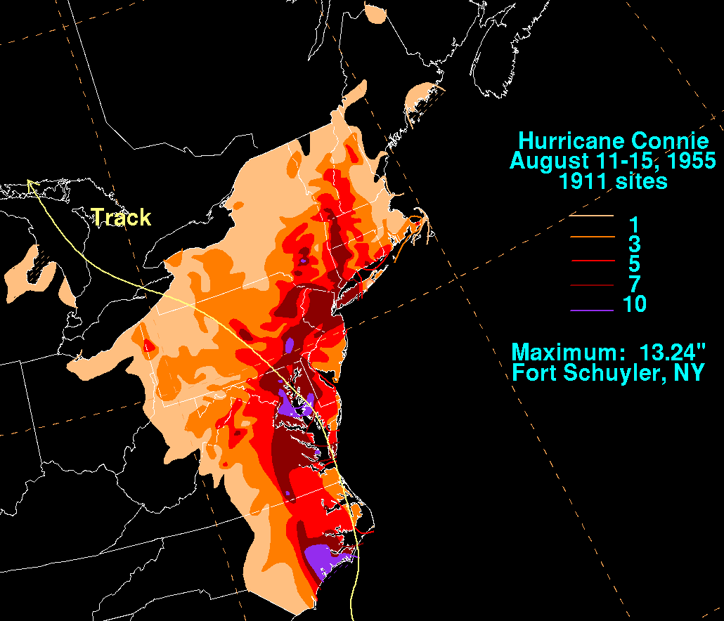
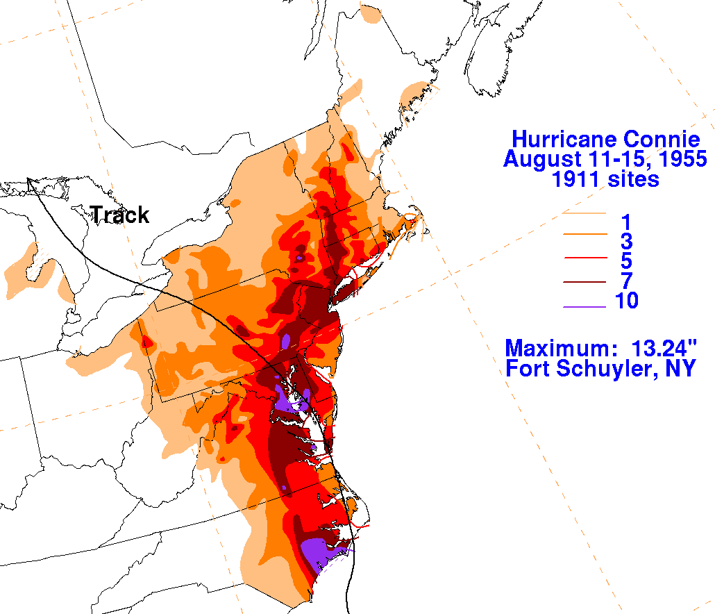
From the 10th through the 12th, Connie
moved north to northeast as it passed inland near Morehead City, North
Carolina. Connie moved slowly
through the Mid-Atlantic, New England, and the Great Lakes which set
the stage for heavy rainfall from
Virginia northward into western New England. The rainfall
maps below for Hurricane Connie were
constructed using rainfall data from the National Climatic Data Center
in Asheville, North Carolina.
 |
 |
 |