A mid- to upper-level distrubance dropped out of the main belt of the
Westerlies towards the Gulf coast, spurring
the development of a surface low west of Gainesville, Florida on the
morning of July 15th. Over the next
24 hours, the low drifted southward and the upper level trough closed
off and moved westward away
from the surface low. The low turned east and northeast, crossing
the central Florida peninsula, with the
system becoming better organized as it emerged offshore St. Augustine
on the 17th. The system became
well enough organized to be classified as a tropical depression late on
the 18th, continuing to move slowly
to the northeast offshore the lower Eastern Seaboard.
The depression became a tropical storm on the 20th. Dry air
just north of system soon slowed tropical cyclone
development. Paralleling the coast of the Carolinas, heavy
rainfall fell across southeast North Carolina before
dry air intruded into the center, leading to a reduction of
thunderstorm activity near its center before moving
near the Outer Banks. As the system slowly accelerated northeast,
Cristobal moved into cooler waters offshore
the Mid-Atlantic and New England coasts. It lost its thunderstorm
activity
and moved eastward, offshore Atlantic
Canada on the 23rd before linking up with a frontal zone and becoming
extratropical. The subsequent extratropical
low moved east-southeast to the Azores, before slowing and turning
northeast, moving offshore the northwest
coast of France while deepeing on the night of the 28th.
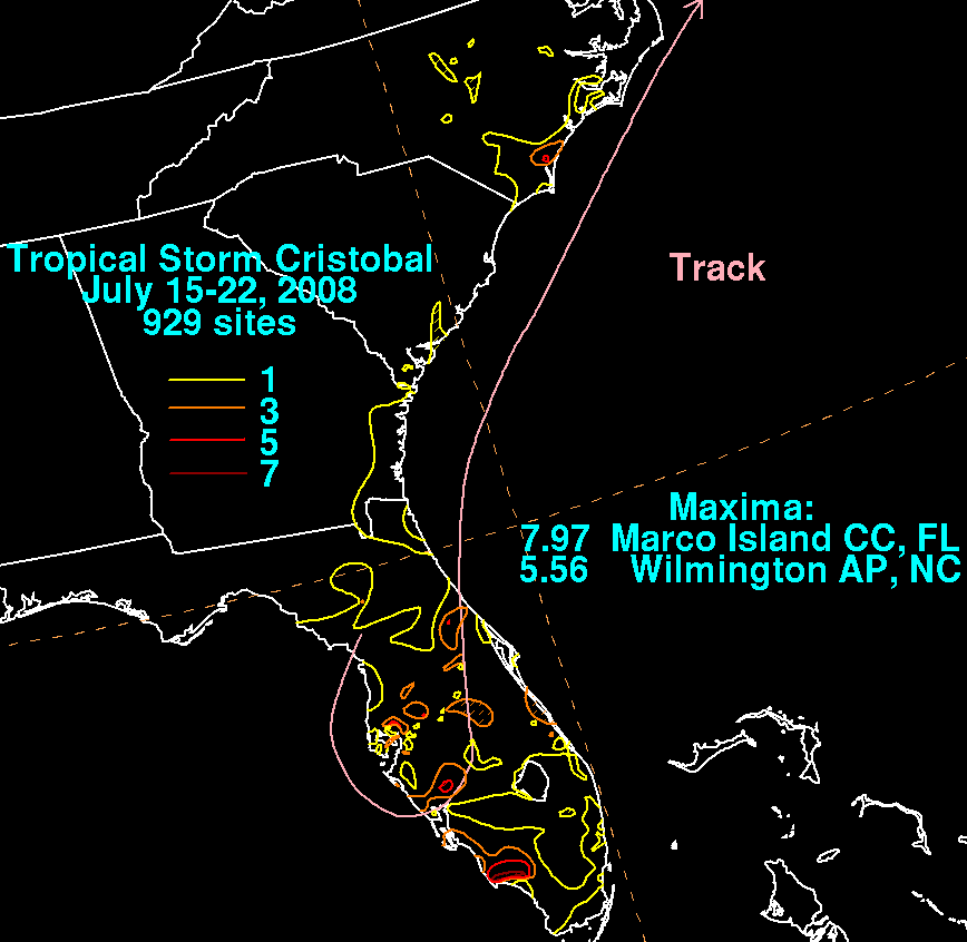
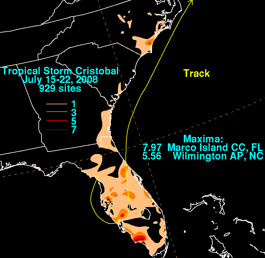
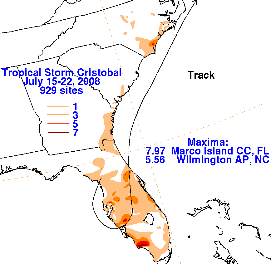
The first three storm total rainfall maps below were constructed using
rain guage data reported by the River Forecast Centers,
CoCoRAHS, and post-storm reports from the Wilmington, Morehead City,
and Wakefield National Weather Service Forecast Offices.
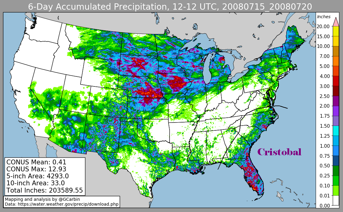
The fourth includes radar-derived information.
 |
 |
 |
 |