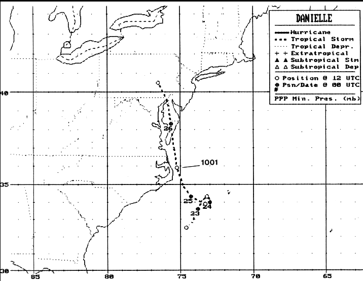
A trough of low pressure lingered near the southeast U.S. coast from
the 18th onward.
A cold front dropped into this trough on the 20th. By the 22nd, a
closed low had formed
at the surface 175 n mi south-southeast of Cape Hatteras; this is when
the system was
designated a tropical depression. Several hours later an aircraft
investigated the system
and found a tropical storm. Initially moving slowly
northeastward, it was blocked by a
ridge of high pressure. It executed an anticyclonic loop,
moving towards the Virginia Capes.
As another low approached the Great Lakes, the system moved
quickly to the north-
northwest, moving onto the Eastern Shore of Maryland on the 25th before
weakening into
a tropical depression. Its surface circulation dissipated
in Pennsylvania on the 26th.
Its
track is below, produced by the National
Hurricane Center.
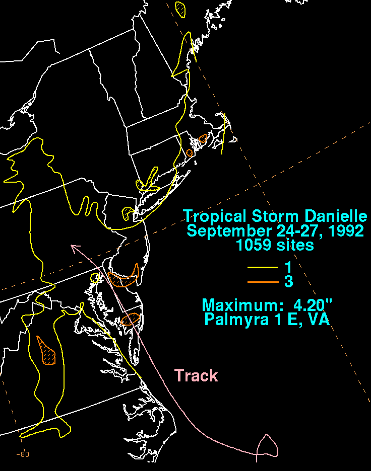
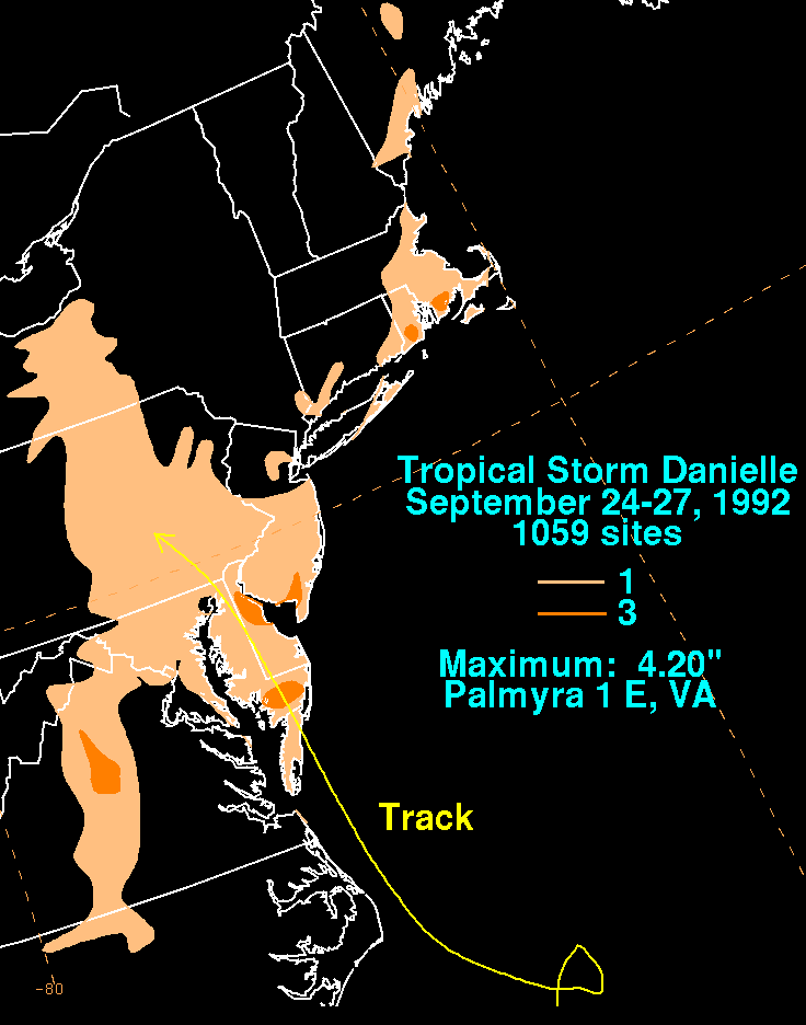
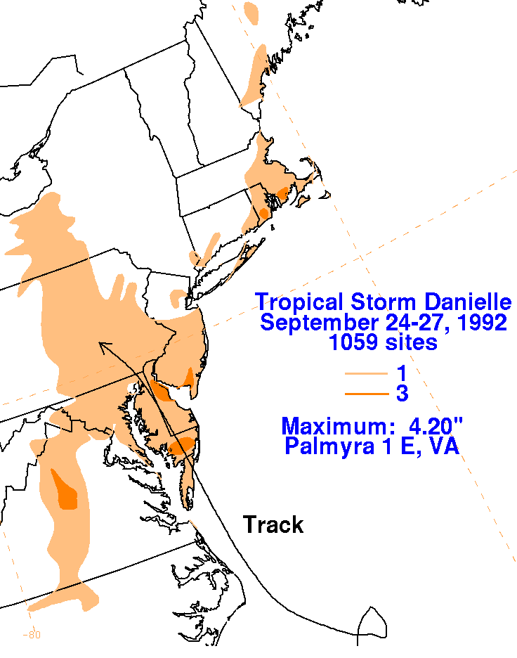
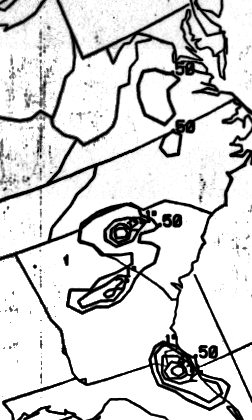
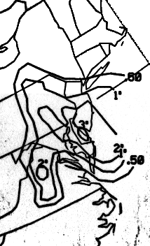
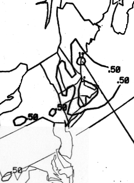
The graphic belows show the storm total rainfall for Danielle...data
provided
by the
National Climatic Data Center in Asheville, NC.
 |
 |
 |
Below is the calendar for Daily Precipitation Maps. Note that the 24-hour periods end at 12z, or
8 am EDT, that morning.