A strong tropical wave moved offshore northwest Africa on August
15th. The system moved westward,
and convection on its northern portion evolved into Tropical Storm
Chris. The southern portion of the
wave continued moving west, remaining disorganized as it crossed the
eastern and central Caribbean.
The system began to organize across the western Caribbean on the 29th,
with a surface low forming
over the Yucatan peninsula on the 30th. After emerging into the
Bay of Campeche, the system became
Tropical Depression #8. Under favorable upper level conditions,
the cyclone strengthened into a
tropical storm overnight on the 1st. Moving westward, Debby
continued to strengthen, becoming a
hurricane on the 2nd. Debby then made landfall just
south-southeast of Tuxpan that evening,
weakening back into a tropical depression as it moved inland into
Mexico.
Remaining well-defined, the depression passed just north of Mexico
City and then along the coast of
the Mexican Riviera, becoming redesignated Tropical Depression #17 as
it moved into the Pacific. An
upper level trough northwest of the system kept the system from
strengthening, but lured the system
northwest into the Sea of Cortez. By the 8th, the cyclone became
exposed due to the vertical level shear
caused by the upper level low, and was deemed to have dissipated on the
afternoon of the 8th. Below
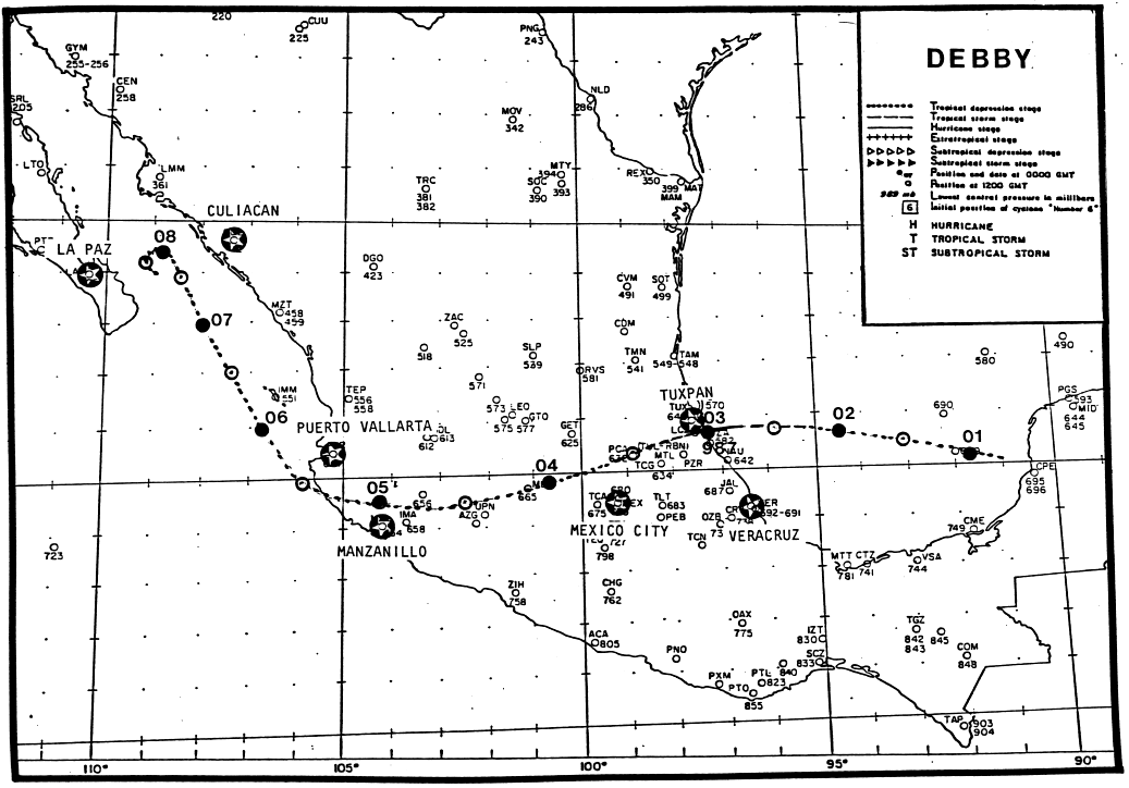
is the track of this cyclone,
provided by the National Hurricane Center.

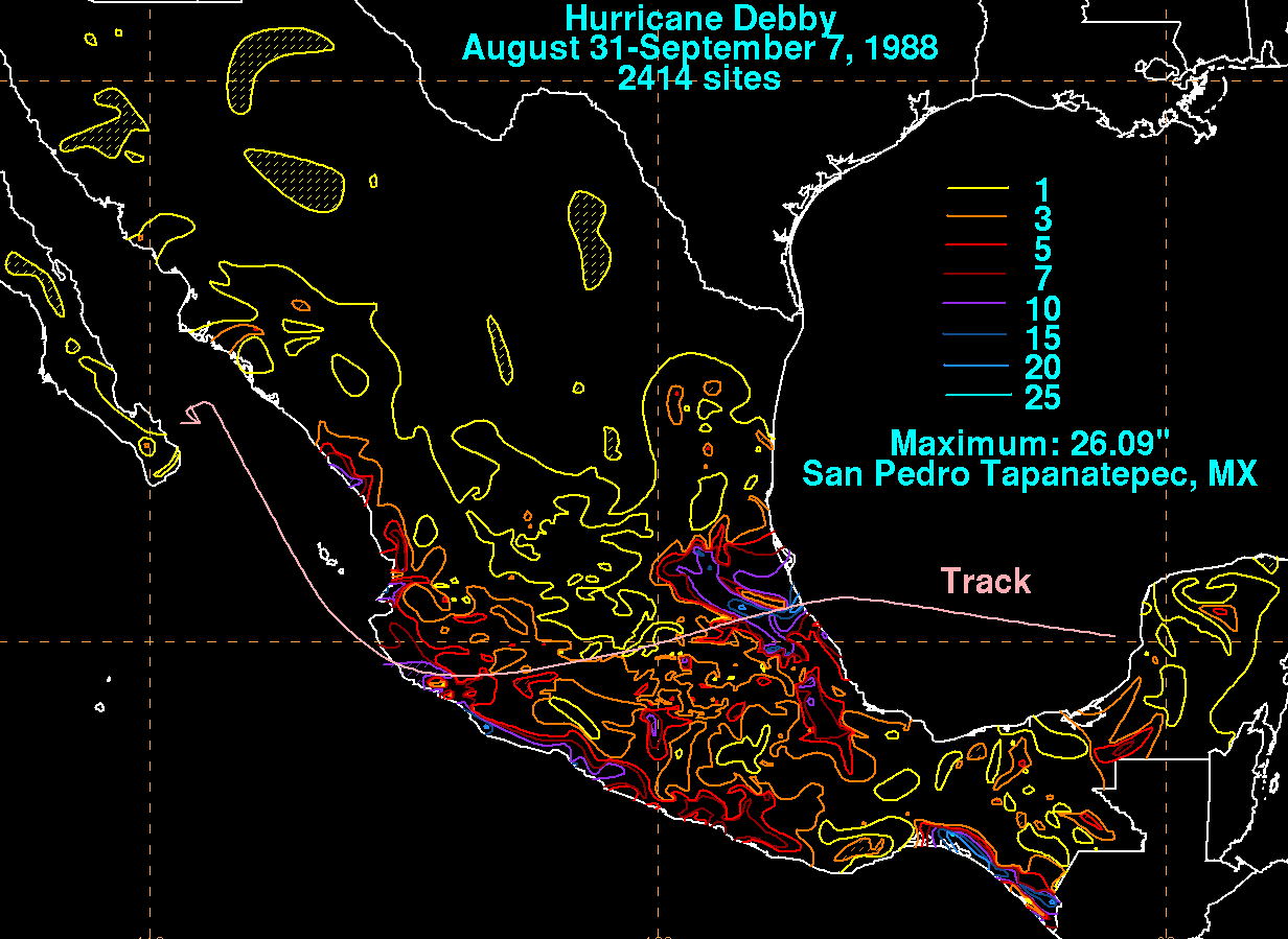
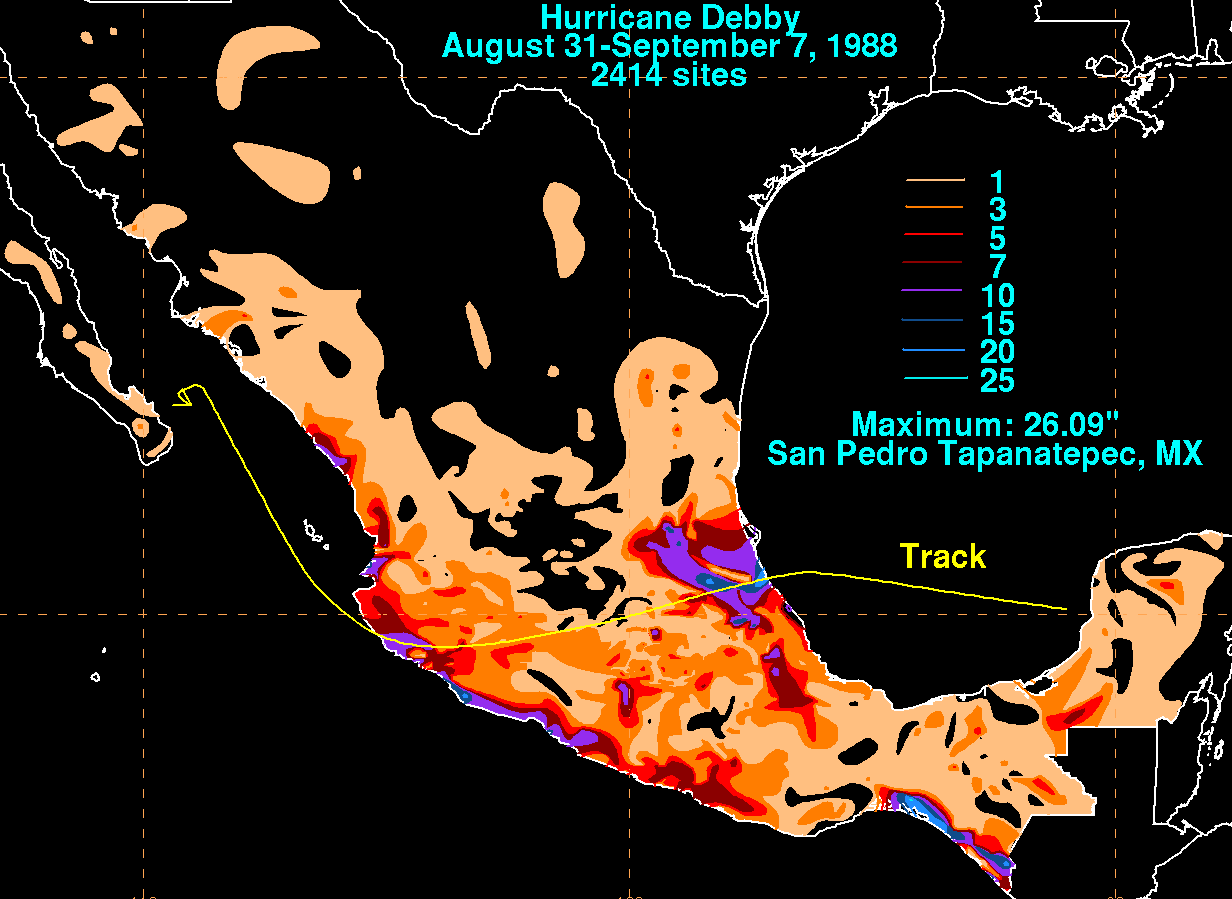
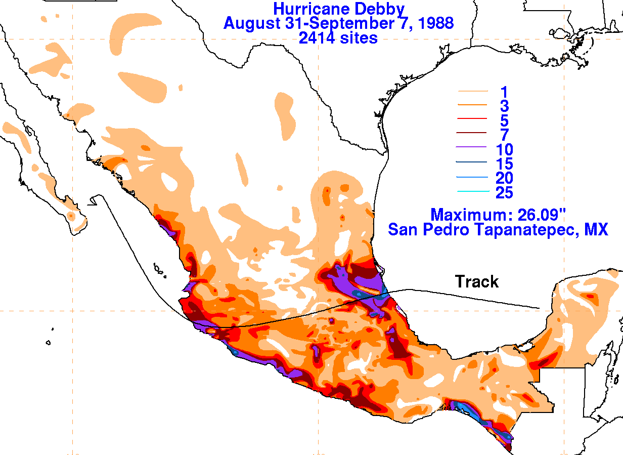
The graphics below show the storm total rainfall for Debby.
Maximum occurred near the track and within
its inflow across the southern Mexican coast.


