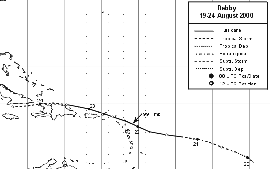
A strong tropical wave moved off the west coast of Africa on August
16th. The following day, a broad area
of low pressure formed near 10N 30W, but the bands of convection were
not curved enough for satellite
classification. A more distinct low level center was found on the
evening of the 17th. Organization of the
system slowly improved, and the fourth tropical depression of the
season formed 900 miles east of the
Windward Islands on the afternoon of the 19th. The cyclone
strengthened and became a tropical storm early
on the morning of the 20th, moving west-northwest towards the Greater
Antilles. Despite slight southwesterly
storm-relative shear, Debby became a hurricane early on the morning of
the 21st. By that afternoon, strengthening
ceased as vertical wind shear became an increasing hindrance to the
cyclone's existence. The center moved over
the British Virgin Islands on the morning of the 22nd, and passed 30
miles offshore the northeast corner of Puerto
Rico. It remained a hurricane until early on the 23rd, before
shearing off and becoming steered by the low level
flow. Its circulation center moved along the north coast of
Hispaniola, and dissipated south of Cuba on the morning
of the 24th. The remnant tropical wave spread locally heavy
showers and gusty winds across Cuba, the Florida
Straits, and southern Florida on the 25th and 26th. Below
is a track of the storm, created by the National
Hurricane Center.
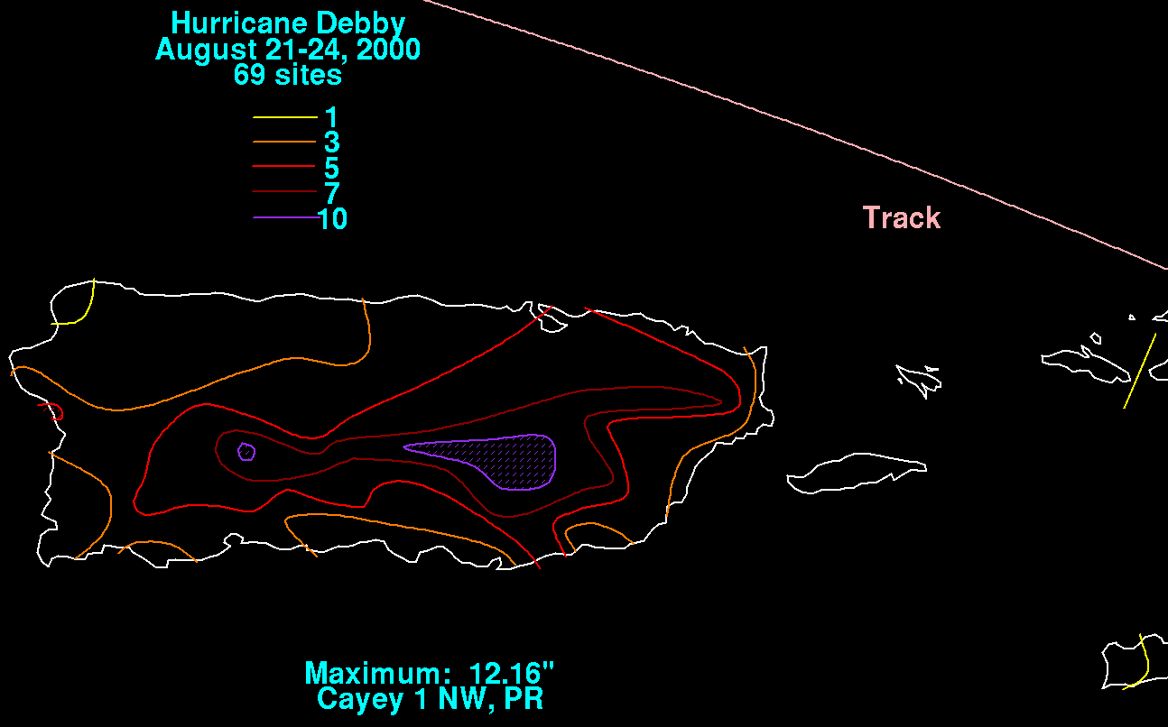
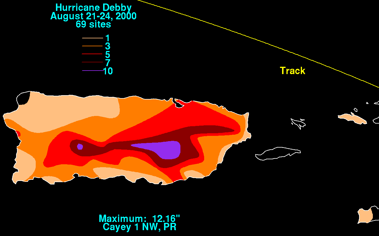
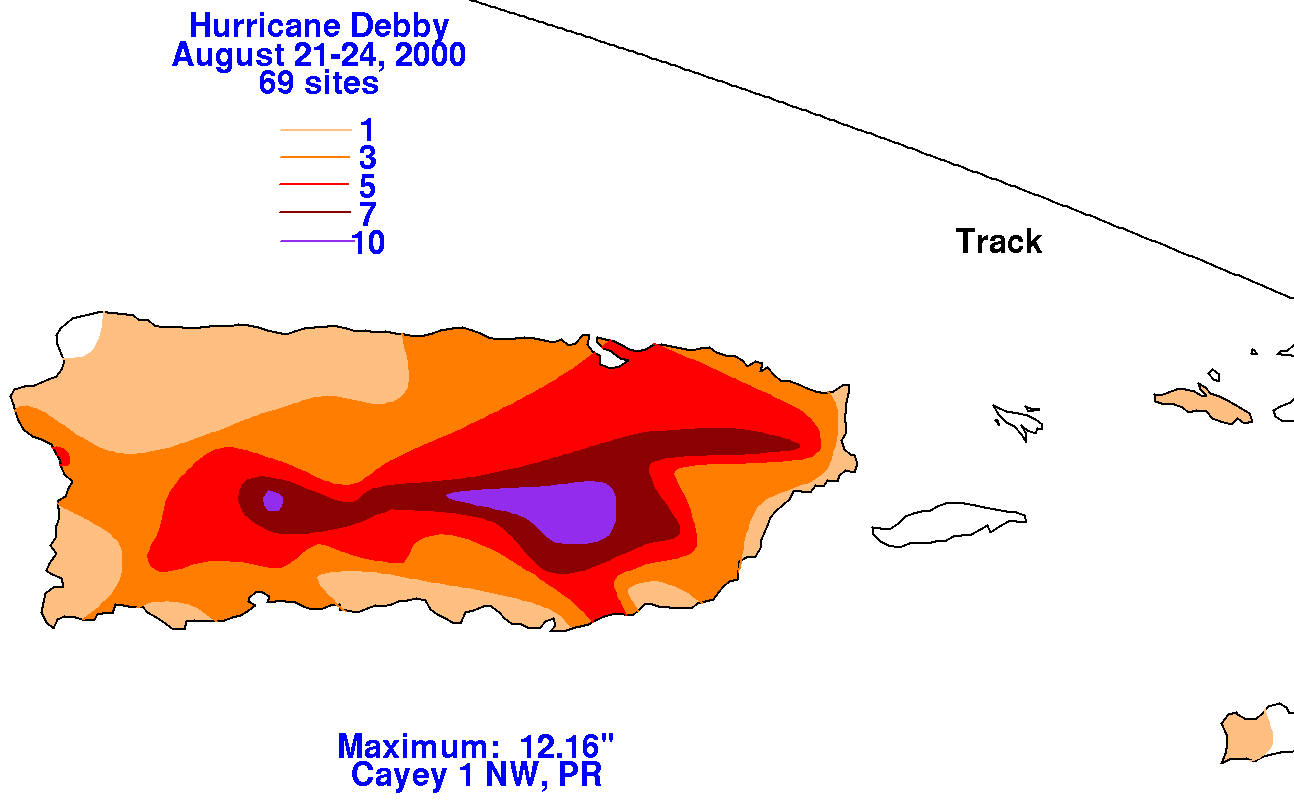
The rainfall graphics below use data supplied by the National
Climatic Data Center in Asheville, NC. Since the
cyclone tracked northeast of Puerto Rico and the U.S. Virgin Islands,
maximum amounts were in the southern
slopes of the higher terrain of southern Puerto Rico.
 |
 |
 |