A tropical wave moved off the African coast on September 26th It remained nondescript while it moved across the tropical
Atlantic over the next several days. On the 30th, thunderstorm activity increased while it was several hundred miles east of the
Lesser Antilles. After entering the Caribbean Sea on October 1st, moderate wind shear continued to hinder development. On the
4th, the system became well enough organized around a well-defined center to be considered a tropical depression while south of
Jamaica. Northerly vertical wind shear kept convection in its southern portion. As wind shear weakened on the 5th, the depression
strengthened into Tropical Storm Delta. Intensification became more rapid, with Delta becoming a major hurricane on the morning of the
6th while south of the Isle of Youth, Cuba.
Vertical wind shear increased once more, and Delta weakened but remainded a hurricane. Delta made landfall near Puerto
Moreles on the morning of the 7th. The hurricane moved into the Gulf of Mexico early that afternoon and reintensified.
Delta regained major hurricane status on the afternoon of the 8th about 300 miles south of the Mouth of the Sabine River.
Turning north, vertical wind shear increased, and Delta made landfall near Creole, Louisiana as a hurricane on the evening
of the 9th, 10 miles from where Laura made landfall several weeks beforehand. The storm turned northeast and weakened,
with Delta regaining tropical storm status around midnight over central Louisiana. By afternoon, Delta linked up with fronts
and became an extratropical/post-tropical cyclone. Delta's circulation broadened as it moved east-northeast through the
southeastern United states into the western north Atlantic.
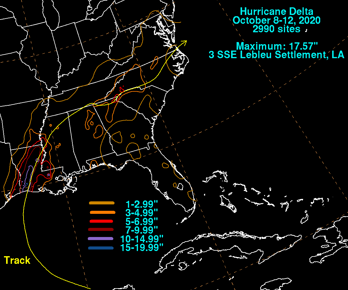
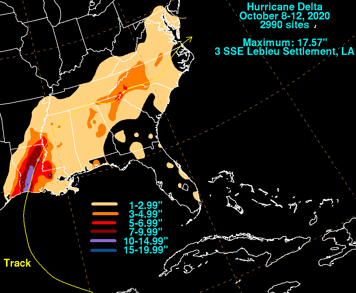
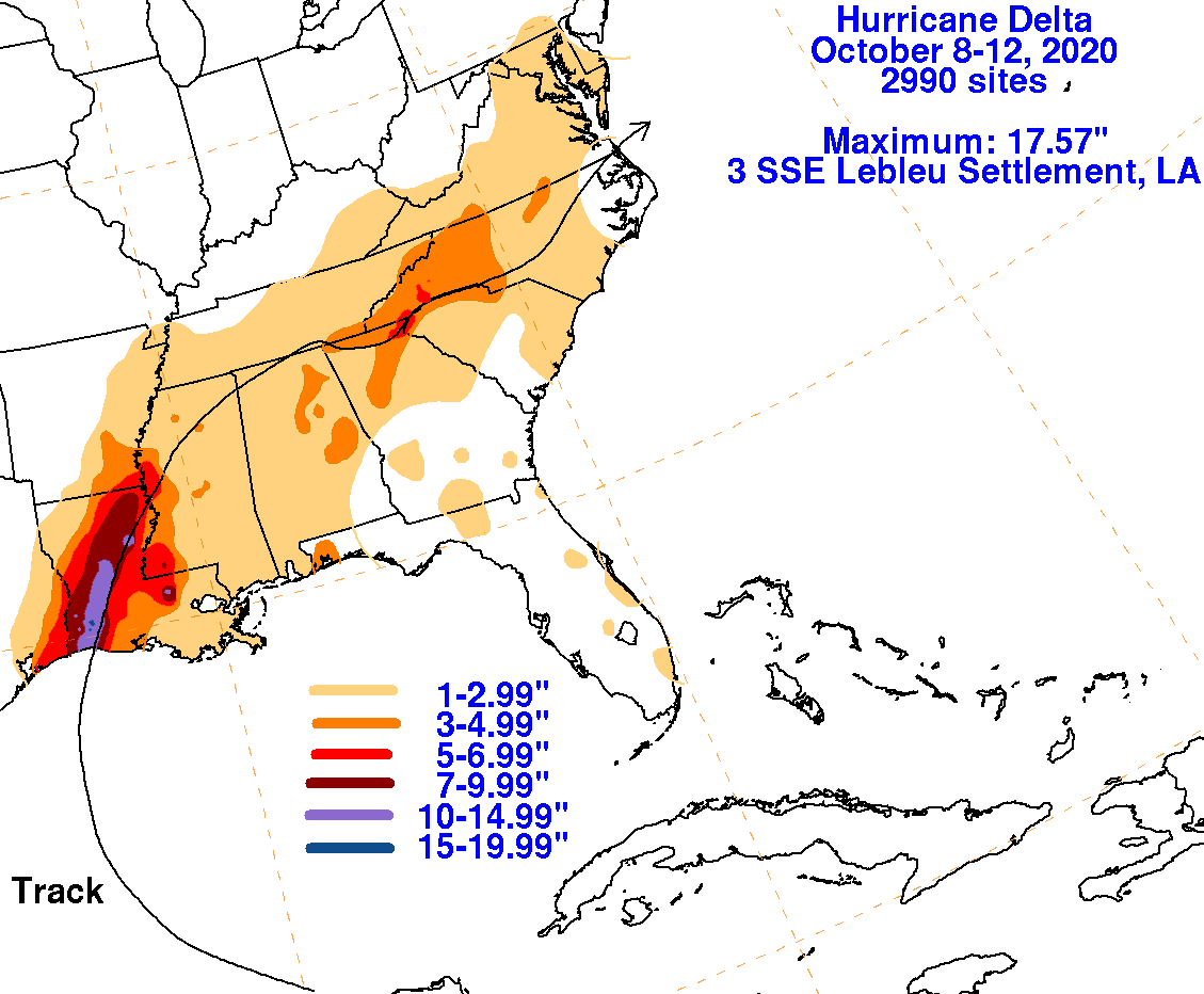
The graphics below show the storm total rainfall for Delta, which used rain gage information from the National Weather
Service River Forecast Centers, Forecast Offices, and CoCoRAHS.
 |
 |
 |