The cold front that swept Tropical Depression Arthur out to sea
stalled
in the Bahamas.
A deep closed low developed near the tail end of this frontal trough,
and convection
increased on the 7th. Winds increased to tropical storm strength
on the 8th, and
the cyclone was designated Diana. After initially drifting
westward
and threatening
the central Florida coast, the system moved north-northeast ahead of
a frontal system
moving out of Canada, essentially along the Gulf Stream. The
frontal system bypassed
the hurricane to the north, allowing it to move in a slow anticyclonic
loop just offshore
North Carolina. On the morning of the 13th, Diana finally made
landfall as a category
two hurricane, and weakened into a tropical storm 12 hours later.
The blocking high
moved out to sea, allowing the storm to move out to the east, offshore
Oregon Inlet
on the 14th and the system nearly regained hurricane strength.
After passing just north
of Sable Island, Nova Scotia, the cyclone became extratropical as it
passed through
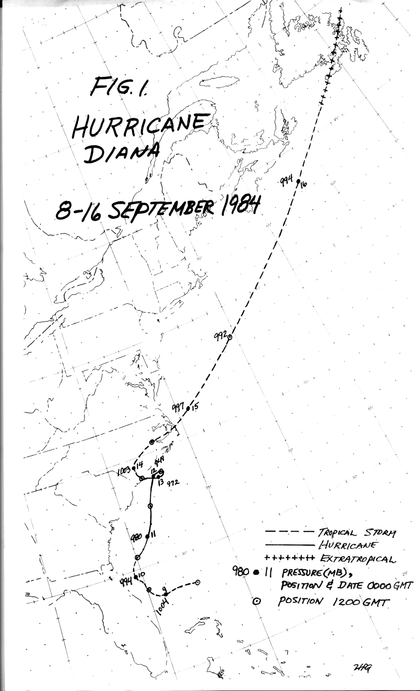
Newfoundland on the 16th. Below is the track of this cyclone,
provided by the
National Hurricane
Center.
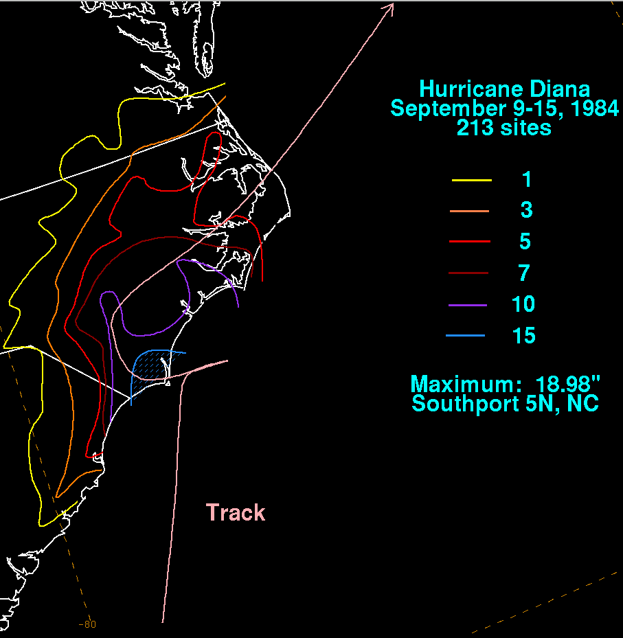
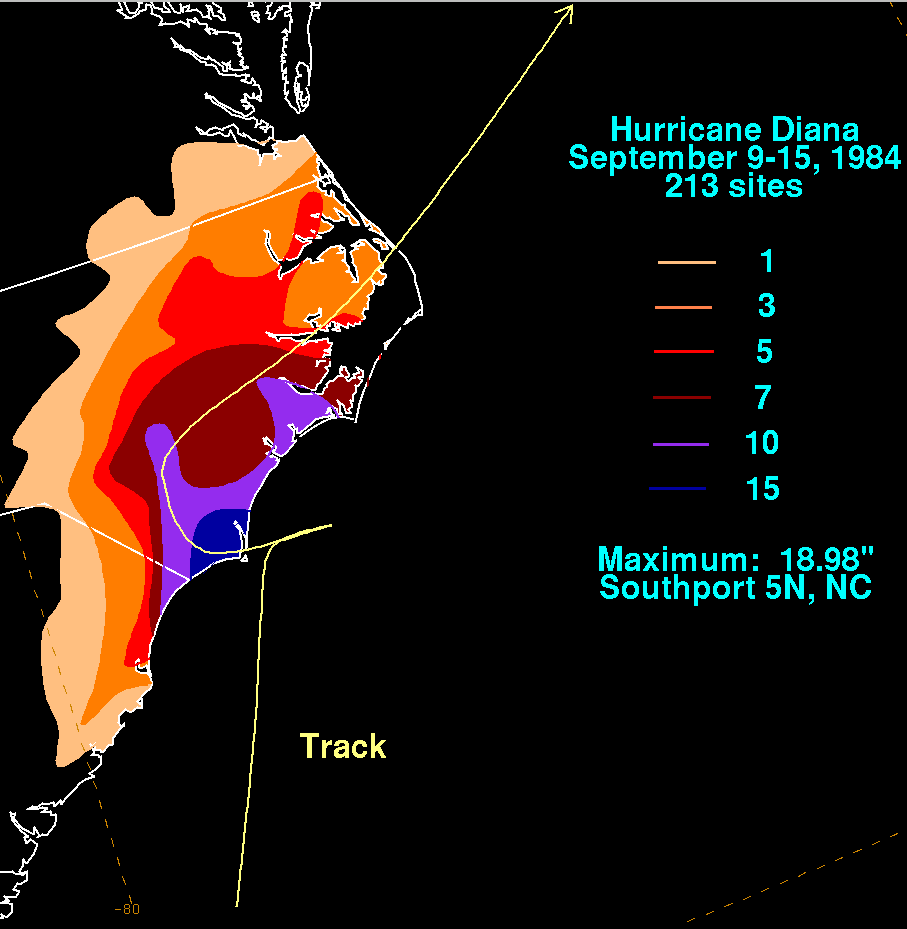
The graphics below show the storm total rainfall for Diana.
Note
the maximum across North Carolina near
the track of the storm.
 |
 |
 |
