On August 10, a cyclonic circulation was noted northeast of
the Leeward Islands with tropical storm force winds.
Reconnaissance aircraft found the tropical storm the next day, which
had not increased in intensity. On the night
of the 11th, the system turned northeast and rapidly intensified.
By the 12th, Diane was a major hurricane, though
its eye was elongated elongated significantly to the northeast,
possibly due to its northeast propagation around a
nearby upper cyclone. Its cyclonic path ended on the 13th,
when Diane resumed its west-northwest track. It
slowly turned northwest, striking near Wilmington, North Carolina on
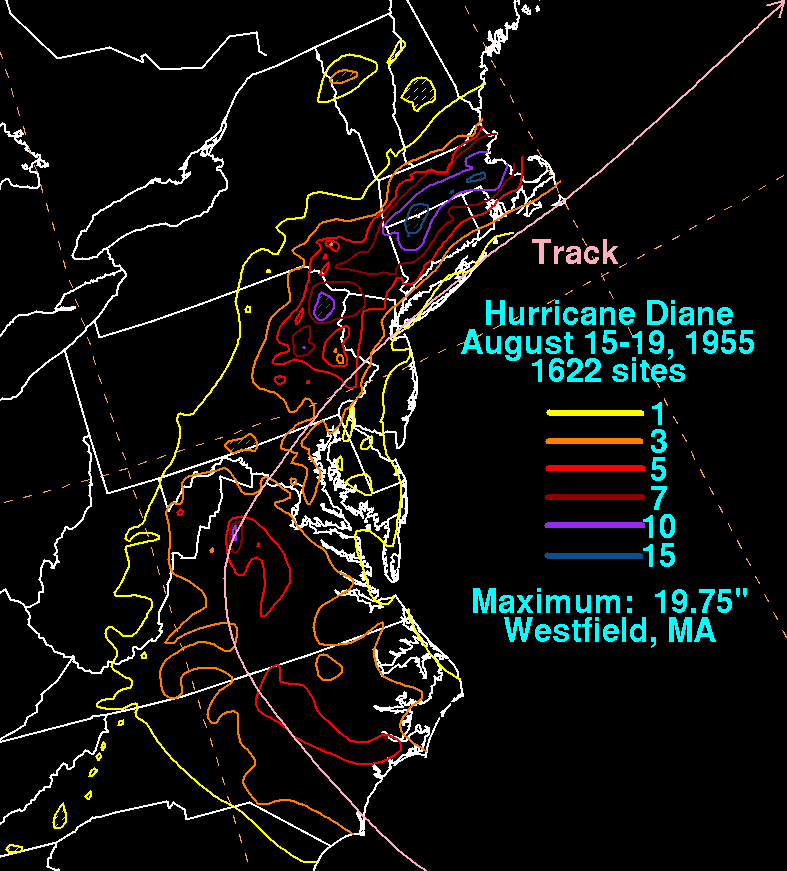
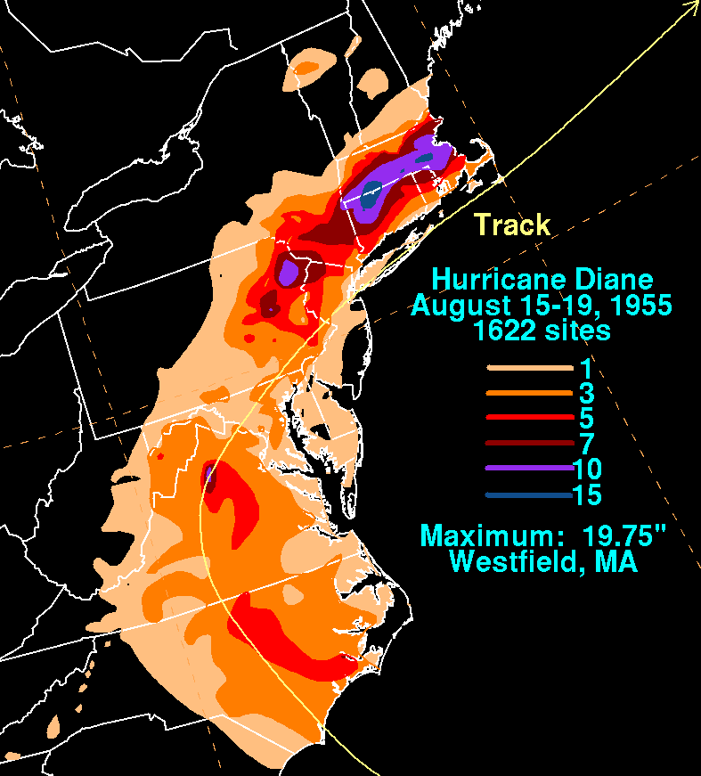
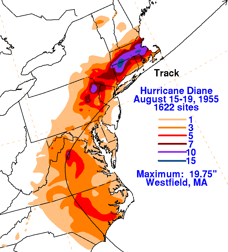
the 17th. Floods in New England led to
Diane becoming the first hurricane with $1 billion in damage, with
about 200 people losing their lives in the
flood from Pennsylvania east-northeast through southern New
England. The rainfall map below for Hurricane
Diane was created using rainfall data from the National Climatic Data
Center in Asheville, North Carolina.
 |
 |
 |