A tropical wave emerged from the coast of Africa on July 31st.
The system moved through the tropical
North Atlantic with little development, until it interacted with a
retrograding upper level low on August
9th. During that night, the center of the new tropical depression
moved inland into the Gold coast,
emerging back offshore into the Atlantic near Cape Canaveral on the
afternoon of the 10th, guided by
an approaching upper level trough and cold front. The system
paralleled the coast of the Carolinas
for the following couple of days, becoming a tropical storm southeast
of Cape Hatteras. Dolly later
developed into a hurricane later on the 12th while crossing the North
Atlantic shipping lanes, but only
briefly, becoming a tropical storm once more on the 13th. Moving
quickly to the east-northeast, Dolly
evolved into an extratropical cyclone north of the Azores on the
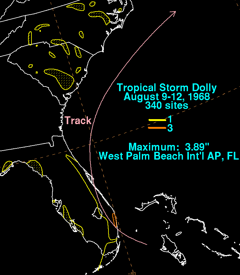
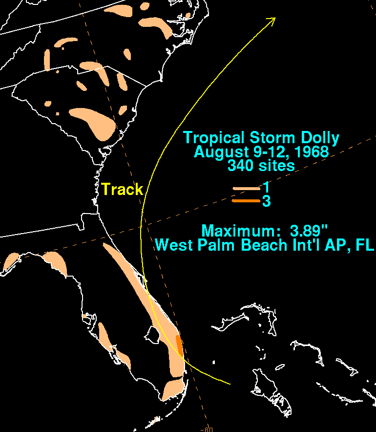
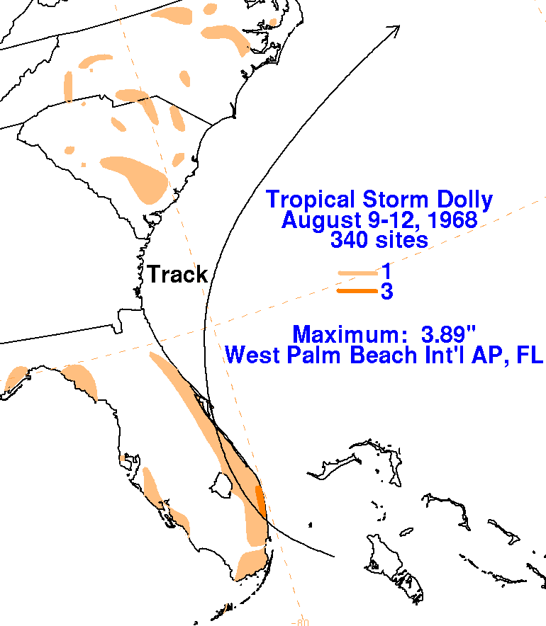
16th. Below
is a storm total rainfall
map for Dolly, using data from the National Climatic Data Center in
Asheville, North Carolina.
 |
 |
 |