A tropical wave moved offshore the coast of Africa on July 11th. The wave moved westward, generating
a surface low midway between Africa and the Lesser Antilles on the 13th. The low moved westward,
crossing the Windward Islands on the 17th. While the system had tropical storm force winds, it had no
well-defined center until reaching the western Caribbean on the 20th, when it was declared a tropical storm.
The system became ill-defined while moving around the periphery of the Yucatan peninsula, reorganizing in
the southern Gulf of Mexico on the 21st. Moving west-northwest, Dolly strengthened into a category 2
hurricane before moving inland into Texas southeast of Port Mansfield. Weakening while moving inland,
Dolly became a tropical depression on the 25th and moved into northern Mexico. Identifiable on surface
analyses for another few days, Dolly led to a burst of heavy rainfall across southern New Mexico on the
26th and 27th. By the morning of the 28th, its surface circulation had dissipated, with its mid-level center
becoming stretched out before merging with an upper level low that night.
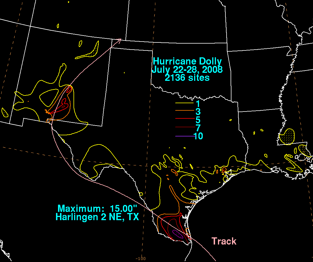
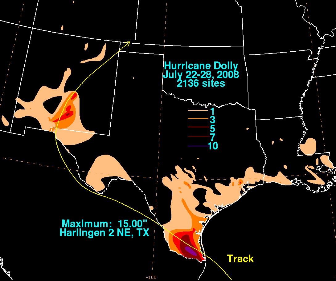
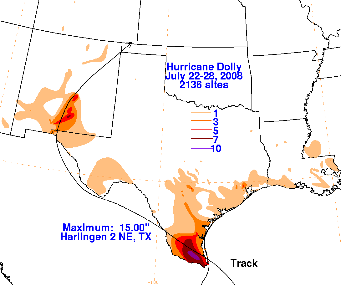
The first three storm total rainfall maps below were constructed using
rain guage data reported by the River Forecast Centers,
CoCoRAHS, and post-storm reports from the Brownsville, Corpus Christi,
and Galveston/Houston National Weather Service Forecast
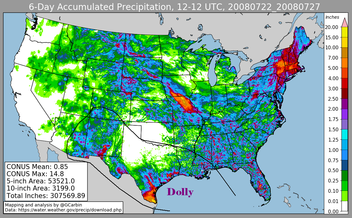
Offices. The fourth image includes radar-derived information.
 |
 |
 |
 |