An active tropical wave moved across western Africa on August 19th. The system moved westward into the eastern tropical
Atlantic over the next several days showing limited convective organization. On the 23rd, a well-defined surface low
formed a little over 800 miles east-southeast of Barbados, which was designated as Tropical Depression Five by the morning
of the 24th. The system moved west to west-northwest, and was deemed a tropical storm as it began to encounter
southwesterly vertical wind shear. It moved by the Lesser Antilles on the 26th and 27th, turning northwestward.
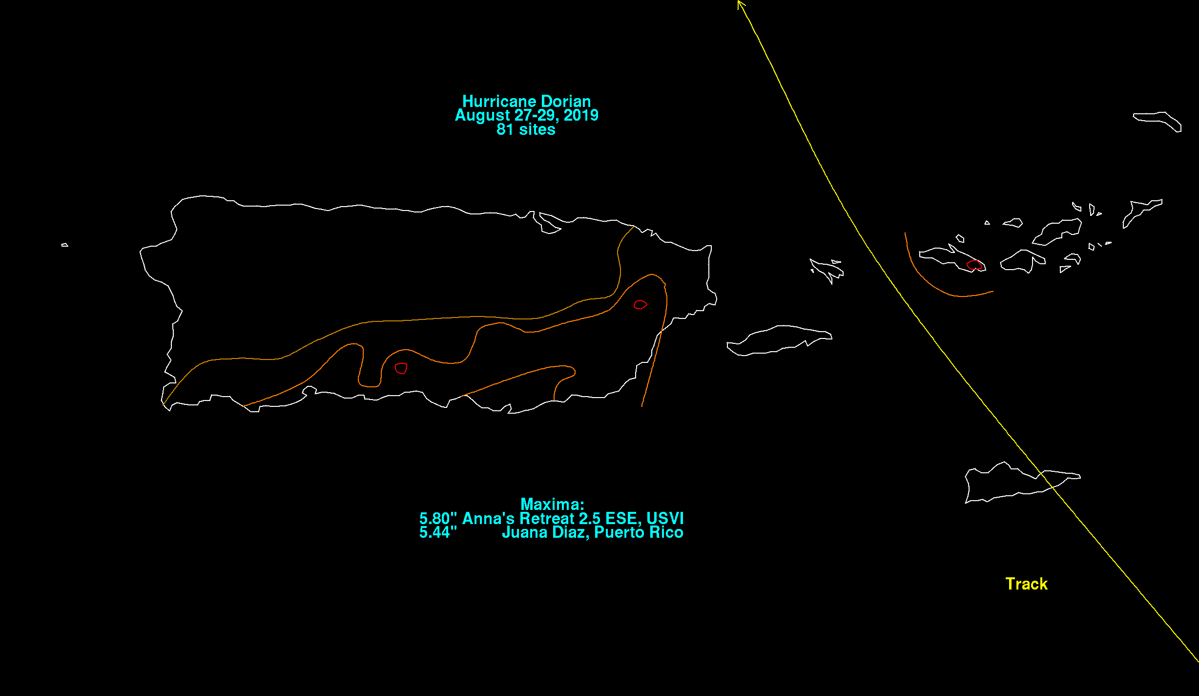
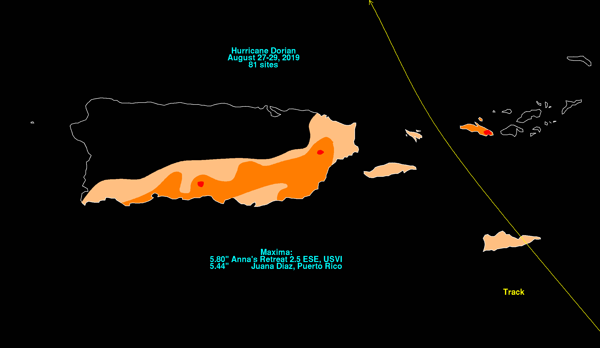
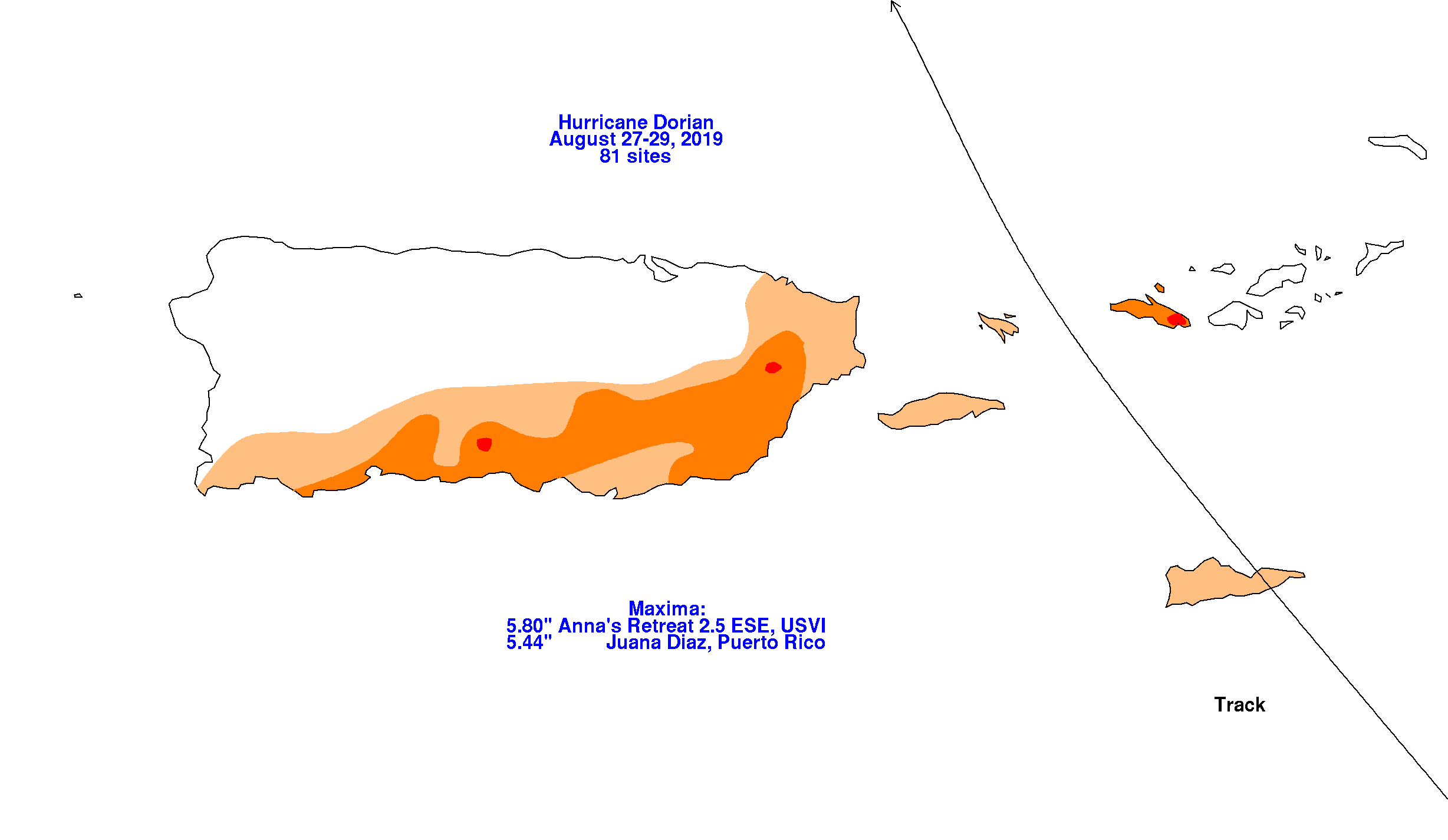
As it approached Puerto Rico and the U.S. Virgin Islands, its cloud pattern shrank as an inner core became apparent
on radar and microwave satellite imagery. Dorian became a hurricane as it approached St. Thomas while the system
moved north-northwest. Its rainfall graphics for Puerto Rico and the U.S. Virgin Islands lie below.
 |
 |
 |
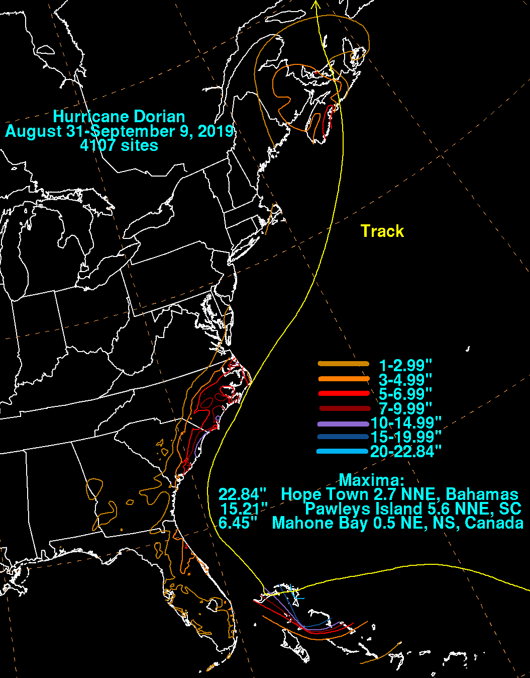
upper level environment and rapidly intensified on the 30th, becoming a major hurricane. Dorian turned westward,
aiming towards the Bahamas due to strengthening ridging to its northeast. Dorian became quite intense as it moved ashore
Great Abaco Island near Marsh Harbour. The system slowed down as it reached the western edge of the subtropical
ridge and towards a col point in the steering flow as a weakness across across the eastern United States began to
develop into an upper trough as a disturbance across the Midwest moved eastward. Within the weak flow pattern,
Dorian hugged the edge of the Bahama Bank, moving to the north side of Grand Bahama Island before stalling. Upwelling
from its slow motion caused Dorian to weaken, and it was no longer a major hurricane by September 3rd.
Turning north-northwest up the Gulf Stream, the system became larger as it interacted with the upper level trough and
gained latitude while paralleling the Florida east coast. While recurving offshore South Carolina, Dorian briefly
regained major hurricane status on the 5th. Increased vertical wind shear caused weakening and extratropical transition
thereafter, with Dorian's center moving near Cape Hatteras on the 6th before turning northeast around the upper level
trough. Becoming fully extratropical on the 7th, Dorian made landfall near Sambro Creek, Nova Scotia and northern Newfoundland.
The system moved across the Labrador Sea and eventually dissipated on the 10th offshore southern Greenland.
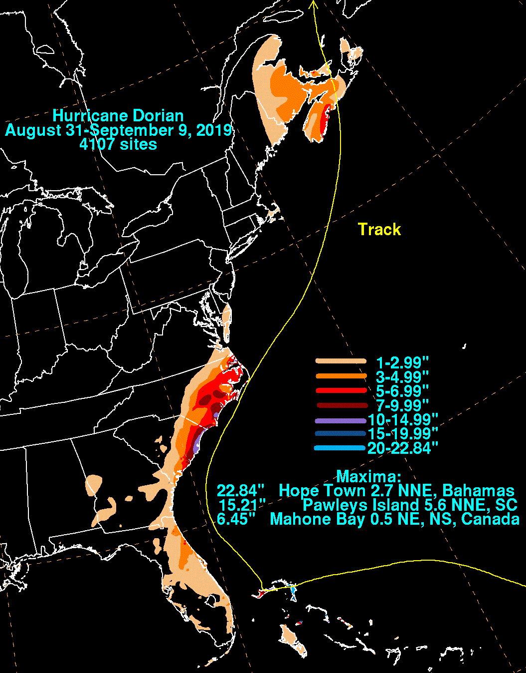
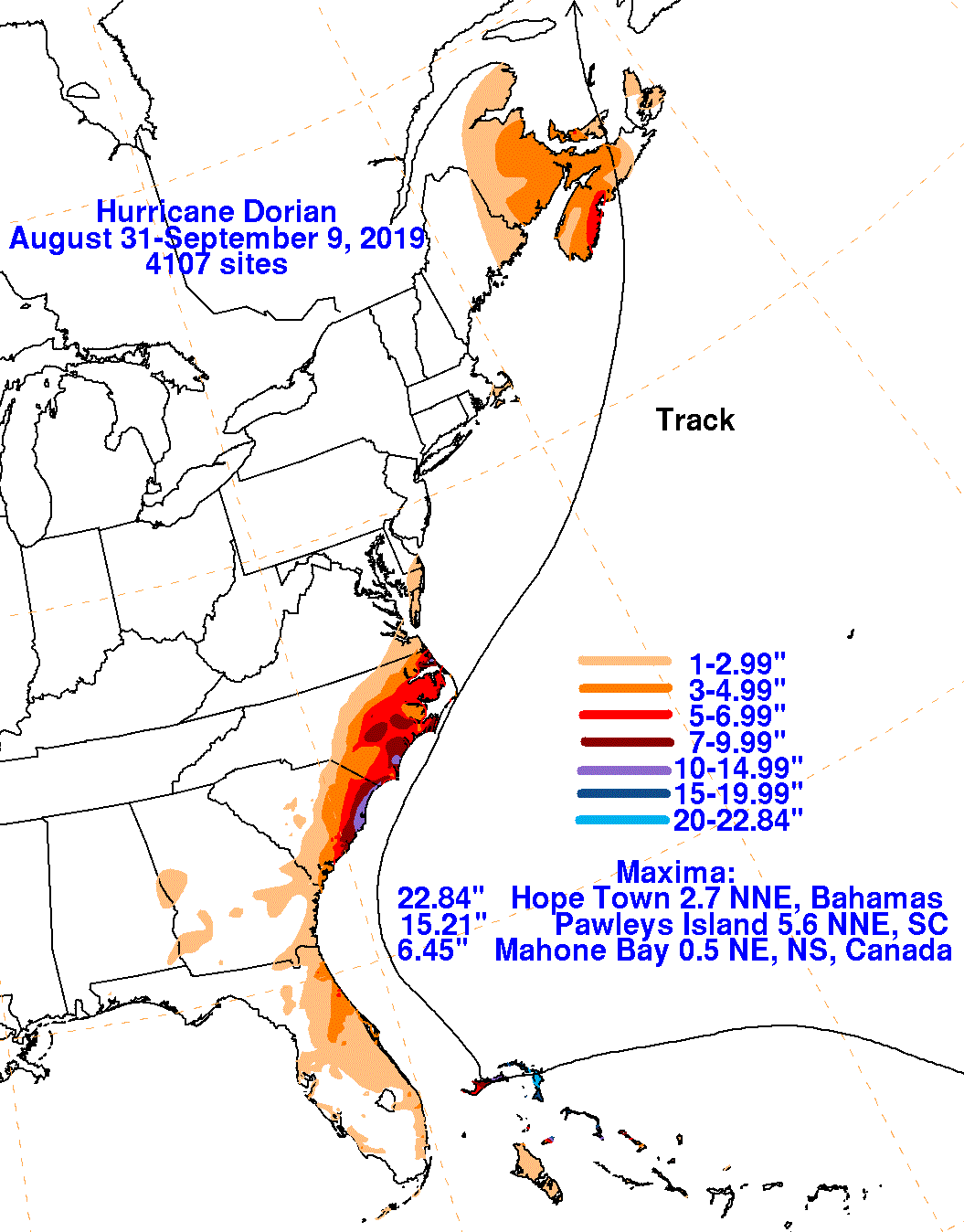
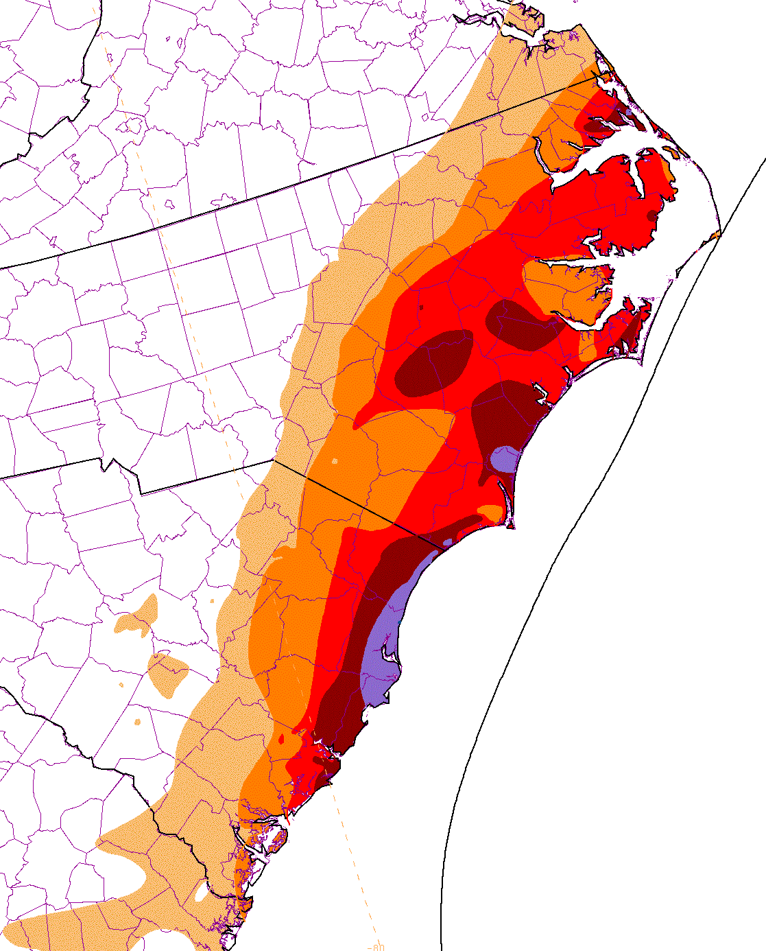
The graphics below show the storm total rainfall for Dorian, which used rain gage information from the National Weather
Service River Forecast Centers, Forecast Offices, and CoCoRAHS.
 |
 |
 |
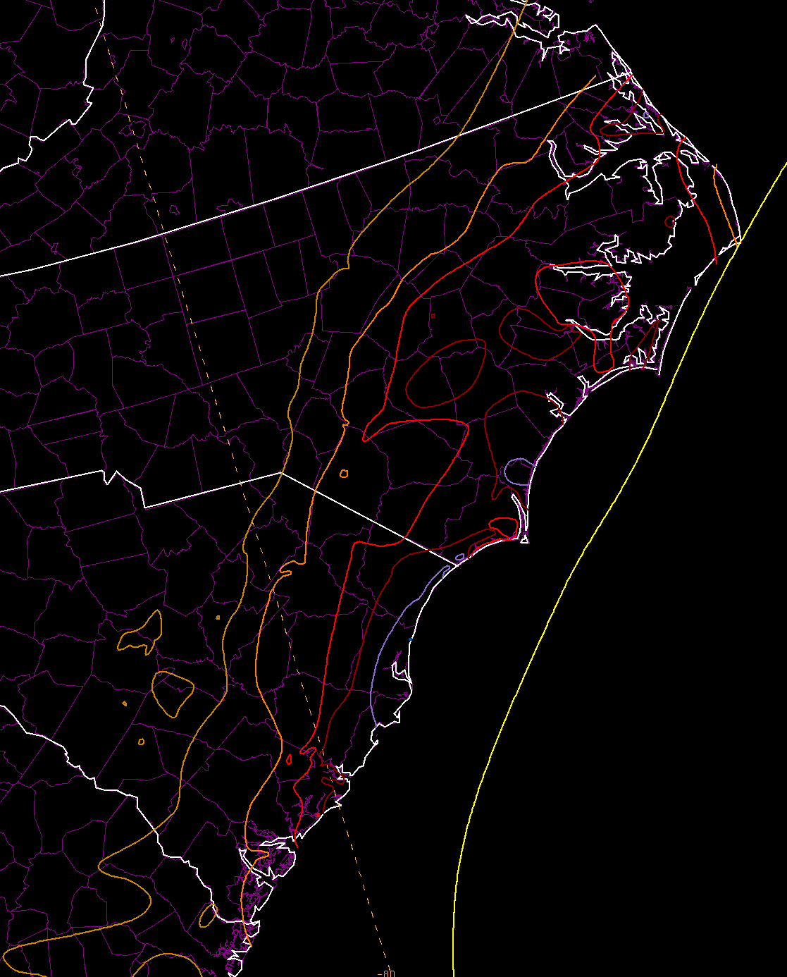
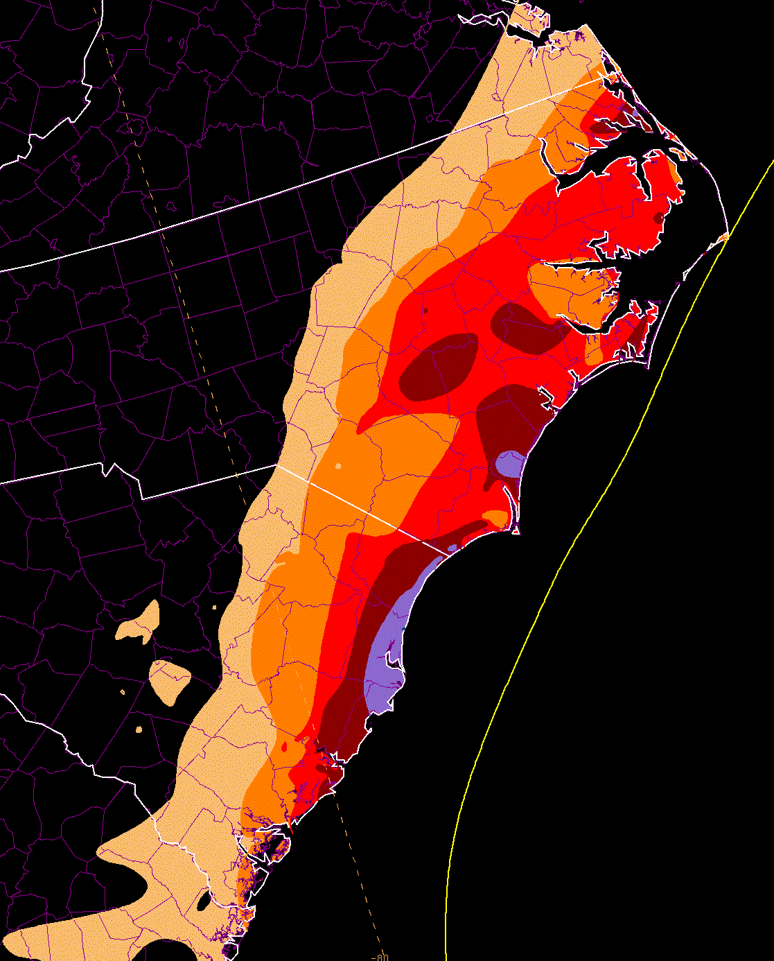
Below are graphics that zoom in on the Carolinas, using the same color palette as the other tropical cyclone rainfall graphics.
 |
 |
 |