A tropical wave moved off the coast of Africa on June 5th. The system moved westward across the tropical Atlantic
and Caribbean sea with minimal development, entering the eastern north Pacific ocean on the 16th. Slowly developing,
the system became organized enough to be considered a tropical depression late on the 18th. The system initially moved
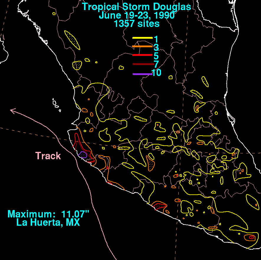
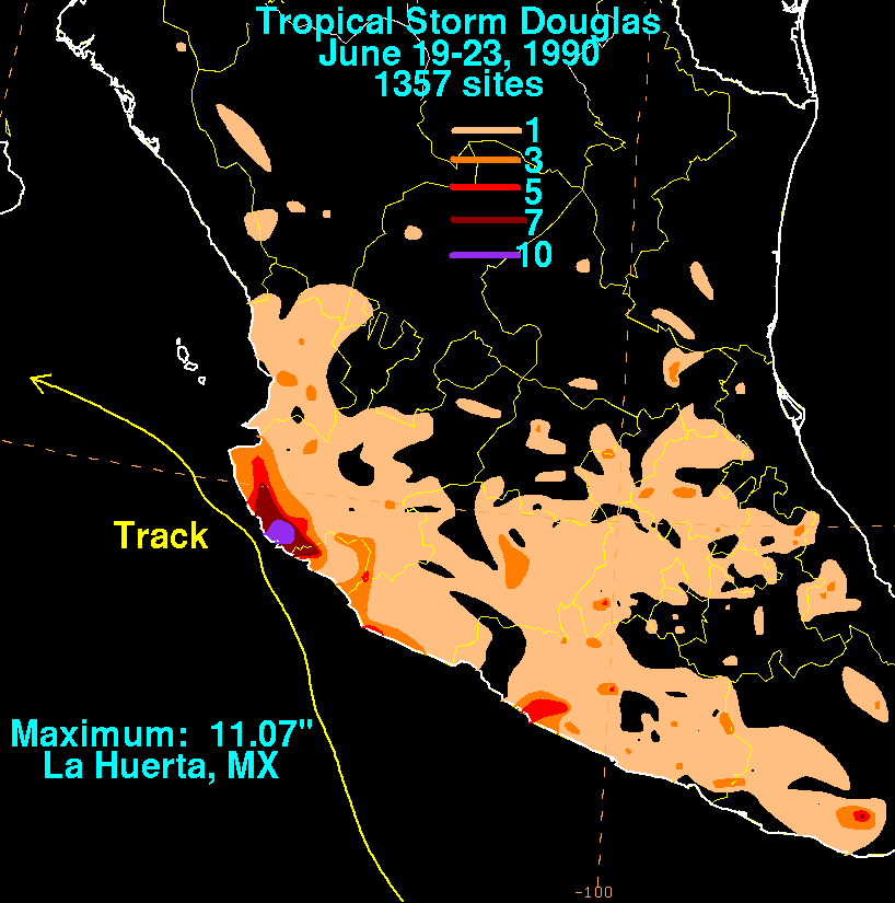
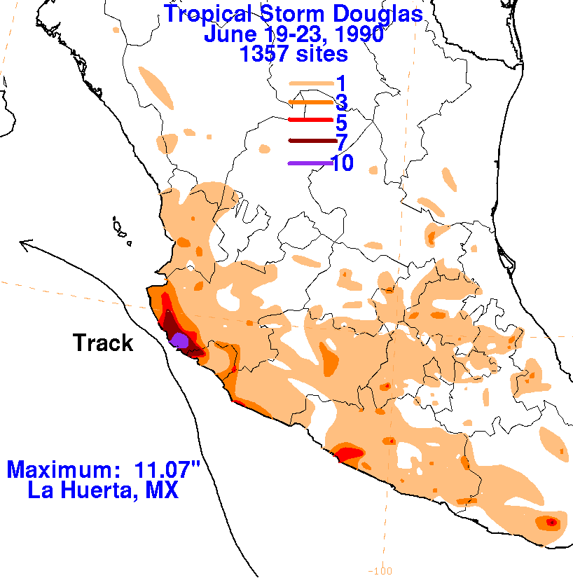
west-northwest south of a weak high pressure area. The system became a tropical storm southwest of Acapulco while
turning to the northwest during the afternoon of the 19th. Douglas' center came within 15 nautical miles of the Mexican
coast during the night of June 21st and began to weaken due to the nearby mountainous terrain. Turning west-northwest,
Douglas continued to weaken and dissipated as a tropical cyclone during the afternoon of the 24th. Below is the track of
this storm, provided by the National Hurricane Center.
The storm total rainfall maps below were constructed using data from
the Comision Nacional del Agua,
the parent agency of Mexico's
national weather service.
 |
 |
 |