On August 22nd, a tropical disturbance emerged off the western
African coast into the tropical Atlantic
ocean. A surface low developed in association with the tropical
disturbance, and thunderstorms became
well-enough organized around the low pressure area for the system to be
deemed a tropical depression
on the 25th. Tracking just north of due west, Earl became a
tropical storm later on the 25th, but its
development slowed thereafter, due to surrounding dry air and by the
29th, northeasterly vertical wind
shear from Hurricane Danielle to its north. Once the wind shear
abated, Earl strengthened into a hurricane
on the 29th and rapidly strengthened into a category 4 hurricane on the
30th. The system moved northeast
of the Leeward Islands around that time. Below are the storm
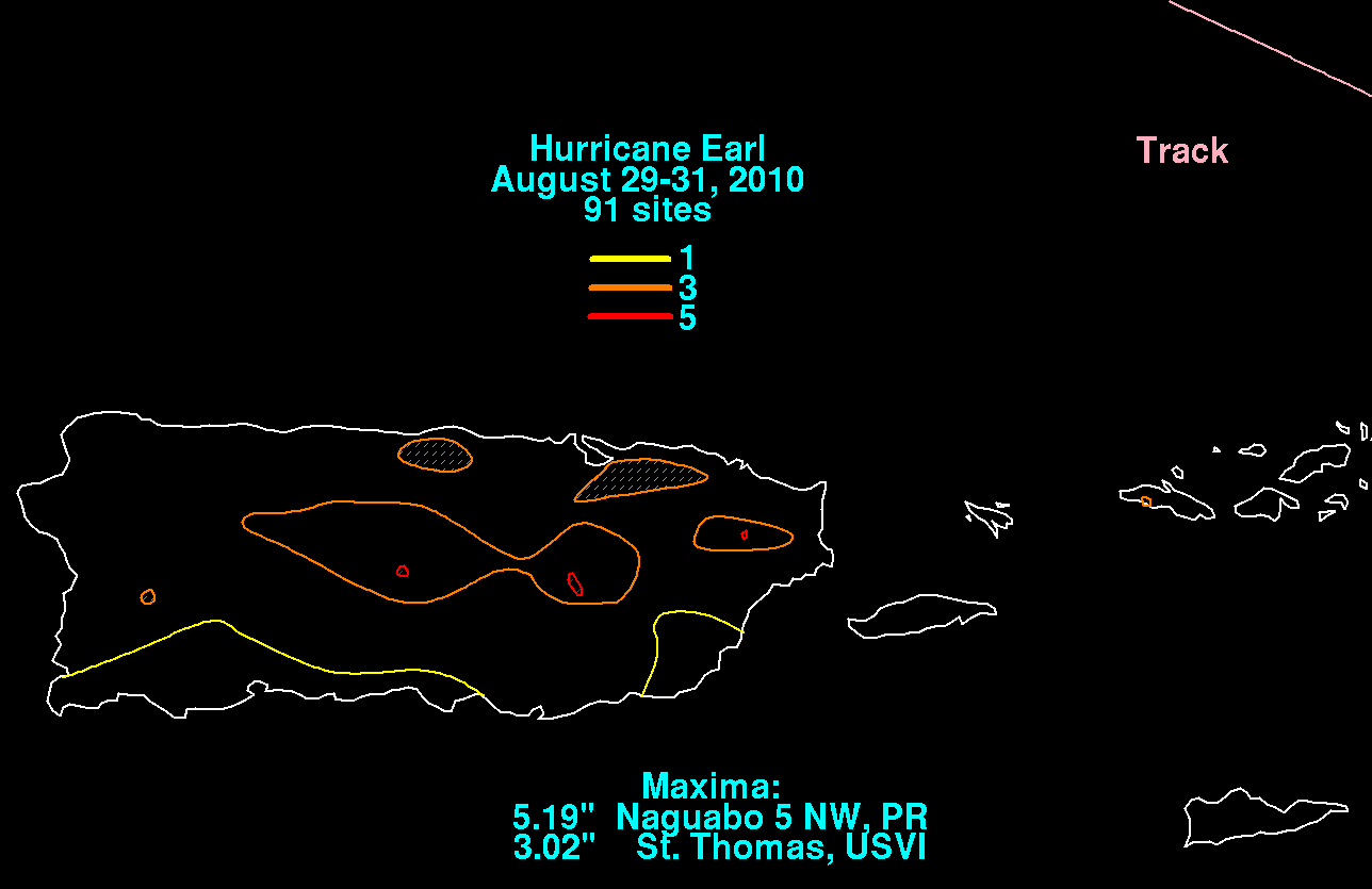
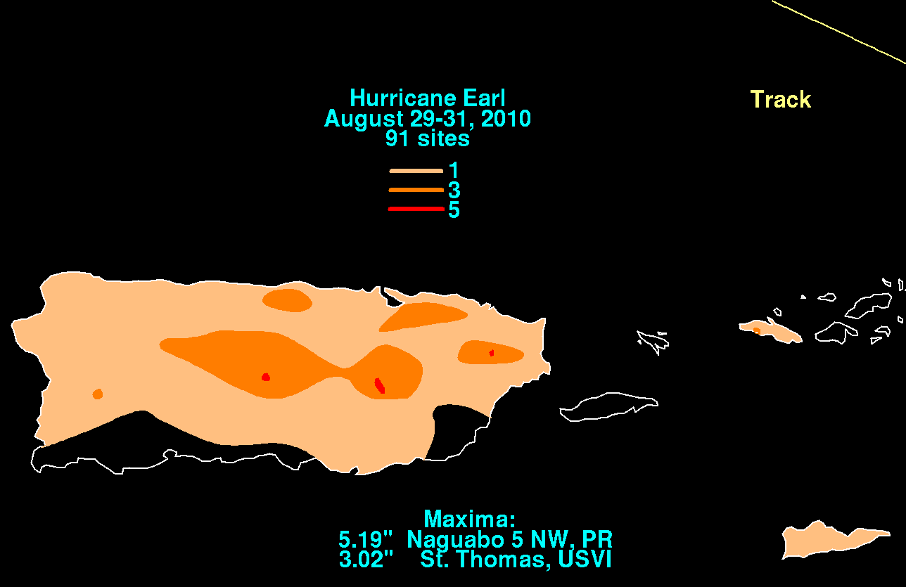
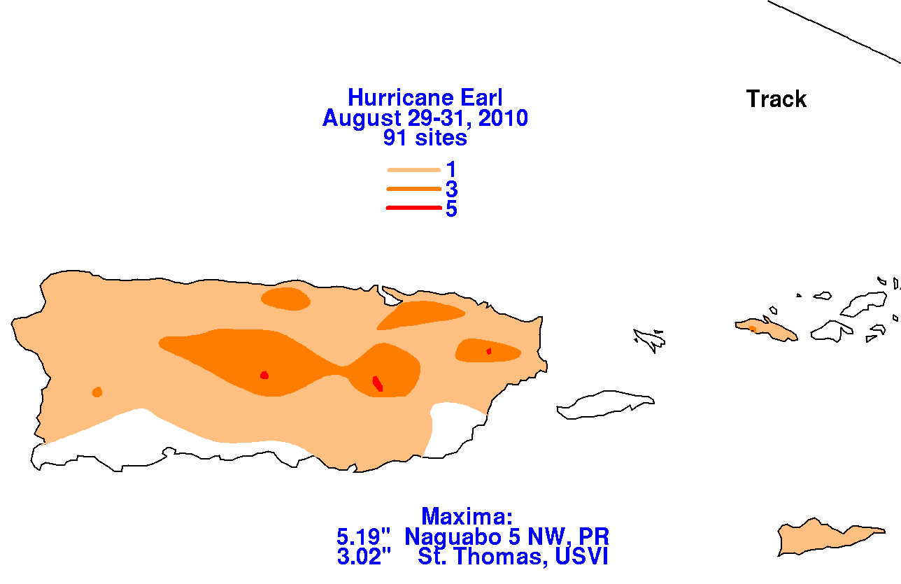
total rainfall maps for Earl for Puerto Rico,
which were produced using data from the National Weather Service's
Southeast River Forecast Center and
the post-tropical cyclone report from the National Weather Service
Forecast Office in San Juan, Puerto Rico.
 |
 |
 |
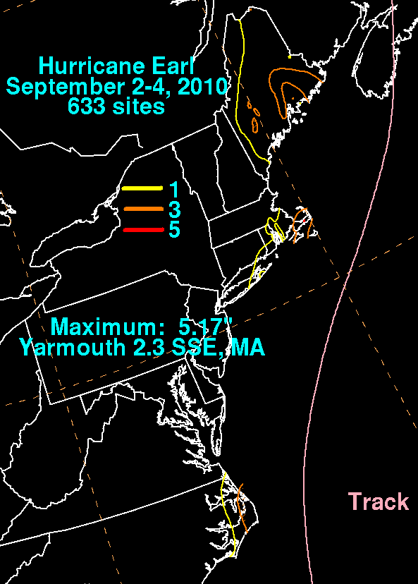
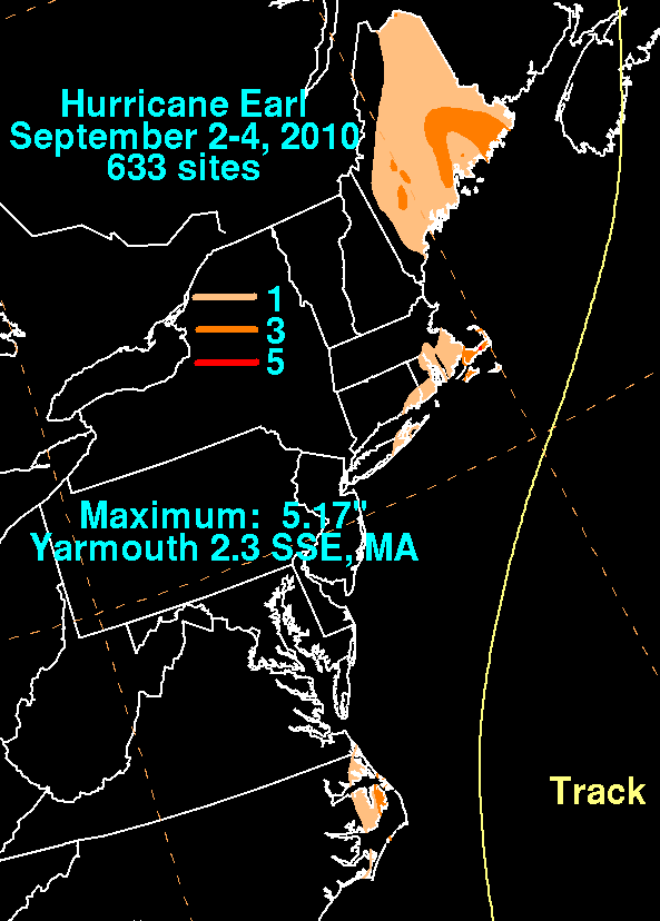
Earl remained a major hurricane into September 2nd, when it started
to weaken due to drier air working
into its circulation and lowering sea surface temperatures. The
hurricane brushed by Cape Hatteras as a
category 2 hurricane, and weakened to a borderline category 1
hurricane/strong tropical storm while moving
by New England and Nova Scotia. The system evolved into an
extratropical cyclone while moving across
eastern Canada on the 4th, and was absorbed by a larger area of low
pressure on the 5th. Below are the
storm total rainfall maps for Earl for the Eastern United States, which
were produced using data from the
National Weather Service River Forecast Centers and CoCoRAHS.
 |
 |
 |